LCT 7: Ridge Hilltops
Landscape character type summary
The Ridge Hilltops are the upper parts of the Midvale Ridge, typically with limestone or sandstone bedrock on the highest ground, located at the western end of Vale of White Horse District and to the east, west and south of Oxford. Strong tree cover is a feature of these areas, and this combined with elevation makes them distinctive elements in the setting of adjacent landscapes and of settlements (notably Oxford). Although some Ridge Hilltop areas are close to large settlements, settlement density within them is variable. Tree cover helps to limit the perception of development where it does occur.
Four Landscape Character Areas (LCA) are identified:
- LCA7A: Faringdon Ridge Hilltops
- LCA7B: Oxford West Ridge Hilltops
- LCA7C: Oxford East Ridge Hilltops
- LCA7D: Oxford South Ridge Hilltops.
LCA 7A: Faringdon Ridge Hilltops
It should be noted that the lines used to denote where LCAs border settlements are approximate and should not be used for planning purposes.
Character Area Location
Located in the west of Vale of White Horse district, between Shrivenham and Watchfield in the south-west and Faringdon in the north-east. It comprises a low ridge that rises above the adjacent Upper Vale landscapes to the north (LCA 11A) and south (LCA 11B).
Key characteristics
- A low ridge with gently undulating landform, albeit with some steeper slopes around watercourses and localised high points.
- Features a mixture of relatively large-scale arable and pasture farmland, with areas of estate land and smaller scale parcels of pastureland associated with settlement.
- Dispersed blocks of woodland across the landscape, including significant areas of Ancient Woodland, particularly to the north. Hedgerows vary, with some having gaps or being intensively managed and species poor, whilst others are more intact with mature trees.
- Settlement comprises several nucleated towns and villages as well as scattered farmsteads. There are also a number of large country houses which are generally located on high points and associated with parklands, including Buscot House Registered Park and Garden (Grade II*).
- There is an abundance of public rights of way across the area, including the D’Arcy Dalton Way and The Vale Way Long Distance Paths.
- Significant woodland cover restricts views in places. Elsewhere low hedges, relatively limited woodland and/or raised vantage points allows long distance views, including from roads and public rights of way .
- The area forms part of the wider northern setting to the North Wessex Downs National Landscape, with a high level of intervisibility with the south of the LCA. Wind turbines at Westmill are prominent in views to and from the National Landscape. The landscape also forms a wooded backdrop in views from the vales to the north and south.
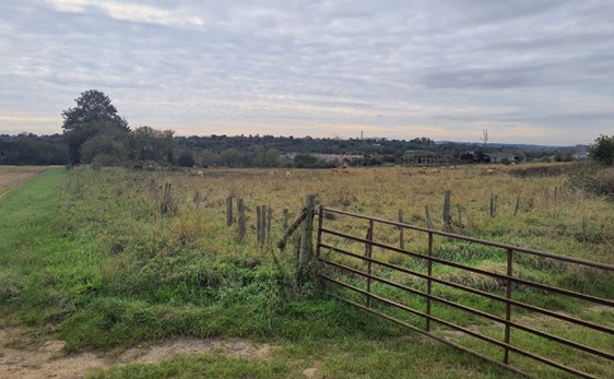
Fields subdivided into paddocks for horse grazing on the edge of Little Coxwell:
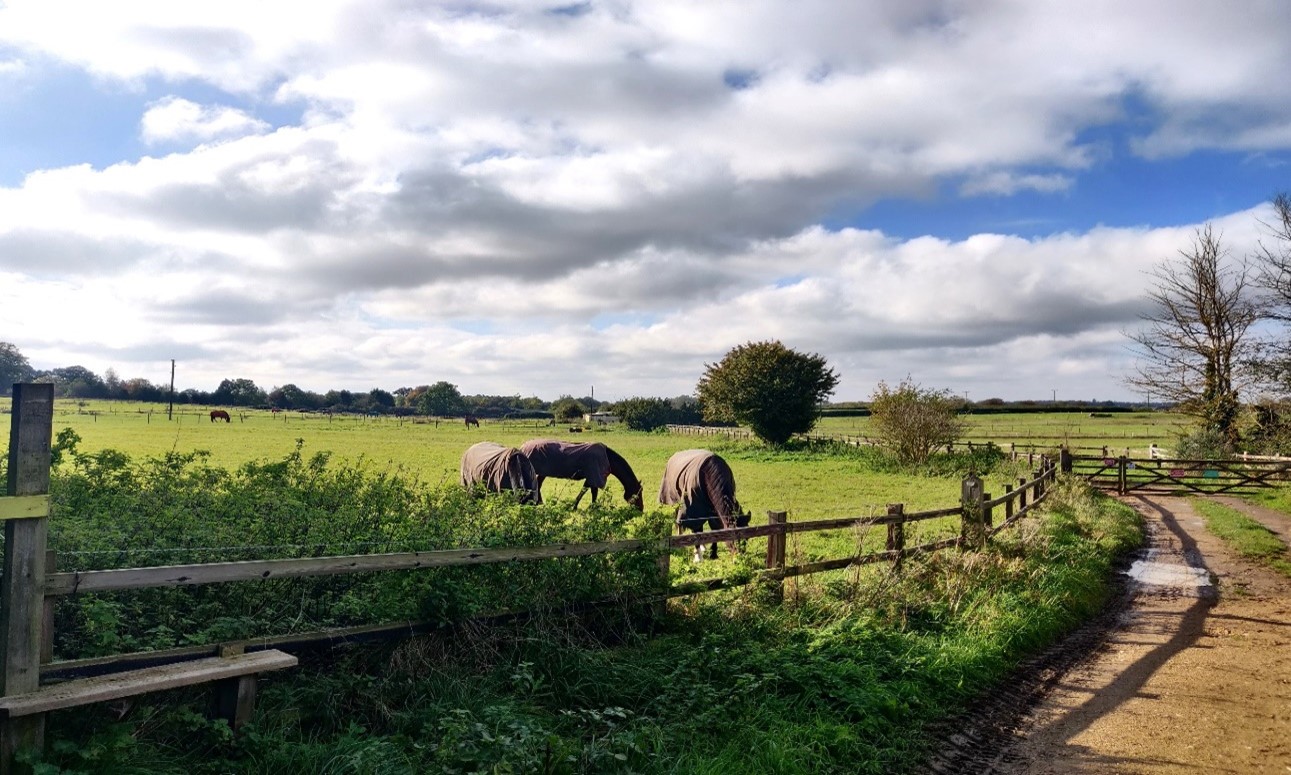
×![]()
Fields subdivided into paddocks for horse grazing on the edge of Little Coxwell:
View north-east from the B4019 towards Coxwell Wood and Badbury Hill:
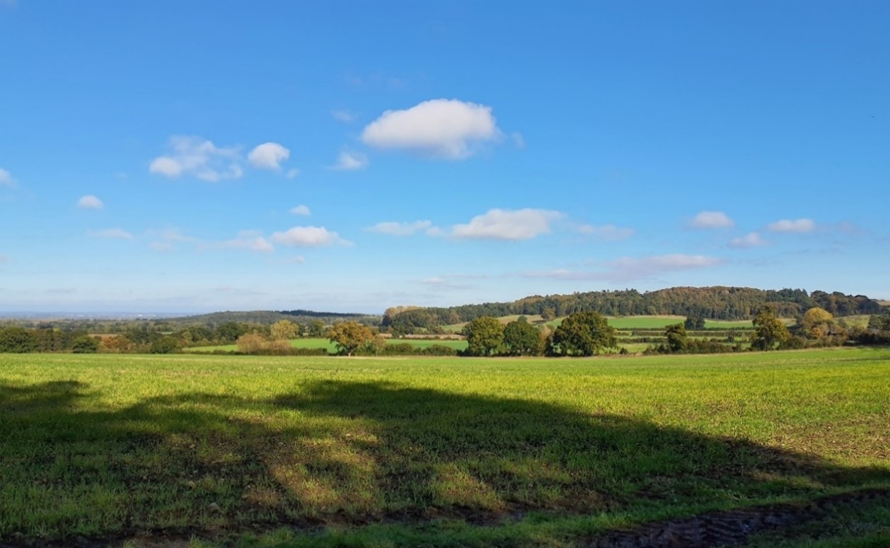
×![]()
View north-east from the B4019 towards Coxwell Wood and Badbury Hill:
The turbines at Westmill Wind Farm are visible across the LCA:

×![]()
The turbines at Westmill Wind Farm are visible across the LCA:
Great Coxwell Barn, a Grade I Listed Building and Scheduled Monument of 13th century origin:
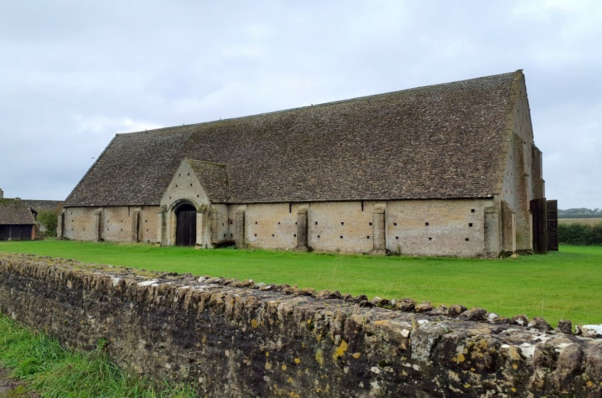
×![]()
Great Coxwell Barn, a Grade I Listed Building and Scheduled Monument of 13th century origin:
Description
Natural (landform, water, semi-natural land cover)
- A low ridge of limestone, sandstone, siltstone and mudstone that rises above the surrounding clay vale landscapes to the north and south. The north facing slopes of the ridge are relatively steep, whilst the south facing slopes are gentler and form a transition to the Upper Vale to the south.
- The landform is predominantly gently undulating between 80 and 110 metres Above Ordnance Datum (AOD); there is some more complex landform including steeper slopes around watercourses and localised high points, such as Badbury Hill (158 metres AOD) and Folly Hill (135 metres AOD).
- Several small-spring fed streams, such as Pennyhooks Brook, incise the chalk ridge before flowing westwards to meet the River Cole.
- Dispersed blocks of woodland are found across the landscape, including significant areas of Ancient Woodland to the north.
- Riparian woodland lines the River Cole (Watchfield Common Wood and Swans Nest Copse) and Pennyhooks Brook to the south-west, which is recorded as Ancient Woodland.
- Hedgerows vary, with some having gaps or being intensively managed and species poor whilst others are more intact and feature mature trees such as oaks and sycamore; some larger arable fields lack significant boundary vegetation, whilst in pastoral areas tree cover tends to increase.
- Tuckmill Meadows Local Nature Reserve (LNR) and Site of Special Scientific Interest (SSSI) in the south includes areas of calcareous grassland and fen; Wicklesham and Coxwell Pits, south of Faringdon, is designated as a SSSI for its geological interest.
Cultural/social (land use, settlement, infrastructure, historic character)
- The area features a mixture of relatively large scale arable and pastoral farmland, with areas of estate land (such as Buscot Park, Coleshill Park and Faringdon Park), and smaller scale parcels of land associated with settlement.
- Settlement comprises several nucleated towns and villages and scattered farmsteads, with many covered by Conservation Areas. There are also a number of large country houses which are generally located on high points with views over the Vale landscapes to the north and south. Corallian limestone and brick are common building materials, forming a strong local vernacular.
- The A420, the main road through the area, runs along the ridge. Several rural lanes run from it to connect to settlements.
- There is an abundance of public rights of way providing recreational access across the landscape, including the D’Arcy Dalton Way and The Vale Way Long Distance Paths.
- Westmill solar farm and the five-turbine Westmill wind farm, the only wind farm within the two districts, are located on the top of the ridge.
- The landscape is identified as predominantly comprising a mixture of post-medieval and modern fieldscapes; estates associated with country houses are post-medieval in date whilst the ancient woodland is older, being medieval or earlier in date.
- The network of hedgerows and mature hedgerow trees is generally intact relative to surrounding areas.
- Historically significant sites include two Iron Age hillforts at Badbury Camp and Little Coxwell Camp and the Grade II* Registered Park and Garden (RPG) at Buscot House. The Grade II Listed Faringdon Folly Tower is a distinctive local landmark, on Faringdon Hill to the east of the town.
Perceptual (views, tranquillity, associations)
- Significant woodland cover restricts views in places and results in a sense of isolation and intimacy.
- Elsewhere low hedge heights, relatively limited woodland and/or raised vantage points allows long distance views, including from roads and public rights of way. There is a sense of exposure and remoteness on the top of the ridge.
- The south-facing slopes of the area form part of the wider northern setting to the North Wessex Downs National Landscape. This area also forms a backdrop and skyline in views from the lower-lying vales to the south and north.
- Wind turbines at Westmill are prominent in views across the area, including in those to and from the National Landscape.
- This is predominantly a rural, relatively tranquil, farmland landscape. Wooded areas in particular provide a strong sense of remoteness and tranquillity although areas close to larger settlements, such as Faringdon and Shrivenham, are influenced by human activity. The Tranquillity Assessment for South Oxfordshire and Vale of White Horse categorises 30% of the LCA in Zone 1 (‘areas of high tranquillity’) and 63% in Zone 2 (‘areas of some tranquillity’), and the Dark Skies Assessment for South Oxfordshire and Vale of White Horse categorises over 50% of the area within its darkest assessment band.
- The A420 is often well assimilated into the landscape by significant roadside vegetation; however noise and light pollution from traffic does in places erode the sense of rural tranquillity.
- The edges of larger settlements of Faringdon, Shrivenham and Watchfield are generally well-integrated by vegetation. However, exposed edges are evident in places such as along Church Street and Orchard Hill to the north of Faringdon and the recent and ongoing development as part of the South Faringdon Strategic Allocation.
Valued qualities
- Areas of more complex/prominent topography, including steep slopes around watercourses and localised high points including Bradbury Hill and Folly Hill, which contrast with the surrounding lower-lying vale landscapes to the north and south, and provide a distinctive sense of place.
- Areas of fens, calcareous grass and Ancient Woodland which contribute positively to the landscape and provide surviving examples of rare semi-natural habitats.
- Watercourses with associated valley landforms and riparian vegetation, such the River Cole and Pennyhooks Brook, which add landscape and ecological diversity.
- Historic character and sense of time-depth provided by historically significant features, including Scheduled Monuments, Buscot RPG, and Listed Buildings; also non-designated sites such as historic parklands at Coleshill Park and Faringdon Park associated with large country houses.
- Distinctive settlement pattern of nucleated towns and villages and scattered farmsteads; the open landscape forms gaps between these and helps retain their individual identities.
- Some settlements, including Faringdon, Great Coxwell and Little Coxwell, contain historic cores covered by Conservation Areas, which contribute to the time-depth of the area; the landscape provides a rural character for these.
- Forms part of the wider northern setting to the North Wessex Downs National Landscape, with a strong visual relationship between the National Landscape and the south of the LCA.
- Recreational value of public rights of way, including the D’Arcy Dalton Way and The Vale Way Long Distance Paths.
- The landscape forms an undeveloped wooded backdrop and skyline in views from the lower-lying vales to the south and north.
- A rural, relatively tranquil, farmland landscape, with an intact network of hedgerows and mature hedgerow trees, providing the rural setting to settlements. Wooded areas provide a stronger sense of enclosure, remoteness and tranquillity, and skies are typically darker than in much of the district.
- Long distance views from the ridgetop north across the vales associated with the River Thames to the north and River Ock to the south.
- The value of the landscape is reflected in the inclusion of most of the area within the Faringdon and Buscot Local Landscape Designation.
Forces for change
- Loss or poor management of hedgerows and hedgerow trees, which is reducing tree cover within the farmed landscape and diminishing the valued sense of enclosure and habitat they provide.
- Agricultural intensification, diversification and amalgamation of fields into lager parcels of arable land which is affecting the characteristic mix of arable and pasture farming.
- Introduction of renewable energy developments, including solar farms and wind turbines north of Watchfield, changing the traditional agricultural land use and impacting on views. Drive for net zero could lead to more solar and wind farm applications in this and the adjacent landscapes which could affect the rural character and characteristic views outward across the vales to the north and south.
- Increased development pressure on the edges of Shrivenham and Faringdon, which may impact the traditional nucleated form and diminish the sense of separation between settlements.
- Increased recreational use of the landscape including higher footfall on the D’Arcy Dalton Way and The Vale Way promoted routes, as well as increased visitor numbers at Buscot Park and Badbury Hill, which may lead to a demand for more visitor facilities, altering the tranquil, rural character.
- The Ridge Hilltops landscape may be susceptible to the impacts of climate change, including:
- Deciduous woodlands are facing decline due to warmer winters, altered rainfall patterns, drier summers and increased frequency of extreme events; there may be a shift in vegetation type and composition, increased competition from invasive species, greater numbers of insect and mammal pests, and a greater risk of wind-throw and loss of mature trees.
- Drier summers and wetter winters may lead to increased mortality and die-back of certain hedgerow tree species; an increased occurrence of insect pests and pathogens could lead to a potential loss or significant reduction in populations of key hedgerow tree species; and increased storm activity may lead to the loss of mature and veteran trees within hedgerows.
- Wetter winters may mean woody species in hedgerows are exposed to prolonged flooding in the growing season and will be at risk of dying, and winter trimming will become more difficult due to wet ground (preferred to autumn trimming to ensure food supply for birds).
- Intensification of adjacent land use leading to increased impacts on hedgerows such as pesticide drift and nutrient enrichment.
- Changing temperatures and extreme weather events are creating vulnerabilities in chalk grassland landscapes, leading to increased soil erosion and run-off.
- Drier summers and wetter winters could cause changes in plant and animal species and community composition of chalk grassland (for example loss of perennials, expansion of drought-tolerant ephemerals and dominance of grasses in the sward of chalk grassland).
- Drier summers leading to an increased fire risk affecting chalk grassland habitats.
- Increase in storm damage could affect veteran and mature trees, and designed landscapes.
Landscape strategy and guidelines
Woodland cover should continue to provide ecological value and a sense of enclosure, remoteness and tranquillity.
- Retain and enhance the pattern of dispersed blocks of woodland across the landscape.
- Encourage landowners to manage woodland appropriately, including to reduce the impacts of pests and diseases and to increase the age structure and structural heterogeneity of woodland. Consider the promotion of natural colonisation adjacent to existing woodland, allowing locally native species to develop resilience to the pressures of climate change through natural processes.
- Seek to prevent further loss or decline in the quality of remaining boundary hedgerows and encourage their restoration/reinstatement; when establishing new hedges, aim to diversify the range of species and select species and provenances adapted to a wider range of climatic conditions.
- Use hedgerows, trees and woodland to integrate development, including any proposed residential development on the edge of settlements, into the landscape.
Discourage intensification of arable farming and manage arable land to enhance its biodiversity value and connectivity.
- Maintain and expand the area of land available for uncultivated arable field margins; seek to maximise the diversity of margins to provide a range of habitats and to assist in the movement of species through the landscape and include species and cultivars that are able to tolerate and flower under hotter, drier summers.
Maintain the open character of farmland which forms gaps between individual settlements and forms an undeveloped backdrop to views back from the vale.
- Maintain the distinctive nucleated settlement pattern and minimise the impact of any new development on local character and on views from other areas. Any new development should use materials which are in keeping with, or complement, the local vernacular of limestone and brick.
- Maintain the valued recreational use of the landscape and consider opportunities to introduce additional connectivity to enhance appreciation of views and landscape character.
- Consider impact of development on views from the North Wessex Downs National Landscape, both local views where there is no woodland screening along the B4507 and longer views from the higher downs, where the transition from scarp to vale can be appreciated.
Conserve the pattern of rural lanes, ensuring that their character is not lost through unsympathetic highway works, unnecessary signage, lighting, or removal of hedgerows and trees. Watercourses with associated riparian vegetation should be retained as distinctive landscape elements with high biodiversity value, and enhanced where possible.
- Retain riparian vegetation along watercourses to maintain their distinctive character and ecological value, including fens, calcareous grass at Tuckmill Meadows.
- Encourage adjacent land uses which strengthen role as ecological corridors and enhance landscape character.
- Seek opportunities to enhance connectivity with other habitats nearby by creating green corridors and networks.
Historic parts of settlements should retain a relationship with their rural landscape settings which contribute to their distinctive historic character and time depth.
- Maintain physical and visual connectivity between Conservation Areas and prominent features in their setting. Ensure that new development does not detract from the rural landscape setting.
Parklands associated with country houses, and the historic value and landscape diversity they provide, should be conserved and enhanced.
- Conserve and manage historic parklands within the landscape, including Buscot RPG with its gardens, landscape park, water garden and lakes. Replant key ornamental tree species to retain the parkland character where necessary.
LCA 7B: Oxford West Ridge Hilltops
It should be noted that the lines used to denote where LCAs border settlements are approximate and should not be used for planning purposes.
Character Area Location
Located to the west of Oxford within the Vale of White Horse district, this LCA comprises part of a wooded ridge of limestone and sandstone. The area is separated into two parcels by the urban area of Botley. It lies to the west of the valley landscapes associated with the River Thames (LCAs 14B and 14C) and to the east of Farmoor Reservoir Valley (LCA 14A) and the Cumnor to Abingdon Ridge Slope (LCA 8C).
Key characteristics
- Part of a limestone ridge that rises above the Thames Valley to the north and east, with locally distinctive high points such as Wytham Hill, Hurst Hill, Pickett’s Heath and Boars Hill.
- Higher ground includes extensive areas of deciduous and coniferous woodland, many identified as Ancient Woodland; Wytham Woods is also designated as a Site of Special Scientific Interest, protecting a complex of habitats.
- Woodland is interspersed with medium to large scale arable fields and smaller grazing fields, generally defined by intact hawthorn hedges; this displays a combination of post medieval and modern fieldscapes.
- Settlement is limited to the south, with scattered farmsteads, isolated properties, and low-density development along roads at Foxcombe Hill and Pickett’s Heath. Botley separates the two areas of the ridge.
- Good levels of recreational access in the south, including the Oxford Greenbelt Way and golf course and nature trail at Hinksey Heights, contrasts with permit-only access to Wytham Woods in the north.
- Woodland cover tends to restrict views, although also frames some long views out across Oxfordshire, including across the lower river valley landscapes and towards the other surrounding limestone ridges. The North Wessex Downs also forms a wooded horizon to the south.
- The wooded slopes provide a distinctive background to surrounding landscapes and settlements, including Oxford. There are good views towards the spires and rooftops of Oxford to the east, including from Hinksey Hill as painted by Turner in Dreaming Spires.
- A sense of intimacy within the woodlands, reinforced by limited public access in the north. Away from human influences of the A34 and adjacent urban areas there is a keen sense of tranquillity.
Ancient Woodland provides recreational opportunitites (Woodcraft Wood):
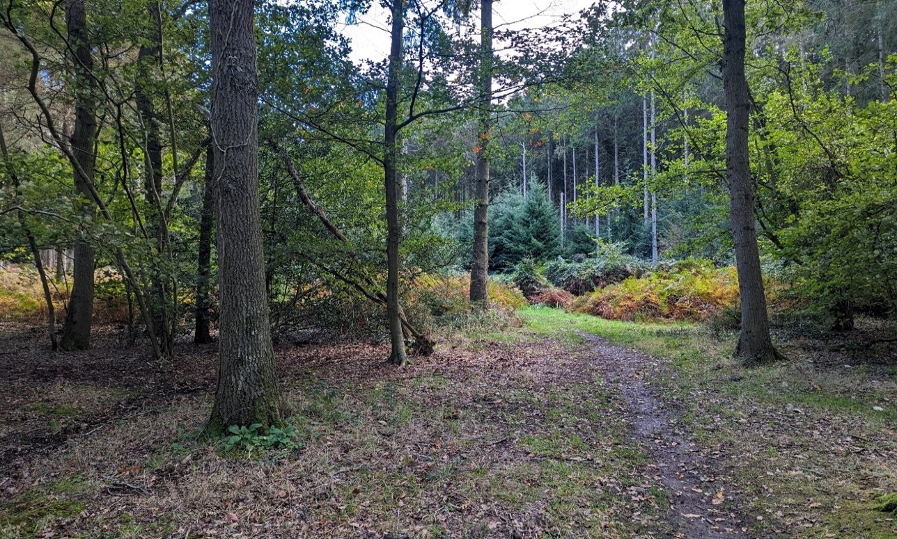
×![]()
Ancient Woodland provides recreational opportunitites (Woodcraft Wood):
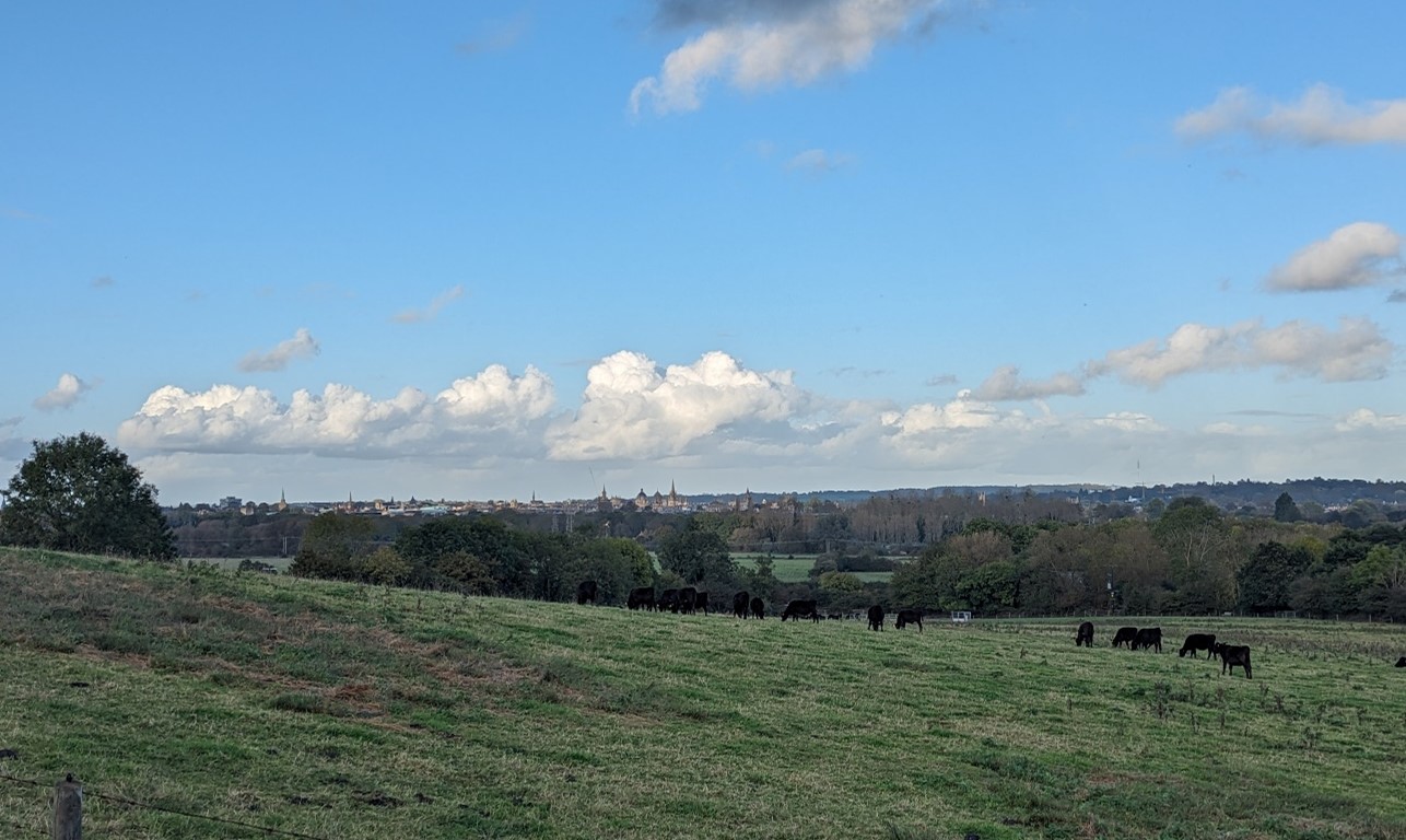
Grazing cattle and views towards the dreaming spires of Oxford at Hinksey Heights:
×![]()
Grazing cattle and views towards the dreaming spires of Oxford at Hinksey Heights:
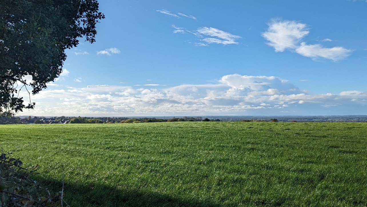
Expansive views across Oxfordshire from Cumnor Hill:
×![]()
Expansive views across Oxfordshire from Cumnor Hill:
Wytham Hill is prominent in views from the Thames floodplain:
×![]()
Wytham Hill is prominent in views from the Thames floodplain:
Description
Natural (landform, water, semi-natural land cover)
- A ridge composed of Corallian and Stanford Limestone Formations.
- A steep and distinctive ridge, rising from the around 65 metres Above Ordnance Datum (AOD) at the Thames valley to a high point of 165 metres AOD at Wytham Hill in the north. Other notable high points include Beacon Hill (133 metres AOD), Hurst Hill (158 metres AOD), Pickett’s Heath (164 metres AOD) and Boars Hill (133 metres AOD).
- Spring feed streams flow along minor valley features within the wider slopes, along with the occasional pond, such as at Youlbury Wood.
- Extensive areas of woodland on higher ground, often identified as Ancient Woodland; this includes Bagley Wood, Wytham Great Wood, Marley Wood and Bean Wood. Wytham Woods are designated as a Site of Special Scientific Interest (SSSI), consisting of a complex of ancient woodland, wood pasture, common land and old limestone grassland on a variety of soils.
- Considerable coniferous coverage intersperses the priority habitat deciduous woodlands. Outside of the woodlands, priority habitats include lowland calcareous grassland, lowland dry acid grassland, lowland fens and lowland meadows.
Cultural/social (land use, settlement, infrastructure, historic character)
- Woodlands are interspersed with medium to large scale arable and pastoral fields, generally defined by intact hawthorn hedges; some smaller scale parcels of land are found on the edges of development around Foxcombe Hill and Boars Hill in the south.
- A combination of post medieval and modern fieldscapes, with woodland dating from the last Ice Age, 17th century and modern plantations from the 1950s and 60s. The Wytham Estate has been owned, maintained and studied by the University of Oxford since 1942.
- Low-density settlement is concentrated in the south, and comprises scattered farmsteads, isolated properties and low-density development along roads to the south-east of Wootton. These properties tend to be large and detached, set back from the minor roads, with no specific vernacular. In contrast, the Wytham Hill area is unpopulated except for a few isolated properties around its fringes, with the nearest settlements being the small villages of Farmoor and Wytham, but both the northern and southern hilltop areas adjoin the larger urban area of Botley. There are a few Grade II Listed Buildings within the area, including Youlbury House, Foxcombe Hall, Templeton College and Chilswell Farm.
- Conduit House south of Botley is a Grade II* Listed Building and Scheduled Monument, which formed part of the system to provide clean drinking water to the City of Oxford.
- Road access is concentrated in the south, with narrow lanes enclosed by vegetation and woodland. There is no vehicular access to the north at Wytham Hill, although the A420 passes through the area close to the edge of Botley.
- There is an extensive network of public rights of way including the Oxford Greenbelt Way; access is more limited to the north, with permissive paths within Wytham Woods requiring a permit. Hinksey Heights golf course lies in the south-east, and has a new nature trail for additional recreation.
Perceptual (views, tranquillity, associations)
- The woodland and steep ridge are prominent in the local landscape, and provide a backdrop and focal point for views, including from Wytham, Botley, Cumnor and Farmoor reservoir.
- Visual contrast between enclosure and intimacy from the tree cover and long views out, framed by woodland with intervisibility with the lower river valley landscapes to the west, north and east; there are also distinctive long-range views of the spires and rooftops of Oxford to the east, and the North Wessex Downs form a distant horizon to the south.
- Seasonal interest in the woodlands, with the changing colour of leaves in autumn and carpets of bluebells in the spring, giving distinctive visual interest to the woodland.
- The busy A34 is locally audible, and visible from the south-east, and Botley is visible from some areas, but elevation above these urbanising influences mean that this is still a relatively tranquil landscape. The Tranquillity Assessment for South Oxfordshire and Vale of White Horse categorises 88% of the LCA in Zone 2 (‘areas of some tranquillity’) whilst the Dark Skies Assessment for South Oxfordshire and Vale of White Horse categorises over 50% of the area within its darkest assessment band.
- Adjacent tree cover and relatively complex topography tends to obscure the edge of Botley in views from less elevated areas.
- The wooded slopes are prominent in strategic views west across Oxford from the east, and Boars Hill offers a prime view back towards Oxford (one of the ten ‘view cones’ that have been defined in Oxford’s local planning policy since 1962). Jarn Mound is an historic viewpoint, set within associated gardens on Boars Hill, although tree cover now restricts the majority of distant views from the mound.
- Views include the ‘dreaming spires’ of Oxford, as painted from Hinksey Hill by William Turner. Matthew Arnold, who coined the phrase ‘dreaming spires’ mentions Hinksey in his poem ‘The Scholar Gypsy’. The Oxford Preservation Trust owns land in the area in order to protect green spaces and views, including Chilswell Fields at Foxcombe Hill.
Valued qualities
- A distinctive ridge, with extensive areas of woodland, including Bagley Wood, Wytham Great Wood, Marley Wood and Bean Wood.
- The distinctive complex of Ancient Woodland, wood pasture, common land, old limestone grassland at Wytham Woods SSSI to the north, and mosaic of deciduous woodland, lowland fens and lowland dry acid grassland to the south provide ecological value and contribute positively to the landscape.
- Provides a wooded backdrop to adjacent settlements at Farmoor, Botley and Wytham, as well as in longer-distance views.
- Prominent in strategic views west from Oxford city, designated as part of the Oxford View Cones. A valued association with William Turner, who painted the ‘dreaming spires’ of Oxford from Hinksey Hill. The Conduit House Scheduled Monument and Grade II* Listed Building also shows the important historic links between this landscape and the City of Oxford.
- Recreational value of the Oxford Greenbelt Way, public rights of way network, Oxford Preservation Trust land and permissive paths (with access by permit only) within Wytham Woods.
- The contrast between enclosure along narrow lanes and within woodlands, and long-distance, sometimes panoramic, views from high points.
- Woodland cover creates a sense of intimacy, and sense of peace and tranquillity. Skies are typically darker than in much of the district.
- The value of the landscape is demonstrated by its inclusion within the West Oxford Hills Local Landscape Designation.
Forces for change
- Increased recreation on the Oxford Greenbelt Way and on permissive paths through Wytham Woods may lead to a demand for visitor facilities, which could alter the rural character and localised sense of tranquillity.
- Pressure for additional institutional development such as university accommodation and teaching facilities, which could affect the rural character of the landscape and localised sense of tranquillity.
- Recent residential development along the southern edge of Botley could lead to further pressure for development within this area which would erode the rural setting of the town.
- Pressure for increased suburbanisation of houses on Hinksey Hill, Foxcombe Hill and Boar’s Hill, such as incongruous gates and fencing.
- The Ridge Hilltops landscape may be susceptible to the impacts of climate change, including:
- Deciduous woodlands are facing decline due to warmer winters, altered rainfall patterns, drier summers and increased frequency of extreme events; there may be a shift in vegetation type and composition, increased competition from invasive species, greater numbers of insect and mammal pests, and a greater risk of wind-throw and loss of mature trees.
- Changing temperatures, drier summers and wetter winters and extreme weather events are creating vulnerabilities in chalk/limestone grassland landscapes, including increased soil erosion and run-off; changes in plant and animal species and community composition; and an increased fire risk.
Landscape strategy and guidelines
The extensive areas of woodland cover should continue to provide ecological value and a sense of intimacy, peace and tranquillity. Maintain the ecological value provided by the complex of Ancient Woodland, wood pasture and other habitats.
- Retain and enhance woodland cover across the landscape, particularly that on higher ground.
- Encourage landowners to manage woodland appropriately, including to reduce the impacts of pests and diseases and to increase the age structure and structural heterogeneity of woodland. Consider the promotion of natural colonisation adjacent to existing woodland, allowing locally native species to develop resilience to the pressures of climate change through natural processes.
- Use trees and woodland to integrate development into the landscape, including any proposed residential development on the edge of settlements.
- Maintain the valued recreational use of the landscape and consider opportunities to introduce additional formal public rights of way connectivity to enhance appreciation of landscape character and views. Consider more permit-free access to Wytham Woods, whilst managing recreational routes to avoid/minimise disturbance to areas of nature conservation value.
Historic settlements and features should retain a relationship with their rural landscape settings which contribute to their distinctive historic character and time depth.
- Maintain physical and visual connectivity between Conservation Areas and prominent features in settlement setting, including the wooded slopes to the west of Wytham.
- Maintain the remaining open setting of Conduit House (Scheduled Monument) by resisting changes to the landscape which are not in keeping with the landscape character.
- Avoid further sub-urbanising features in the south of the area, including CCTV, metal fencing and entranceways and coniferous hedges around property boundaries.
- Any new development should fit the low-density settlement pattern. Any new development should use materials which are in keeping with, or complement, the local vernacular of brick, limestone and tile roofs.
Protect and enhance valued long views outwards towards Oxford and the North Wessex Downs National Landscape.
- Protect and enhance views towards the spires and rooftops of Oxford by managing woodland to maintain viewing corridors. Conserve and enhance the view from Hinksey Hill as painted by Turner in Dreaming Spires.
- Protect and enhance distant views towards the North Wessex Downs to the south
LCA 7C: Oxford East Ridge Hilltops
It should be noted that the lines used to denote where LCAs border settlements are approximate and should not be used for planning purposes.
Character Area Summary and Location
Located to the east of Oxford in South Oxfordshire district, this LCA comprises part of a low wooded ridge of limestone and sandstone that rises above the surrounding vale and river valley landscapes to the west (LCAs 12D and 12G), east (LCA 12F) and south-east (LCA 14E).
Key characteristics
- Distinctive low limestone and sandstone ridge, with an undulating landform of valleys and hills.
- Woodland features widely throughout the north and centre, many of which (particularly to the north) are Ancient Woodland. Some of these, as well as some former extraction sites, are nationally designated and contain important habitats including deciduous woodland, calcareous fen and limestone grassland.
- Land use comprises a mixture of large-scale arable fields and smaller-scale pasture fields associated with settlements and steeper hillsides.
- Sparsely settled with scattered farmsteads and villages/ hamlets, typically connected by a network of small, hedged sunken lanes. Several settlements retain historic cores, often covered by Conservation Areas, and containing clusters of Listed Buildings.
- Good recreational access on a network of public rights of way, including the Oxford Greenbelt Way and the Oxfordshire Way promoted paths. The southern slopes of Shotover Hill are managed as a Country Park.
- Landform and woodland create a sense of enclosure and restrain views. Some longer views are available from hillsides and higher ground; notable viewpoints include Shotover Hill and Beckley Hill.
- A more open and exposed character on ridges and higher ground, with dominant sky and long views, particularly where large-scale arable farming dominates.
- The telecommunications masts at Beckley are visible from a wide area, and pylons and overhead power lines are apparent in views across the south.
- A predominantly rural character with few detracting influences; some localised influence from settlement edges and from traffic along the busy A40, B4027 and B480 which run through the area.
Dominant sky and long views from higher ground near Forest Hill:
×![]()
Dominant sky and long views from higher ground near Forest Hill:
Hedgerows foreground views south from the Oxfordshire Way:

×![]()
Hedgerows foreground views south from the Oxfordshire Way:
Edge of proposed residential development north of Barton:
×![]()
Edge of proposed residential development north of Barton:
Woodeaton Wood SSSI:

×![]()
Woodeaton Wood SSSI:
Description
Natural (landform, water, semi-natural land cover)
- Comprises part of a belt of low limestone and sandstone hills that surround Oxford and rise prominently above lower-lying clay vales to the north and south.
- Upper Jurassic Corallian Limestone and Sandstone outcrop in places, but elsewhere are overlain by Kimmeridge Clay and Lower Greensand; limestone and sandstone outcrops have historically been the source of building stone for the surrounding area.
- An undulating landform of hills and valleys, ranging between approximately 60 metres Above Ordnance Datum (AOD) and 170 metres AOD. Notable high points include Shotover Hill (170 metres AOD), Thorn Hill (154 metres AOD), Beckley Hill (141 metres AOD) and Red Hill (134 metres AOD).
- Land falls towards low-lying Cherwell Valley and Otmoor lowlands in the north and towards the alluvial floodplain of the River Thame in the east and south.
- The landscape is drained by a network of watercourses forming tributaries of the Cherwell, Thame, or the Thames to the south-west; these tributaries include Bayswater Brook, Moorbirge Brook, Northfield Brook, Hollow Brook and Cuddesdon Brook.
- Blocks of predominantly deciduous woodland are scattered across the landscape; many of these, particularly to the north, are Ancient Woodland (including Stanton Great Wood, Holly Wood, Stow Wood, Long Wood and Woodeaton Wood), and designated as Sites of Special Scientific Interest (SSSIs).
- Outside of the woodlands, significant biodiversity is found at former extraction sites, which contain priority habitats calcareous fen and acid and limestone grassland. These include Woodeaton Quarry, Lyehill Quarry and Littleworth Brick Pit, which are designated as SSSIs. Some areas of priority habitat lowland fens and lowland calcareous grassland are found to the north near Wadley Hill and Wick Copse.
Cultural/social (land use, settlement, infrastructure, historic character)
- The land use is predominantly agricultural, comprising a mixture of arable and pasture; the northern area comprises mostly of pasture and the southern area mostly of arable land.
- Intensively farmed arable areas typically feature a large-scale rectilinear field pattern with a weak structure of tightly clipped or gappy hedgerows; where present, hedgerow trees such as ash and oak are distinctive features within these areas.
- Elsewhere a medium to large-scale field pattern is defined by a stronger structure of hedgerows and trees which provide clearer definition of field pattern.
- A smaller-scale field pattern with a more intact species-rich hedgerow structure is often associated with settlements and/or steeper hillsides.
- Shotover Registered Park and Garden (RPG) has a well-managed parkland character with formal features such as avenues and free-standing mature trees in pasture, clumps and blocks of woodland, exotic tree species, formal structures and boundary features.
- A scattered settlement pattern of farmsteads and small villages/hamlets, including Beckley, Elsfield, Stanton St John, Forest Hill, Littleworth, Horspath, Garsington and Cuddesdon. The larger town of Wheatley is the main settlement lying to the south-east of the area.
- Buildings in the villages often reflect the underlying geology, with many older houses constructed from the distinctive local Corallian Limestone. Red tiles or thatch are common as roofing materials.
- Historic clustered settlement form is retained in some villages (such as Woodeaton, Elsfield and Stanton St John), marked by the presence of several Listed Buildings and Conservation Area designations; however, modern expansion of other villages has resulted in a more linear or sprawling form, particularly at Wheatley.
- Settlements are typically connected by a network of small, sunken lanes with low trimmed hedges and hedgerow trees that wind up the slopes towards the hills and ridges; the A40, B4027 and B480 are the principal roads in the area which overall has a good road network.
- More recent infrastructure includes electricity pylons and telecommunications masts at Beckley.
- The area features a network of public rights of way, including the Oxford Greenbelt Way and the Oxfordshire Way promoted paths. The southern slopes of Shotover Hill are managed as a Country Park, providing over 117 hectares of publicly accessible land.
- Other important historic sites include medieval moated sites at Holton House and Church Farm (Scheduled Monuments), and Shotover House (Grade I Listed Building) with its 18th century formal parkland designed by William Kent (Grade I RPG).
Perceptual (views, tranquillity, associations)
- Landform and woodland create a sense of enclosure and reduces views across the area, particularly in the north.
- Some longer views available from hillsides and higher ground; notable viewpoints include Shotover Hill, from which spectacular views across south Oxfordshire are available, and Beckley Hill, with views north towards Otmoor.
- Open and exposed character on ridges and higher ground, with dominant sky and long views, particularly where large-scale arable farming dominates.
- The varied topography, mixed land use and strong woodland and tree cover create an attractive, diverse, patchwork landscape.
- A predominantly rural character, with few detracting influences. The telecommunications masts at Beckley are visible from a wide area, and pylons and overhead power lines are apparent in views across the south.
- Traffic along the busy A40 is locally audible, and traffic along other busy roads (B4027 to the north and B480 to the south) causes some localised intrusion. Localised urbanising influences are caused by the Oxford fringe at Headington to the east and around the settlement edges of Wheatley and some of the larger villages such as Horspath and Littleworth.
- Higher sense of tranquillity in the north and centre where woodland cover is most prevalent. Larger-scale arable agriculture and proximity to industrial park and powerlines carried on large pylons in Oxford reduce tranquillity in the south. The Tranquillity Assessment for South Oxfordshire and Vale of White Horse categorises 16% of the LCA in Zone 1 (‘areas of high tranquillity’) and 76% in Zone 2 (‘areas of some tranquillity’), whilst the Dark Skies Assessment for South Oxfordshire and Vale of White Horse categorises over 50% of the area within darkest assessment band.
Valued qualities
- Distinctive landform of low hills, ridges and valleys, which contrasts with the surrounding lower-lying vale landscapes to the north, east and south.
- Areas of Ancient Woodland, deciduous woodland, calcareous fen and acid and limestone grasslands, provide ecological value, examples of rare semi-natural habitats and contribute positively to the landscape.
- A strong structure of woodland, hedgerows and hedgerow trees, including smaller-scale field pattern often associated with settlements and/or on steeper hillsides.
- Historic, scattered settlement pattern of farmsteads and villages/hamlets linked by hedged sunken lanes, with a surviving historic clustered settlement form of some villages providing time-depth. The open landscape forms gaps between these which helps to retain their individual identities.
- Open landscape provides an immediate setting to settlements, including historic cores containing clusters of Listed Buildings and covered by Conservation Area designations. This open rural setting contributes to their historic character.
- Historically significant sites, including medieval moated sites and Shotover House with its 18th century formal parkland, which provide time-depth and historic landscape character.
- Recreational value of public rights of way, including the Oxford Greenbelt Way and the Oxfordshire Way promoted paths, and Shotover Country Park.
- Sense of enclosure due to landform and woodland cover, which contrasts with the longer-range views from hillsides and higher ground across the surrounding lower-lying vales, including from Shotover Hill and Beckley Hill.
- Forms a wooded backdrop in views from the lower lying vales to the north, east and south.
- Comprises part of the eastern setting of Oxford, forming part of a green backdrop seen in views from the city. Shotover Hill and high ground near Elsfield are particularly prominent, with the latter the location of one of the ten ‘view cones’ that have been defined in Oxford’s local planning policy since 1962.
- A predominantly rural character with few detracting influences over much of the area. Skies are typically darker than in much of the district.
- The value of the landscape is demonstrated by its inclusion within the East Oxford Hills Local Landscape Designation.
Forces for change
- Loss or poor management of woodland, hedgerows and hedgerow trees which affects the wooded character and sense of enclosure.
- Agricultural intensification, diversification and amalgamation of fields into lager parcels of arable land which is reducing the valued remnant areas of smaller-scale field pattern.
- Introduction of polytunnels creates a visual distraction within the landscape and undermines the rural character of the landscape.
- Recent and proposed large-scale residential development on the northern edge of Headington and Barton, including a strategic development allocation on land north of Bayswater Brook. This is expanding the urban area into the landscape, affecting its rural character. It would also reduce the physical and perceived gap between the edge of Oxford and the smaller villages of Elsfield and Beckley to the north, affecting the characteristic settlement pattern.
- Pressure for residential development to the north of Wheatley, including allocated development on land at Oxford Brookes University’s former Wheatley Campus, which would expand the settlement into the landscape, affecting its rural character. It would also reduce the gap between Wheatley and Holton to the north, affecting the characteristic settlement pattern.
- Pressure for solar development and associated infrastructure (cable routes etc) to the south. Increased need for renewable energy and a drive for net zero could lead to more solar farm applications in this and adjacent vale landscapes which could affect the rural character and characteristic outward views.
- Increased recreation on the Oxford Greenbelt Way and Oxfordshire Way which may lead to a demand for greater visitor facilities, including car parks, which would have a localised effect on the rural character.
- The Ridge Hilltops landscape may be susceptible to the impacts of climate change, including:
- Deciduous woodlands are facing decline due to warmer winters, altered rainfall patterns, drier summers and increased frequency of extreme events; there may be a shift in vegetation type and composition, increased competition from invasive species, greater numbers of insect and mammal pests, and a greater risk of wind-throw and loss of mature trees.
- Drier summers and wetter winters may lead to increased mortality and die-back of certain hedgerow tree species; an increased occurrence of insect pests and pathogens could lead to a potential loss or significant reduction in populations of key hedgerow tree species; and increased storm activity may lead to the loss of mature and veteran trees within hedgerows.
- Intensification of adjacent land use leading to increased impacts on hedgerows such as pesticide drift and nutrient enrichment.
- Changing temperatures, drier summers and wetter winters and extreme weather events are creating vulnerabilities in chalk/limestone grassland landscapes, including increased soil erosion and run-off; changes in plant and animal species and community composition; and an increased fire risk.
- Increase in storm damage could affect veteran and mature trees, and designed landscapes.
Landscape strategy and guidelines
Woodland blocks and mature tree cover should continue to contribute to rural character and provide ecological value, landscape structure and a sense of enclosure.
- Retain and enhance woodland blocks and tree lines; conserve and manage the Ancient Woodland and SSSI sites to improve landscape character and encourage biodiversity.
- Encourage the appropriate management of woodland, including to reduce the impacts of pests and diseases and to increase its age structure and structural heterogeneity. Consider the promotion of natural colonisation adjacent to existing woodland, allowing locally native species to develop resilience to the pressures of climate change through natural processes.
- Explore opportunities to expand and connect existing woodland and tree cover through natural regeneration or small-scale planting, particularly around settlements, whilst maintaining characteristic longer-range views from hillsides and higher ground across the surrounding lower-lying vales. This will strengthen landscape character and bring benefits for biodiversity.
- Seek to prevent further loss or poor management of hedgerows and hedgerow trees and encourage their restoration/reinstatement, whilst maintaining characteristic longer-range views outward; when establishing new hedges, aim to diversify the range of species and select species and provenances adapted to a wider range of climatic conditions.
- Use trees and woodland to integrate development into the landscape, including that on the edge of Oxford and Wheatley.
Maintain the open and wooded rural character of the landscape which contributes positively to the setting of Oxford and forms gaps between individual villages and hamlets, helping to retain their individual identities and their rural character.
- Avoid urban development or other forms of non-agricultural development within more open areas.
- Consider the impact of views of any new solar development in the surrounding vales. Refer to the South Oxfordshire and Vale of White Horse Renewable Energy Study when considering any solar panel applications.
- Maintain the distinctive scattered settlement pattern and minimise the impact of new housing development through careful design. Any new development should use materials which are in keeping with, or complement, the local vernacular of limestone and red tiles or thatch roofs.
- Conserve the pattern of rural sunken lanes, ensuring that their character is not lost through unsympathetic highway works, unnecessary signage, lighting, or removal of hedgerows and trees.
- Maintain the valued recreational use of the landscape which allow appreciation of views and landscape character.
- Consider impact of any development on views east from Oxford and from the surrounding vales.
- Protect and where possible enhance open views across the landscape towards Oxford to the west, and across the surrounding lower-lying vales to the north, east and south.
Historic villages should retain a relationship with their rural landscape settings which contribute to their distinctive historic character.
- Maintain physical and visual connectivity between Conservation Areas and their rural setting, including Ancient Woodlands and the smaller-scale pasture fields.
Estate and parklands, and the historic value and character they provide, should be conserved and enhanced.
- Conserve and manage historic parkland associated with Shotover House, including its avenues and free-standing mature trees in pasture, clumps and blocks of woodland, exotic tree species, formal structures and boundary features. Replant key ornamental tree species to retain the parkland character where necessary.
LCA 7D: Oxford South Ridge Hilltops
It should be noted that the lines used to denote where LCAs border settlements are approximate and should not be used for planning purposes.
Character Area Summary and Location
Located in South Oxfordshire district, to the south of Oxford and east of Abingdon. It comprises a prominent ridge of higher ground that rises above the valley and vale landscapes associated with the River Thames to the west (LCA 14D) and south (LCA 13B and 13C) and Baldon Brook to the east (LCA 12D).
Key characteristics
- A limestone ridge that forms a prominent spur of higher ground that rises steeply from the River Thames to the north and west; a gentler rolling plateau landform to the south and east that grades gradually to low-lying floodplains of the River Thames and Baldon Brook.
- A relatively well wooded landscape, with numerous scattered, large woodland blocks and significant stands of deciduous and coniferous woodland at Nuneham Courtenay Park.
- Predominantly large-scale rectilinear arable fields, defined by drainage ditches or low hedgerows with few hedgerow trees; some smaller scale pasture fields with more intact and species rich hedgerows associated with settlements and to the north around Nineveh Farm.
- Nuneham Courtenay Grade I Registered Park and Garden, designed by ‘Capability’ Brown for Lord Harcourt, comprises an extensive area of 18th century parkland and associated estate landscape in the centre of the plateau.
- Low density settlement pattern comprising scattered farmsteads and small villages at Nuneham Courtenay and Marsh Baldon; both villages are covered by Conservation Areas, with that at Nuneham Courtenay also covering the wider associated parkland.
- A good network of public rights of way allows access across the landscape, including the Oxford Greenbelt Way and Shakespeare’s Way.
- Predominantly rural character; areas of comparative inaccessibility in particular create a rural and remote character, particularly in the south. Some localised intrusion of main roads, overhead power lines and built development
- Views generally reduced by landform and tree cover resulting in an enclosed and intimate landscape; some longer views available from hillsides and higher ground.
Pasture fields bordered by mature trees (near Nuneham Courtenay):
×![]()
Pasture fields bordered by mature trees (near Nuneham Courtenay):
Enclosed, tree-lined lanes funnel views (Baldon Lane):

×![]()
Enclosed, tree-lined lanes funnel views (Baldon Lane):
Large-scale arable agriculture foregrounds views to Bluebell Wood:
×![]()
Large-scale arable agriculture foregrounds views to Bluebell Wood:
Large power pylons cross arable fields (Thame Lane):
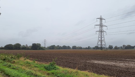
×![]()
Large power pylons cross arable fields (Thame Lane):
Description
Natural (landform, water, semi-natural land cover)
- A limestone ridge that forms a prominent spur of higher ground rising above the River Thames to the west and south. A rolling plateau landform ranging around 80 metres Above Ordnance Datum (AOD), with the highest land at Ninevah Farm in the north at 105 metres AOD.
- The valley sides fall steeply to the west (within LCA 14B), but grades more gently to the south and east, towards the low-lying floodplains of the Rivers Thames and Baldon Brook respectively.
- A relatively well wooded landscape, with numerous, scattered woodland blocks (often recorded as priority habitat deciduous woodland) and significant stands of deciduous and coniferous woodland at Nuneham Courtenay Park.
- Two small blocks of Ancient Woodland lie in the east – Sands Corner Copse and Hanginglands Copse.
- Outside of the woodlands, priority habitats include lowland meadows and traditional orchards.
Cultural/social (land use, settlement, infrastructure, historic character)
- Land use is predominantly agricultural with large areas of arable land and some smaller areas of pasture around settlements.
- A predominantly large-scale rectilinear field pattern, defined generally by low or gappy hedgerows with few hedgerow trees or drainage ditches; around settlements and to the north around Nineveh Farm there is a smaller-scale field pattern with a more intact and species rich hedgerows. Fieldscapes are typical of Parliamentary enclosure.
- Nuneham Courtenay is a Grade I Registered Park and Garden (RPG), comprising an extensive area of 18th century designed parkland and associated estate landscape in the centre of the plateau. This was designed by ‘Capability’ Lancelot Brown for Lord Harcourt.
- Low density settlement comprising scattered farmsteads and small villages at Nuneham Courtenay and Marsh Baldon; both covered by Conservation Areas, with that at Nuneham Courtenay covering the wider associated parkland. The villages typically developed around a central green; the green at Marsh Baldon is a fine surviving example. Limestone rubble, timber-framing, brick and tile or thatch roofs form a local vernacular.
- Nuneham Courtenay was originally located on high ground overlooking the Thames, but was subsequently demolished and rebuilt as a model estate village in its present location in the mid-18th Its original site was used for Lord Harcourt’s ‘villa with a view’.
- The A4074 crosses through the area and the A415 defines the south-western edge; other roads connecting the villages retain a minor, rural character. Access via road is relatively restricted, particularly in the south-west.
- The Cherwell Valley Line (railway) passes through the area to the west and is bordered by the Oxford Greenbelt Way.
- A strong network of public rights of way, including the Oxford Greenbelt Way and Shakespeare’s Way.
Perceptual (views, tranquillity, associations)
- Predominantly rural character but some localised intrusion of main roads, overhead power lines and built development; areas of comparative inaccessibility in particular create a rural and remote character. The Tranquillity Assessment for South Oxfordshire and Vale of White Horse categorises 12% of the LCA in Zone 1 (‘areas of high tranquillity’) and 87% in Zone 2 (‘areas of some tranquillity’).
- Electricity pylons are a strong visual detractor in this landscape, particularly in the south-west where there are views to the industrial estate on Abingdon’s southern edge.
- Views generally reduced by landform and tree cover resulting in a more enclosed and intimate landscape; some longer views available from hillsides and higher ground.
Valued qualities
- Distinctive steeply rising spur of higher ground rising above the River Thames, which contrasts with the surrounding lower-lying river valley and vale landscapes to the west, south and east.
- Woodland cover with significant stands of deciduous and coniferous woodland, provide a distinctive landscape pattern.
- Semi-natural habitats such as calcareous fen, acid and limestone grassland, Ancient Woodland and lowland meadows provide ecological value and contribute positively to the landscape.
- Surviving smaller scale pasture fields with relatively intact and species rich hedgerows associated with settlements and to the north around Nineveh Farm; this contrasts with the predominant more open large-scale rectilinear arable fields.
- Sparse historic settlement pattern of scattered farmsteads and villages/hamlets; the open landscape forms gaps between these which helps to retain their individual identities.
- Conservation Areas and Listed Buildings in Nuneham Courtenay and Marsh Baldon provide historic character and time-depth; the open landscape provides a rural setting to these, directly abutting the historic core in places.
- Remnant areas of orchards to the north of Marsh Baldon provide links to historic land uses, contribute to historic landscape character, and provide texture and visual interest to the landscape.
- Nuneham Courtenay RPG, which provides time-depth and historic landscape character and creates a distinct sense of place and parkland character.
- Recreational value of public rights of way, including the Oxford Greenbelt Way and Shakespeare’s Way.
- A predominantly rural character, with sense of enclosure and intimacy due to landform and woodland cover; some longer outward views available from hillsides and higher ground.
Forces for change
- Loss or poor management of woodland, hedgerows and hedgerow trees, which affects the wooded character of the landscape.
- Agricultural intensification, diversification and amalgamation of fields into lager parcels of arable land, which threatens the surviving smaller-scale field patterns including in the vicinity of settlements.
- Increased development pressure from the Strategic Allocation adjacent to Culham Science Centre, and from the Science Centre which may impact on views south from the ridge hilltops and the wider setting of Nuneham Courtenay RPG.
- Increased recreation on the Oxford Greenbelt Way which may lead to a demand for greater visitor facilities, including car parks, altering the rural character.
- Pressure for recreational and community uses to the west, which would replace arable land with parkland and associated buildings, access and outdoor play structures. This would affect the rural character of the landscape by introducing amenity and recreational uses.
- Pressure for solar development and associated infrastructure (cable routes etc) to the north, within both this and the adjacent vale and river valley landscapes. This would undermine the rural character of the landscape and introduce infrastructural elements into views across the landscape. It would also affect the rural setting of the historic settings of Nuneham Courtenay and Marsh Baldon.
- The Ridge Hilltops landscape may be susceptible to the impacts of climate change, including:
- Deciduous woodlands are facing decline due to warmer winters, altered rainfall patterns, drier summers and increased frequency of extreme events; there may be a shift in vegetation type and composition, increased competition from invasive species, greater numbers of insect and mammal pests, and a greater risk of wind-throw and loss of mature trees.
- Drier summers and wetter winters may lead to increased mortality and die-back of certain hedgerow tree species; an increased occurrence of insect pests and pathogens could lead to a potential loss or significant reduction in populations of key hedgerow tree species; and increased storm activity may lead to the loss of mature and veteran trees within hedgerows.
- Higher average temperatures and drier summers could lead to changes to community composition in arable field margins; an increase in bare ground and an increased risk of dieback in drought prone locations; the introduction of new crops and associated changes to management could alter the area and type of field margins; and an increase in agricultural use of summer insecticides which could reduce insect numbers and pollination.
- Intensification of adjacent land use leading to increased impacts on hedgerows such as pesticide drift and nutrient enrichment.
- Changing temperatures, drier summers and wetter winters and extreme weather events are creating vulnerabilities in chalk/limestone grassland landscapes, including increased soil erosion and run-off; changes in plant and animal species and community composition; and an increased fire risk.
- Increase in storm damage could affect veteran and mature trees, and designed landscapes.
Landscape strategy and guidelines
Woodland blocks and mature tree cover should continue to contribute to rural character and provide ecological value, landscape structure and a sense of enclosure and intimacy.
- Retain and enhance woodland blocks and tree lines; conserve and manage the Ancient Woodlands to improve landscape character and encourage biodiversity.
- Encourage the appropriate management of woodland, including to reduce the impacts of pests and diseases and to increase its age structure and structural heterogeneity. Consider the promotion of natural colonisation adjacent to existing woodland, allowing locally native species to develop resilience to the pressures of climate change through natural processes.
- Explore opportunities to expand and connect existing woodland and tree cover through natural regeneration or small-scale planting, particularly around settlements. This will strengthen landscape character and bring benefits for biodiversity.
- Seek to prevent further loss or poor management of hedgerows and hedgerow trees and encourage their restoration/reinstatement. Consider re-introducing a smaller-scale field pattern to complement those areas surviving around settlements and to the north; when establishing new hedges, aim to diversify the range of species and select species and provenances adapted to a wider range of climatic conditions.
- Use trees and woodland to integrate development into the landscape, including that associated with amenity/recreational uses.
Important habitats, including calcareous fen, lowland meadows and acid and limestone grassland, should be retained as distinctive landscape elements with high biodiversity value, and enhanced where possible. Opportunities to enhance ecological value of intensively managed arable farmland should also be considered.
- Manage grassland habitats to enhance their biodiversity value and appearance; ensure best practice management through suitable grazing regimes and avoiding agrochemical and fertiliser inputs; manage recreational routes to avoid/minimise disturbance; and manage scrub vegetation appropriately to maintain the open character (a certain amount of scrub can be beneficial, especially on sites that are prone to heat stress or drought, due to its shading effect potentially providing refuge for invertebrates).
- Manage arable land to enhance its biodiversity value and connectivity, by maintaining and expanding the area of land available for uncultivated arable field margins. Seek to maximise the diversity of margins to provide a range of habitats and to assist in the movement of species through the landscape and include species and cultivars that are able to tolerate and flower under hotter, drier summers.
- Seek opportunities to enhance habitat connectivity by creating green corridors and networks.
Maintain the open and wooded rural character of the landscape which forms the wider setting to Nuneham Courtenay RPG and forms gaps between individual settlements, helping to retain their individual identities and their rural character.
- Maintain the low-density settlement pattern of villages set around central greens, and minimise the impact of any new development on local character and on views from other areas. Any new development should use materials which are in keeping with, or complement, the local vernacular of limestone rubble, timber-framing, brick and tile or thatch roofs.
- Maintain the valued recreational use of the landscape which allow appreciation of views and landscape character.
- Consider impact of any development in adjacent areas on outward views, particularly for solar panel applications. Refer to the South Oxfordshire and Vale of White Horse Renewable Energy Study.
Historic parts of villages should retain a relationship with their rural landscape settings which contribute to their distinctive historic character.
- Maintain physical and visual connectivity between conservation areas and features in settlement setting, including Ancient Woodlands and the parkland at Nuneham Courtenay and traditional orchards to the north of Marsh Baldon.
Maintain and enhance remnant orchards on the edge of Marsh Baldon and the historic character, texture and visual interest they provide.
- Encourage the traditional farming practice and maintain and restore orchards and other horticultural uses where appropriate, including the remaining older orchard trees which have visual and biodiversity value and sense of time depth.
Estates and parklands, and the historic value and character they provide, should be conserved and enhanced.
- Conserve and manage historic parkland at Nuneham Courtenay, including its landscape park and pleasure grounds. Replant key ornamental tree species to retain the parkland character where necessary.