LCT 12: Middle Vale
Landscape character type summary
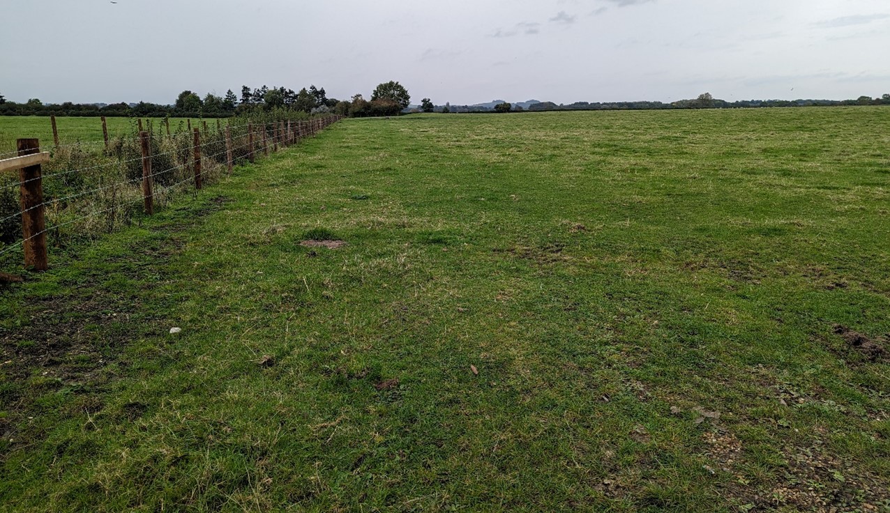
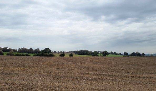
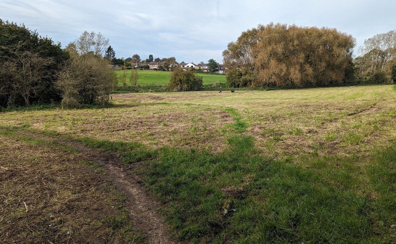
The clay vales, which form the majority of the land area within South Oxfordshire and Vale of White Horse, are located beneath the chalk downlands and Midvale Ridge. They are divided into Upper, Middle and Lower Vales. The Middle Vales are similar in character to the Upper Vales but the landform is typically less undulating. Mostly 55-70m Above Ordnance Datum (AOD), they are largely dominated by arable farming, but pastures occur on floodplain areas around the main watercourses. Watercourses are less dominant landscape features than in the Lower Vale areas, and field sizes are typically smaller than in the Lower Vales.
Seven Landscape Character Areas (LCA) are identified:
- LCA 12A: Thames Middle Vale
- LCA 12B: Western Middle Vale
- LCA 12C: Eastern Middle Vale
- LCA 12D: Oxford Middle Vale
- LCA 12E: Thame Middle Vale
- LCA 12F: Studley Middle Vale
- LCA 12G: Cherwell Middle Vale
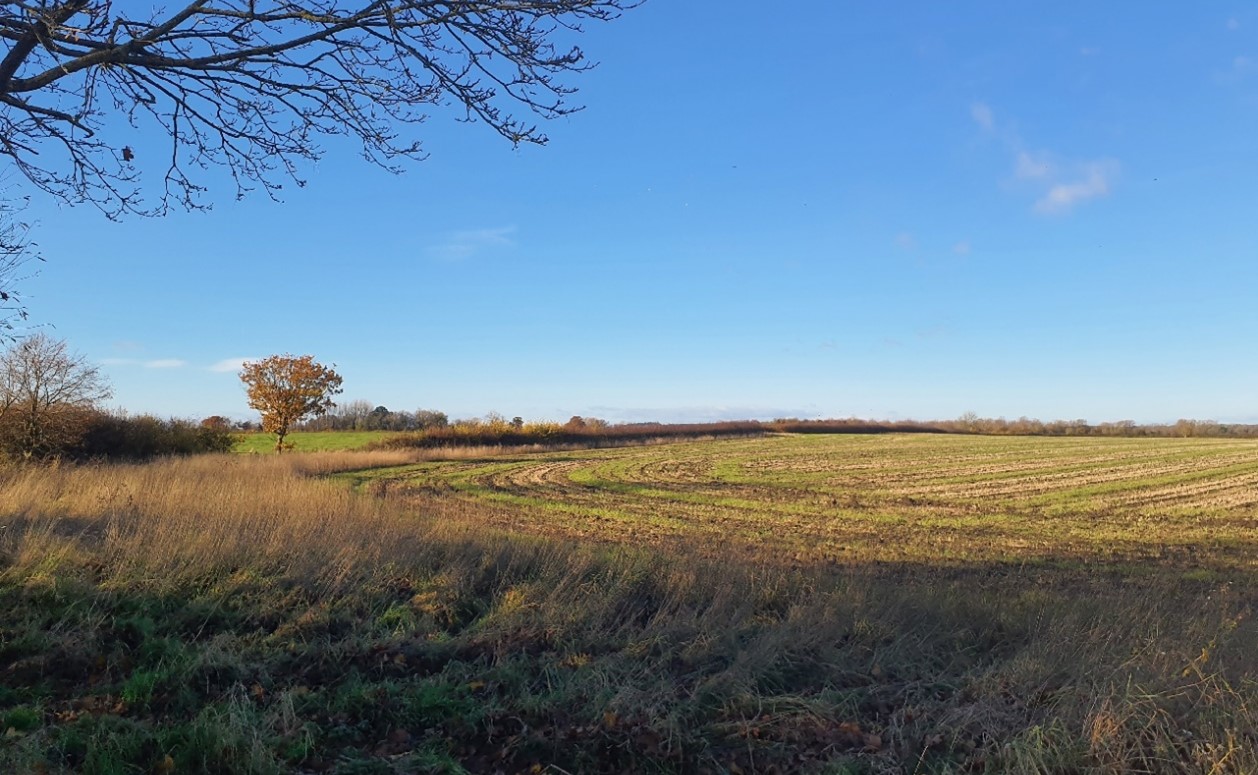
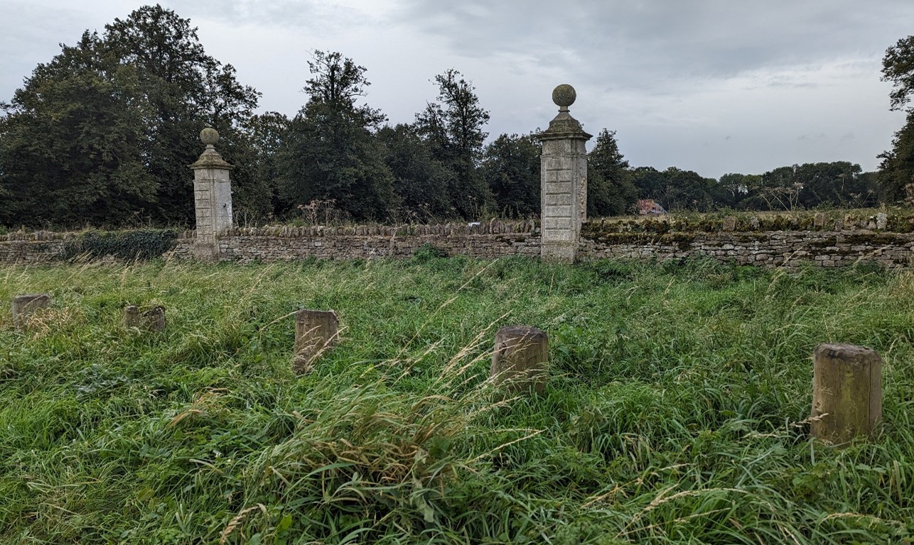
LCA 12A: Thames Middle Vale
It should be noted that the lines used to denote where LCAs border settlements are approximate and should not be used for planning purposes.
LCA 12A - View the map full screen in a new tab
Character Area Location
Located along the northern edge of the Vale of White Horse district, this LCA comprises the southern floodplain of the River Thames as it meanders eastwards. The floodplain is overlooked and contained by the adjacent Corallian Limestone Ridge (LCA 9G) to the south.
Key characteristics
- Flat, low-lying landscape associated with the River Thames that rises to the south towards the footslopes of the Corallian Limestone ridge.
- Important wetland and grassland habitats along and adjacent to the river add landscape and visual interest.
- On the floodplain, land use is predominately pasture, while on higher ground away from the river arable cultivation predominates.
- Pasture fields generally have greater intact boundary vegetation including some mature trees, while the larger, more open, arable fields tend to have low clipped hedges which are often degraded.
- Woodland cover is limited to dispersed small blocks and broad tree belts between fields, some of which are recorded as Ancient Woodland.
- Views south are backdropped by the Corallian Limestone Ridge; riparian vegetation along the river limits longer-range views to the north.
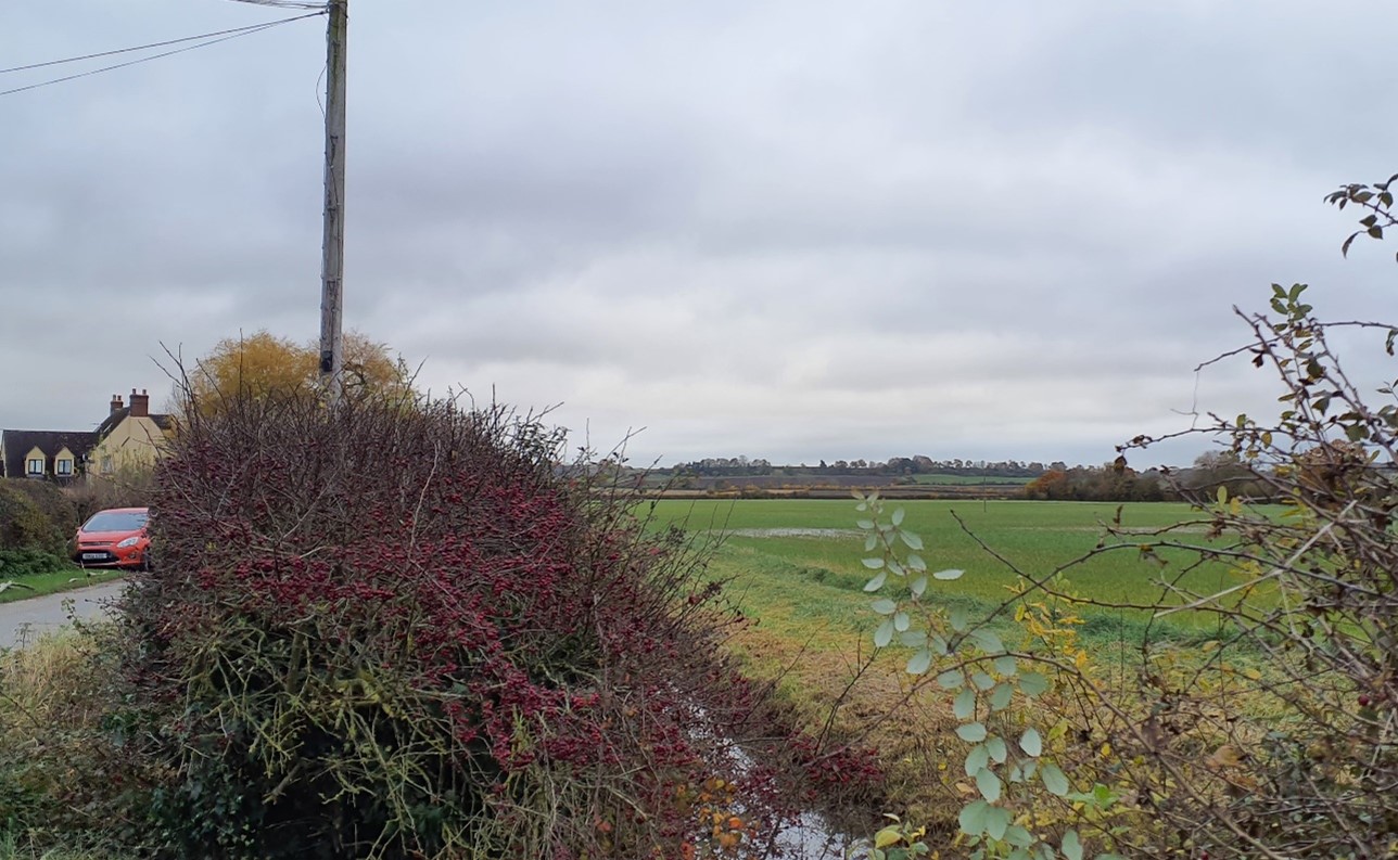
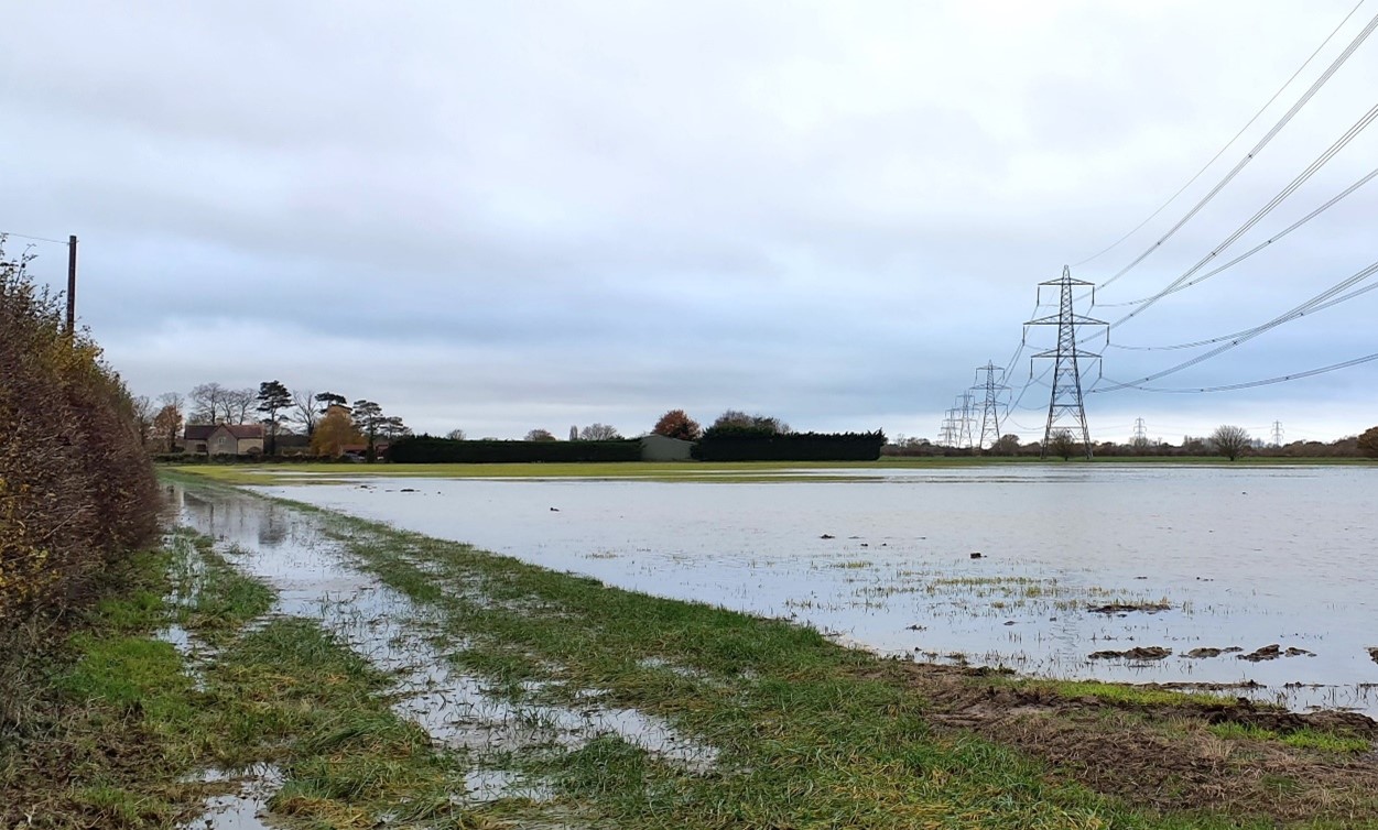
- A rural landscape with strong sense of tranquilly due to limited settlement; electricity pylons, the A415 and large agricultural structures form localised detracting features.
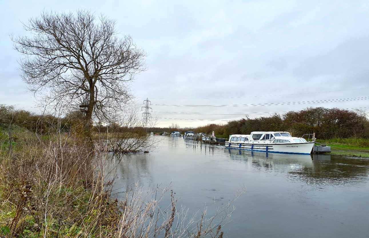
- Boat moorings, occasional stone bridges, and dense riparian vegetation including willow, contribute to the sense of place along the River Thames.
View south to the vale edge slopes(near Crossways):
×![]()
View south to the vale edge slopes(near Crossways):
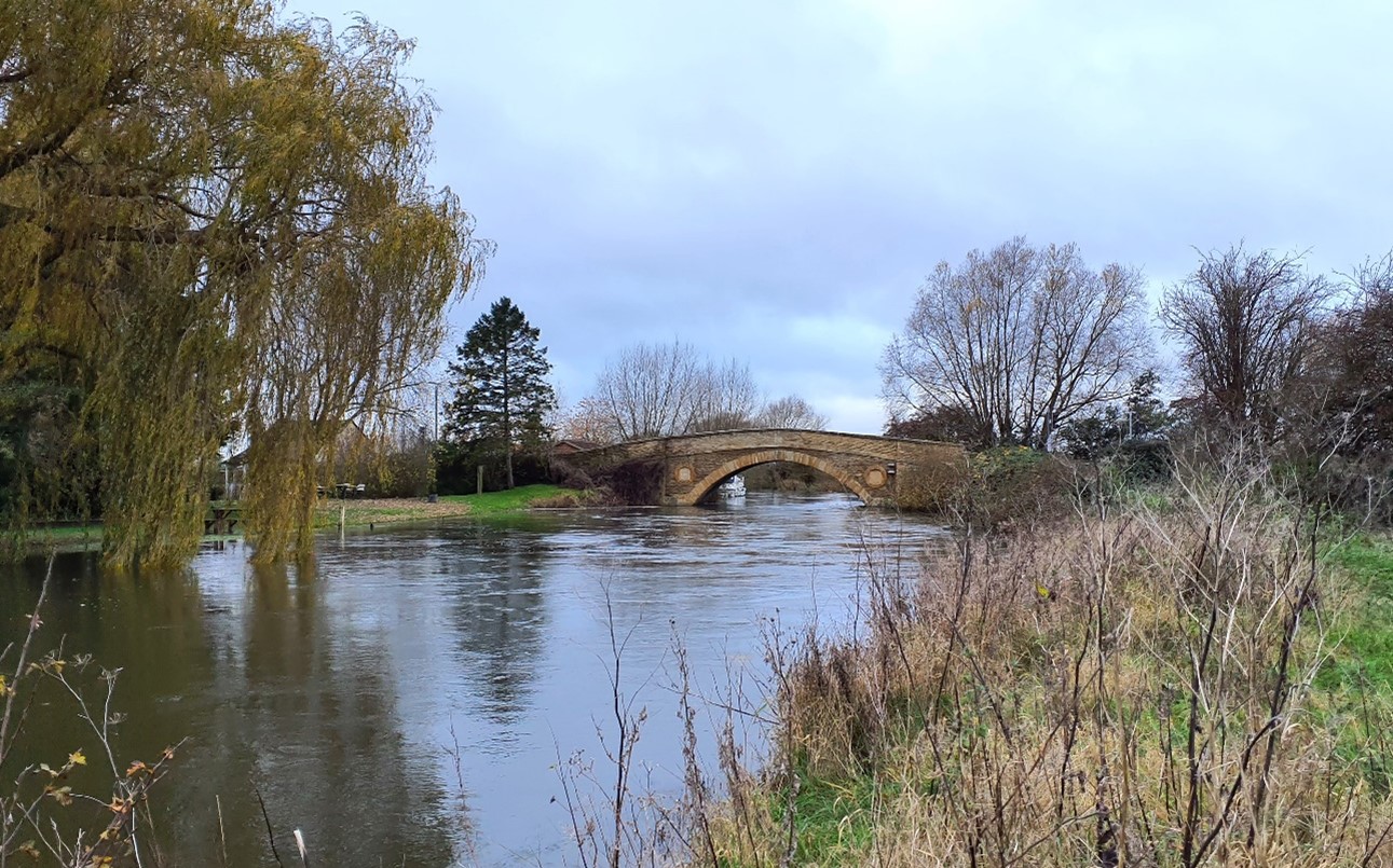
Traditional stone bridge at Tadpole Bridge over the River Thames:
×![]()
Traditional stone bridge at Tadpole Bridge over the River Thames:
Pylon lines form prominent vertical features in the flat floodplain landscape (Thrupp Turn):
×![]()
Pylon lines form prominent vertical features in the flat floodplain landscape (Thrupp Turn):
Boats moored on the River Thames (near Tadpole Bridge):
×![]()
Boats moored on the River Thames (near Tadpole Bridge):
Description
Natural (landform, water, semi-natural land cover)
- A flat, low-lying landscape on the southern side of the River Thames, with much of the area lying within the river’s floodplain. Land rises very gently to the south to meet the footslopes of the Corallian Limestone Ridge. Elevations range from around 65-75 metres Above Ordnance Datum (AOD).
- Underlain by Oxford Clay Formation Mudstone, with alluvium of clay, silt, sand and gravel superficial deposits.
- Fields are drained by a network of ditches which discharge north into the Thames, and are often lined with trees including willow, alder, ash and hawthorn.
- Woodland is limited to dispersed small blocks and broad tree belts between fields, some of which, such as Long Copse in the east, are recorded as Ancient Woodland.
Cultural/social (land use, settlement, infrastructure, historic character)
- Land use is predominately pastoral on the floodplain, with intact boundary vegetation of hawthorn and blackthorn hedgerows, with some mature hedgerow trees, such as ash, oak, and willow. Larger arable fields lie on higher ground, bounded by low clipped hedges which are degraded and gappy in places.
- Settlement is limited to the small hamlet of Duxford near Duxford Ford, occasional isolated farmsteads and dwellings, and the Trout Inn located on the riverbank to the north of Buckland Marsh.
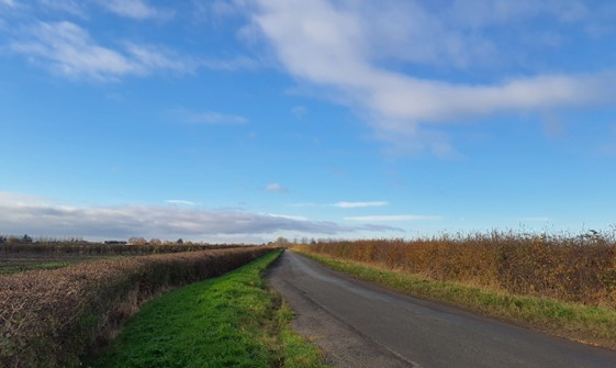
- Limited road access, generally running north-south connecting the river floodplain to the higher ground to the south and north. The A415 crosses in the east, and the A4095 the west. Buckland Road passes north-south through the area and crosses the Thames at Tadpole Bridge. Elsewhere, vehicle access predominantly consists of narrow tracks.
- Public rights of way cross the area and connect to the Thames Path National Trail which largely follows the south bank of the Thames.
- The Thames is navigable, providing further recreational value and waterborne craft on the Thames add colour to the winding river course, including at Radcot and Rushey locks.
- Causewayed enclosure and associated features immediately west of Rushey Weir are Scheduled Monuments, as is Wyke Monastic Grange in the south-west. Several of the bridges, including at Radcot, Tadpole Bridge and Newbridge, are Grade II Listed Buildings.
- Fieldscapes within the area are recorded as being a mixture of post medieval, pre-18th century and modern origin.
Perceptual (views, tranquillity, associations)
- The River Thames is visible from sections of the Thames Path along its banks, although layers of vegetation limit views north across the pastoral farmland towards the river.
- Views along the valley floor are seen in context with the wooded Corallian Limestone Ridge which forms a backdrop to the south. Riparian vegetation associated with the Thames limits longer views to the north.
- Electricity pylons and agricultural structures form detracting features, and traffic noise from the A415 and A4095 locally lowers tranquillity, but the sparsely settled, rural area has a general sense of peace and tranquillity. There is limited urban influence, and containment is provided by the wooded slopes of the Corallian Limestone Ridge to the south. The Tranquillity Assessment for South Oxfordshire and Vale of White Horse categorises 46% of the LCA in Zone 1 (‘areas of high tranquillity’)and 54% in Zone 2 (‘areas of some tranquillity’).
- The sparse settlement and limited urban influence result in dark night skies. Over 90% of this landscape is categorised as within the darkest two bands in the Dark Skies Assessment for South Oxfordshire and Vale of White Horse.
- Boating activity and moorings contribute to the sense of place along the Thames. Moorings can be detracting features with scaffold jetties and parking areas, locally reducing remoteness and tranquillity.
Valued qualities
- Strong sense of place associated with the River Thames and floodplain.
- Intact hedgerows with mature trees provide landscape structure and valuable ecological corridors within the farmed landscape.
- Scattered woodland (including Ancient Woodland) adds texture to the landscape and provides important habitats.
- A good network of public rights of way provides recreational access to the landscape, including the Thames Path National Trail. Opportunities for water-based recreation on the Thames are also valued.
- Views to the wooded limestone ridge to the south provide a sense of containment and contribute to the sense of place.
- The sparse settlement pattern and rural character, with a sense of tranquillity across much of the landscape, especially on the valley floor.
- Important historic features including Scheduled Monuments and several listed bridges.
- The value of the Thames Middle Vale landscape is demonstrated by the inclusion of most of it within the Northern Thames Valley Local Landscape Designation.
Forces for change
- Historic conversion of meadow and pasture fields to arable farming, and a decline in active management of remaining floodplain pasture meadows affecting the small-scale field pattern and diluting the pastoral character of the landscape.
- Poor maintenance and loss of field boundaries, resulting in fragmentation and gaps in hedgerows.
- Lack of pollarding, loss of boundary Willows and decline in riparian vegetation along watercourses affecting the distinctive character of the river corridors and resulting in reduced biodiversity value.
- Increased water-based recreation on the River Thames may result in increased demand for facilities including moorings, winter storage, repair areas and parking. This would erode the tranquil, naturalistic qualities of the river corridor.
- Pressure for increased facilities associated with events, such as marquees and holiday accommodation like shepherds huts, which are changing the character of this largely unsettled landscape.
- Duxford Old River, adjacent to Chimney Meadows SSSI and NNR, has been added to the Biodiversity Net Gain (BNG) site register. This will enable the creation of key floodplain habitat, such as floodplain wetland mosaic, neutral grassland, broad-leaved woodland, and mixed scrub.
- The Middle Vale landscapes may be susceptible to the impacts of climate change, including:
- Drier summers and wetter winters may lead to increased mortality and die-back of certain hedgerow tree species; an increased occurrence of insect pests and pathogens could lead to a potential loss or significant reduction in populations of key hedgerow tree species; and increased storm activity may lead to the loss of mature and veteran trees within hedgerows.
- Wetter winters may mean woody species in hedgerows are exposed to prolonged flooding in the growing season and will be at risk of dying, and winter trimming will become more difficult due to wet ground (preferred to autumn trimming to ensure food supply for birds).
- Intensification of adjacent land use leading to increased impacts on hedgerows such as pesticide drift and nutrient enrichment.
- Hotter drier summers and wetter winters and winter flooding could result in changes to wetland and riparian plant community composition; some non-native species may become invasive, and other currently geographically restricted species may spread more easily.
- Wetter winters and higher peak river flows may lead to increased flood defence activity, creating more physical habitat degradation and introducing potentially detracting features.
- Higher average temperatures and drier summers could lead to changes to community composition in arable field margins; an increase in bare ground and an increased risk of dieback in drought prone locations; the introduction of new crops and associated changes to management could alter the area and type of field margins; and an increase in agricultural use of summer insecticides which could reduce insect numbers and pollination.
- Hotter, drier summers and wetter winters will lead to changes in food production and growing seasons, and are likely to cause heat stress to livestock. Flooded land is only capable of supporting lower-value crops, pasture or woodland, which would impact important arable crops. Landscape appearance will likely also be altered, particularly if relocation of growing areas is required or crop diversification occurs (causing a need for changes in field pattern and the potential removal of field margins, hedgerows, woodlands).
Landscape strategy and guidelines
Maintain the open, rural and sparsely settled character, with its strong association with the River Thames, and views south to the wooded limestone ridge.
- Maintain the sparse settlement pattern centred around the small hamlet of Duxford. Any new development should be small-scale to fit within this open landscape.
- Carefully consider the visual and landscape character impacts of new recreational facilities including any permanent holiday accommodation or marquees on views from within the area.
- Consider the impact of any new lighting on night-time views (refer to the guidance in the Dark Skies / Light Impact Assessment for South Oxfordshire and Vale of White Horse).
- Protect and conserve historic assets and their setting, including the listed bridges which are locally distinctive features and contribute to the sense of time depth in the landscape.
- Ensure recreational pressures on the River Thames are sustainably managed to protect the tranquil, rural character of the river corridor.
Retain the pastoral character along the River Thames floodplain and its tributaries by strengthening the small-scale field pattern and conserving and enhancing areas of floodplain grazing marsh and riparian vegetation, and the ecological value they provide. Consider opportunities to enhance the ecological value and appearance of intensively farmed arable land.
- Manage floodplain grazing pastures and wet grassland areas to enhance their biodiversity value and appearance; ensure best practice management through suitable grazing regimes and avoiding agrochemical and fertiliser inputs; manage recreational routes to avoid/minimise disturbance; and manage scrub vegetation appropriately to maintain the open character.
- Conserve and enhance wetland habitats, including riparian vegetation, to enhance their contribution to landscape character and biodiversity value.
- Maintain and where appropriate restore the locally distinctive network of drainage ditches which are valuable ecological corridors and contribute to the wider wetland habitat network.
- Encourage adjacent land uses which strengthen role as ecological corridors and enhance landscape character.
- Seek opportunities to enhance connectivity with other habitats nearby by creating green corridors and networks.
Woodland cover should continue to provide landscape structure and ecological value whilst contributing to the tranquil, rural character of the landscape.
- Retain and enhance the network of mature trees within hedgerows and riparian woodland along watercourses.
- Encourage the appropriate management of woodland (including Ancient Woodland) to reduce the impacts of pests and diseases and to increase its age structure and structural heterogeneity. Consider the promotion of natural colonisation adjacent to existing woodland, allowing locally native species to develop resilience to the pressures of climate change through natural processes.
- Explore opportunities to expand and connect existing woodland and tree cover through natural regeneration or small-scale planting. This will strengthen landscape character and bring benefits for biodiversity.
- Seek to retain and enhance hedgerows and encourage their restoration/reinstatement where sections have been lost. When establishing new hedges, aim to diversify the range of species and select species and provenances adapted to a wider range of climatic conditions.
LCA 12B: Western Middle Vale
It should be noted that the lines used to denote where LCAs border settlements are approximate and should not be used for planning purposes.
LCA 12B - View the map full screen in a new tab
Character Area Location
Located between Stanford in the Vale in the west and Steventon in the east, in Vale of White Horse district. The LCA comprises an area of low-lying farmland, part of a wider vale landscape to the east and west (LCAs 11B and 13A). It is enclosed by the Corallian Limestone Ridge (LCA 8A) to the north and hills rising to the chalk escarpment to the south (LCA9B).
Key characteristics
- Gently undulating, low-lying farmland associated with the River Ock valley; land rises gradually to the south towards the footslopes of the North Wessex Downs.
- A pattern of small to medium-sized waterside meadows and pasture, with arable fields of varying size away from the river.
- Boundary vegetation varies from degraded hedgerows with broken tree lines, through intact low clipped hedges along fields and roads, to hedges with mature hedgerow trees (predominantly along water courses and ditches).
- Moderately wooded landscape, with occasional scattered small blocks of woodland, substantial belts of trees along the Great Western Main Line railway, vegetation along the Wilts and Berks Canal, and riparian vegetation along the River Ock.
- Settlement comprises scattered but relatively frequent nucleated villages, all of which have Conservation Areas containing clusters of Listed Buildings.
- Boundary vegetation and woodland frequently shorten views, although between tree cover there are views north towards the Corallian Limestone Ridge and south to the North Wessex Downs.
- An overall rural landscape, particularly away from settlement; however, the notable presence of settlement, transport, utilities and business/light industrial land uses limits the sense of tranquillity and remoteness.
- The character area forms a significant part of the wider setting to the north of the North Wessex Downs National Landscape, with intervisibility from vantage points within the Downs.
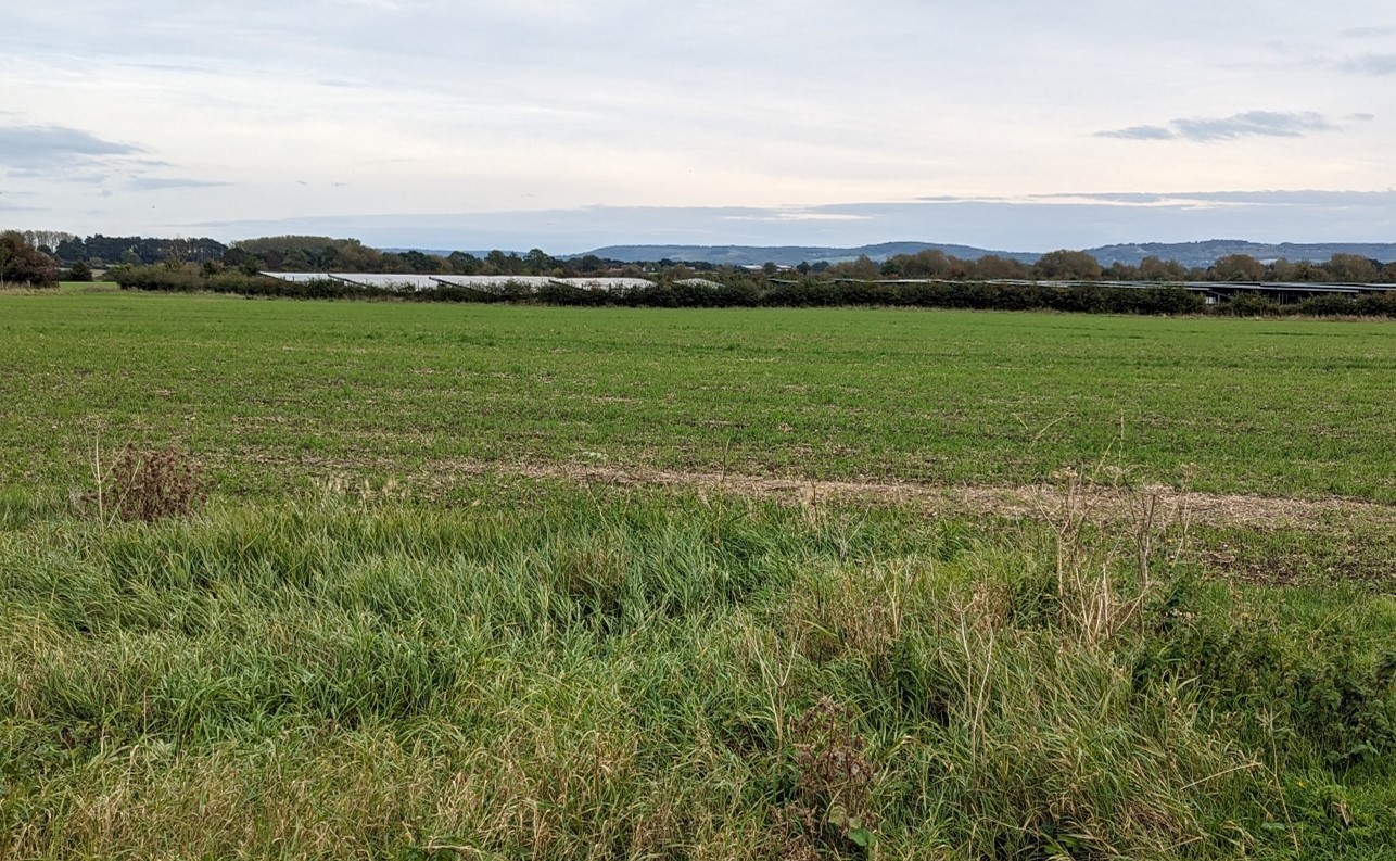
Large-scale arable field bounded by hedgerows and occasional mature trees (near Goosey):
×![]()
Large-scale arable field bounded by hedgerows and occasional mature trees (near Goosey):
Narrow country lane flanked by low-clipped hedgerows (near Lydford):
×![]()
Narrow country lane flanked by low-clipped hedgerows (near Lydford):
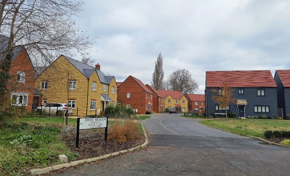
Modern residential development on the edge of East Hanney:
×![]()
Modern residential development on the edge of East Hanney:
Public rights of way provide access to the landscape near Charney Bassett:

×![]()
Public rights of way provide access to the landscape near Charney Bassett:
Description
Natural (landform, water, semi-natural land cover)
- Underlain by a combination of Gault Formation Mudstone Sedimentary Bedrock, Ampthill Clay Formation and Kimmeridge Clay Formation, with areas of Kimmeridge Clay Formation Sandstone, and Lower Greensand Group Sandstone. Alluvium clay, silt, sand and gravel superficial deposits line the river floodplain.
- The area consists of a broad swathe of low-lying but gently undulating land, drained by numerous ditches and minor watercourses including Stutfield Brook and Land Brook which flow from the surrounding higher ground towards the Ock.
- The landscape rises slightly from the low-lying River Ock at 60 metres Above Ordnance Datum (AOD) in the north to meet the footslopes of the North Wessex Downs at 70 metres AOD in the south.
- Deciduous woodland is scattered across the area within small blocks and some substantial belts of trees along the railway, a corridor of vegetation along the Wilts and Berks Canal and an area of plantation woodland on the eastern edge of Grove. Riparian vegetation (including willow, alder and ash) lines the meandering course of the River Ock.
- Small traditional orchards occur within villages, for example at East and West Hanney. There are very occasional pockets of Ancient Woodland.
- Individual mature trees within hedges are frequent, with occasional large mature trees within fields.
Cultural/social (land use, settlement, infrastructure, historic character)
- Land use comprises predominantly well-maintained farmland. A pattern of small to medium sized waterside meadows and pasture gives way to arable fields of varying size away from the river corridor.
- Boundary vegetation varies; intact hawthorn and beech hedges along boundaries and roads are generally maintained to low heights. There are hedgerows in a number of areas without significant vegetation, or with broken tree lines. Along water courses and straight ditch lines are low hedges with trees, including ash, willow and poplar.
- Settlement comprises scattered but relatively frequent nucleated villages including Stanford in the Vale, Goosey, Denchworth, Charney Bassett, East and West Hanney, and Steventon, all of which contain clusters of Listed Buildings, and have designated Conservation Areas.
- The Great Western Main Line railway, with recently installed overhead electrification infrastructure, crosses east-west through the landscape. A section of the old Wilts and Berks Canal, identified by a corridor of vegetation, cuts through the southern part of the LCA.
- The A338 and A417 pass through the landscape, with a network of minor rural lanes linking the dispersed villages. There are large areas which have no road access.
- There is a well-connected network of public rights of way across most of the area, including footpaths, bridleways and byways. The promoted Vale Way passes through the west of the landscape.
- A large solar farm is located to the west of Steventon, although its visibility from within the vale is limited.
Perceptual (views, tranquillity, associations)
- Boundary vegetation and woodland frequently shorten views within the landscape. However, between tree cover, there are striking views to and intervisibility with the high ground of the Corallian Limestone Ridge to the north (particularly from Folly Hill), and the North Wessex Downs National Landscape to the south.
- The landscape forms a significant part of the wider setting to the North Wessex Downs National Landscape, with the area visible in the distance from vantage points within the Downs, including from The Ridgeway and Open Access Land surrounding the Uffington White Horse.
- Overall, a rural landscape with areas of low-key human influence away from settlement, which can be appreciated from the public rights of way across the countryside. Despite some intrusion by settlement, transport, light industrial buildings and activity, factors such as the visibility of woodland, proximity to the River Ock and absence of larger settlements contribute to the Tranquillity Assessment for South Oxfordshire and Vale of White Horse categorising 91% of the LCA in Zone 2 (‘areas of some tranquillity’).
Valued qualities
- Vegetation cover provides a sense of enclosure, contrasting with intervisibility with high ground of the Corallian Limestone Ridge to the north, and the North Wessex Downs to the south.
- Small watercourses and their associated riparian vegetation provide biodiversity value, ecological connectivity across the farmed landscape and contribute positively to the landscape.
- Recreational value of public rights of way, including the promoted Vale Way, which enable access to the rural landscape.
- Traditional settlement pattern of historic, nucleated villages, with Listed Buildings and designated Conservation Areas, provides time-depth. The open landscape provides a rural setting to these.
- The area forms a significant part of the wider rural setting to the north of the North Wessex Downs National Landscape and is prominent in views from key vantage points including the Uffington White Horse.
Forces for change
- Pressure for increased residential development on the edges of Grove, East Hanney and Stanford in the Vale, which could affect the tranquil, rural character and reduce the sense of separation between settlements.
- Introduction of solar energy developments, both within this area and in adjacent landscapes, changing views and the agricultural character of the landscape.
- Past amalgamation of fields into lager parcels of arable land, changing the traditional small-scale field pattern.
- Increase in horse grazing and associated facilities, changing the agricultural character.
- Fragmentation of hedgerows along field boundaries affects the wooded character and sense of enclosure, and affects their role in providing landscape structure and functioning as ecological corridors.
- Increase in small-scale rural development along roads, and intensification of settlement-edge uses such as subdivision of land for paddocks, introduces suburban features to the landscape and erodes the traditional, rural character.
- Historic conversion of meadow and pasture fields to arable farming, and a decline in active management of meadows and pasture on the floodplain, affecting the pastoral character of the landscape.
- Lack of pollarding, loss of boundary willows and decline in riparian vegetation along watercourses affecting the distinctive character of the river corridors and resulting in reduced biodiversity value.
- The Middle Vale landscapes may be susceptible to the impacts of climate change, including:
- Drier summers and wetter winters may lead to increased mortality and die-back of certain hedgerow tree species; an increased occurrence of insect pests and pathogens could lead to a potential loss or significant reduction in populations of key hedgerow tree species; and increased storm activity may lead to the loss of mature and veteran trees within hedgerows.
- Wetter winters may mean woody species in hedgerows are exposed to prolonged flooding in the growing season and will be at risk of dying, and winter trimming will become more difficult due to wet ground (preferred to autumn trimming to ensure food supply for birds).
- Intensification of adjacent land use leading to increased impacts on hedgerows such as pesticide drift and nutrient enrichment.
- Hotter drier summers and wetter winters and winter flooding could result in changes to wetland and riparian plant community composition; some non-native species may become invasive, and other currently geographically restricted species may spread more easily.
- Wetter winters and higher peak river flows may lead to increased flood defence activity, creating more physical habitat degradation and introducing potentially detracting features.
- Higher average temperatures and drier summers could lead to changes to community composition in arable field margins; an increase in bare ground and an increased risk of dieback in drought prone locations; the introduction of new crops and associated changes to management could alter the area and type of field margins; and an increase in agricultural use of summer insecticides which could reduce insect numbers and pollination.
- Hotter, drier summers and wetter winters will lead to changes in food production and growing seasons, and are likely to cause heat stress to livestock. Flooded land is only capable of supporting lower-value crops, pasture or woodland, which would impact important arable crops. Landscape appearance will likely also be altered, particularly if relocation of growing areas is required or crop diversification occurs (causing a need for changes in field pattern and the potential removal of field margins, hedgerows, woodlands).
Landscape strategy and guidelines
Maintain the sparsely settled, rural character of the landscape away from existing settlements, which forms rural gaps between settlements and affords intervisibility with the Corallian Limestone Ridge to the north and North Wessex Downs National Landscape to the south.
- Maintain the nucleated settlement pattern, focussed in the small villages and minimise the impact of any new development on local character and on views from other areas.
- Use planting and appropriate locally sourced materials to integrate any new development into the landscape, particularly any new settlement extensions on the edge of villages.
- Maintain the valued recreational use of the landscape and consider opportunities to introduce additional public rights of way, particularly to increase connectivity to the north to enhance appreciation of views and landscape character.
- Respect the setting of the Conservation Areas and sensitivity of historic settlement edges by resisting changes which are not in keeping with the landscape character, including intensive equestrian activities and unsympathetic housing developments.
- Consider the impact of new development (including renewable energy development) in long views north from the Wessex Downs National Landscape. Refer to the South Oxfordshire and Vale of White Horse Renewable Energy Study when considering any solar panel applications.
Retain the pastoral character along watercourses by strengthening the smaller-scale field pattern and conserving and enhancing areas of floodplain grazing marsh and riparian vegetation and the ecological value they provide. Consider opportunities to enhance the ecological value and appearance of intensively farmed arable land.
- Manage grazing marsh habitats to enhance their biodiversity value and appearance; ensure best practice management through suitable grazing regimes and avoiding agrochemical and fertiliser inputs; manage recreational routes to avoid/minimise disturbance; and manage scrub vegetation appropriately to maintain the open character.
- Conserve and enhance wetland habitats, including riparian vegetation, to enhance their contribution to landscape character and their nature conservation and biodiversity value.
- Encourage adjacent land uses which strengthen role as ecological corridors and enhance landscape character, for example through restoring floodplain pasture meadows.
The network of hedgerows along field boundaries and roads, small blocks of woodland, and large mature trees should continue to contribute to the rural character, providing landscape structure and acting as ecological corridors within the farmed landscape.
- Conserve and manage the Ancient Woodland sites to improve landscape character and encourage biodiversity.
- Explore opportunities to expand and connect existing woodland and tree cover through natural regeneration or small-scale planting. This will strengthen landscape character and bring benefits for biodiversity.
- Seek to prevent further loss or decline in the quality of remaining boundary hedgerows and encourage their restoration/reinstatement, whilst maintaining characteristic open views; when establishing new hedges, aim to diversify the range of species and select species and provenances adapted to a wider range of climatic conditions.
- Use trees and woodland to integrate development (including solar energy developments) into the landscape.
LCA 12C: Eastern Middle Vale
It should be noted that the lines used to denote where LCAs border settlements are approximate and should not be used for planning purposes.
LCA 12C - View the map full screen in a new tab
Character Area Summary and Location
The LCA comprises a low-lying area of farmland in South Oxfordshire district. It forms a transitional landscape between the wider vale landscape to the north and west (LCAs 11C and 13C), the Thame valley (LCA 14E) to the north and the rising foothills of the chalk escarpment to the south-east (LCA 9D).
Key characteristics
- A low-lying, gently rolling landform featuring a network of small watercourses with associated valley landforms and riparian vegetation, which add landscape and ecological diversity; calcareous fen and carr habitats at Spartum Fen Site of Special Scientific Interest provide important habitats and visual texture to the landscape.
- A moderately wooded landscape with several small, scattered blocks of woodland, including some surviving areas of Ancient Woodland.
- Land is predominantly under large-scale arable cultivation, although there are smaller-scale areas of pasture concentrated around settlements and adjacent to watercourses.
- Hedgerow boundaries are variable, with clipped hawthorn hedges, substantial lengths of gappy and degraded hedgerows; in places field boundaries comprise open ditches and fences.
- Sparse settlement pattern of nucleated villages; historic Berrick Salome and Little Haseley contain clusters of Listed Buildings, reflecting the long history of settlement in the area.
- Upstanding features at Ascott Park (including gate piers and stone walls) and a parkland character at Ascott and Rofford also contribute to the historic character of the landscape.
- Military connections including the Civil War battlefield at Chalgrove, former RAF base at Chalgrove and current RAF airfield at Benson.
- An open character, enabling long distance views towards the wooded hills of the Chilterns National Landscape to the south-east.
- A rural character with some localised intrusion from built development; tree cover around infrastructure (including solar farms and Chalgrove Airfield) has a screening function which limits the urbanising influence of the developments.
- Smaller scale fieldscapes around watercourses with intimate, pastoral and tranquil character contrast with the larger scale open arable farmland that dominates much of the area.
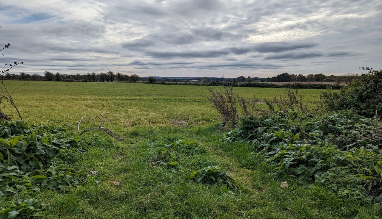
Large-scale arable fields with woodland block (near Larchford):
×![]()
Large-scale arable fields with woodland block (near Larchford):
Ascott Park stone walls and parkland:
×![]()
Ascott Park stone walls and parkland:
Arable fields with variable hawthorn hedges (near Berrick Salome):

×![]()
Arable fields with variable hawthorn hedges (near Berrick Salome):
Flat pasture field with small watercourse, bound by post and wire fencing (near Berrick Salome):
×![]()
Flat pasture field with small watercourse, bound by post and wire fencing (near Berrick Salome):
Description
Natural (landform, water, semi-natural land cover)
- A low-lying, gently rolling landform, lying around 55 to 65 metres Above Ordnance Datum (AOD), featuring a network of small watercourses, including the Haseley Brook. Some small local hills add topographical interest, such as Town Hill in the west at 72 metres AOD
- Underlain by heavy blue grey Gault Clay, which gives rise to the low ground, subdued topography and heavy soils which are typical of the gently rolling vale landscape.
- Spartum Fen Site of Special Scientific Interest (SSSI), located to the east of Great Haseley, is designated for its calcareous fen and carr vegetation, open water habitats and damp oak woodland.
- Small blocks of woodland are scattered across the landscape. Small areas of deciduous and coniferous woodland are recorded as ancient woodland, including Fernhill Wood, to the south-east of the village of Tiddington.
Cultural/social (land use, settlement, infrastructure, historic character
- Land use is predominantly agricultural, comprising mostly of arable land, with widespread biodiversity-friendly field margins. Small areas of pastoral land are concentrated around settlements.
- Hedgerow boundaries are variable, with clipped hawthorn hedges, substantial lengths of gappy and degraded hedgerows, and few hedgerow trees. Field boundaries comprise open ditches and fences in places.
- Sparse settlement pattern of nucleated villages. Berrick Salome and Little Haseley contain clusters of Listed Buildings, reflecting the long history of settlement in the area, and have designated Conservation Areas. The Conservation Areas of Warborough, Brightwell Baldwin, Cuxham and Great Haseley also extend into this landscape. Brick, soft clunch stone and flint are all common, with thatched and tile roofs forming the local vernacular.
- A Registered Battlefield dating to the Civil War lies to the north of Chalgrove village. The Battle of Chalgrove Field, in 1643, was a cavalry engagement which ended in the defeat of Parliamentarian forces by the Royalists under Prince Rupert, and consequent death of the leading local Parliamentarian, John Hampden. The ‘great hedge’, which initially separated the two forces, is still visible in the landscape.
- Aside from the A329 in the west and B480 connecting Stadhampton and Chalgrove to Watlington (in LCA 6B), road access to the area is limited, especially in the north.
- Solar farms and airfields at Benson and Chalgrove introduce modern urban built development to the landscape, although visibility is limited due to the uniform low-lying elevation and surrounding vegetation which conceals the built infrastructure.
- The Grade II Ascott Park, Registered Park and Garden (RPG), has a limited visual relationship with the surrounding landscape, although the ornate gate piers are visible from the B480.
- Public rights of way are relatively sparse, especially in the north. The Shakespeare’s Way long distance footpath runs across the area from Brookhampton to Chalgrove.
Perceptual (views, tranquillity, associations)
- An open and exposed landscape, with high intervisibility including long distance views to the wooded hills of the Chilterns National Landscape to the south-east. The landscape forms part of the wider setting to the National Landscape.
- A predominantly rural character with some localised intrusion from the modern settlement edges north and south-east of Chalgrove and east of Benson. Benson and Chalgrove airfields are local sources of low-flying aircraft and noise. The Tranquillity Assessment for South Oxfordshire and Vale of White Horse categorises 23% of the LCA in Zone 1 (‘areas of high tranquillity’) and 66% in Zone 2 (‘areas of some tranquillity’).
- Close to watercourses, smaller-scale landscapes with an intimate and tranquil pastoral character contrast with the large scale open arable farmland that dominates much of the area.
Valued qualities
- Small, scattered woodlands across the area, including Ancient Woodland at Fernhill Woods, are ecologically important and provide structure to the landscape.
- Calcareous fen and carr vegetation, open water habitats and damp oak woodland habitats provide ecological value and contribute positively to the landscape; Spartum Fen SSSI, is nationally designated for its ecological importance.
- Time-depth and historic character provided by historic features, including Ascott Park RPG, traditional villages with Conservation Areas at Berrick Salome and Little Haseley, and the Hampden Monument at Chalgrove battlefield.
- Long distance views to the Chilterns National Landscape to the south-east provide a distinctive sense of place and backdrop. The landscape contributes to the wider setting of the National Landscape.
- The pastoral, intimate and tranquil character of the more intimate areas close to watercourses such as Haseley Brook.
Forces for change
- Pressure for further residential development on the edges of Chalgrove and Benson, and a potential new town at Chalgrove Airfield (as part of the Land at Chalgrove Airfield Strategic Allocation), could impact on the rural character.
- Introduction of solar energy developments, both within the Middle Vale and in adjacent LCAs, changing views and the agricultural character.
- Amalgamation of fields into lager parcels of arable land, changing the landscape character.
- Fragmentation of hedgerows along field boundaries, which affects the wooded character and sense of enclosure, and affects their role in providing landscape structure and functioning as ecological corridors.
- Increase in intensive horse grazing and associated facilities, particularly close to settlements, changing the agricultural character.
- Historic conversion of meadow and pasture fields to arable farming, changing the traditional small-scale pastoral field pattern resulting in a larger-scale, more open agricultural character.
- Decline in active management of meadows and pasture on the floodplain, affecting the pastoral character of the landscape.
- Lack of pollarding, loss of boundary willows and decline in riparian vegetation along watercourses affecting the distinctive character of the river corridors and resulting in reduced biodiversity value.
- The Middle Vale landscapes may be susceptible to the impacts of climate change, including:
- Drier summers and wetter winters may lead to increased mortality and die-back of certain hedgerow tree species; an increased occurrence of insect pests and pathogens could lead to a potential loss or significant reduction in populations of key hedgerow tree species; and increased storm activity may lead to the loss of mature and veteran trees within hedgerows.
- Wetter winters may mean woody species in hedgerows are exposed to prolonged flooding in the growing season and will be at risk of dying, and winter trimming will become more difficult due to wet ground (preferred to autumn trimming to ensure food supply for birds).
- Intensification of adjacent land use leading to increased impacts on hedgerows such as pesticide drift and nutrient enrichment.
- Hotter drier summers and wetter winters and winter flooding could result in changes to wetland and riparian plant community composition; some non-native species may become invasive, and other currently geographically restricted species may spread more easily.
- Wetter winters and higher peak river flows may lead to increased flood defence activity, creating more physical habitat degradation and introducing potentially detracting features.
- Higher average temperatures and drier summers could lead to changes to community composition in arable field margins; an increase in bare ground and an increased risk of dieback in drought prone locations; the introduction of new crops and associated changes to management could alter the area and type of field margins; and an increase in agricultural use of summer insecticides which could reduce insect numbers and pollination.
- Hotter, drier summers and wetter winters will lead to changes in food production and growing seasons, and are likely to cause heat stress to livestock. Flooded land is only capable of supporting lower-value crops, pasture or woodland, which would impact important arable crops. Landscape appearance will likely also be altered, particularly if relocation of growing areas is required or crop diversification occurs (causing a need for changes in field pattern and the potential removal of field margins, hedgerows, woodlands).
Landscape strategy and guidelines
Maintain the rural character of the landscape, which forms gaps between settlements and provides an immediate setting, including the historic villages.
- Retain the sparse settlement pattern of nucleated villages. Any new development should use materials which are in keeping with, or complement, the local vernacular of brick, stone clunch, flint, and thatched or tiled roofs.
- Refer to the South Oxfordshire and Vale of White Horse Renewable Energy Study when considering any solar panel applications. Consider the impact on views of the solar arrays from the surrounding higher ground, including the Chilterns National Landscape.
- Conserve historic features and their setting, ensure that new development does not detract from the heritage significance of assets including Ascott Park RPG and Chalgrove Battlefield.
- Maintain physical and visual connectivity between Conservation Areas and prominent landscape/historic features in settlement setting.
- Respect the setting to Conservation Areas at Berrick Salome and Little Haseley by resisting changes to the landscape which are not in keeping with the landscape character, including intensive equestrian activities and unsympathetic housing developments.
- Consider the impact of new development on intervisibility with the Chilterns National Landscape, and the landscape’s role as part of the setting to the National Landscape.
Woodland cover should continue to provide structure to the landscape, ecological value and help to limit the urbanising visual influence of adjacent settlements.
- The pattern of small, scattered woodland (including Ancient Woodland) should be maintained and where possible enhanced.
- Encourage the appropriate management of woodland, including to reduce the impacts of pests and diseases and to increase its age structure and structural heterogeneity. Consider the promotion of natural colonisation adjacent to existing woodland, allowing locally native species to develop resilience to the pressures of climate change through natural processes.
- Seek to prevent further loss or decline in the quality of remaining boundary hedgerows and encourage their restoration/reinstatement; when establishing new hedges, aim to diversify the range of species and select species and provenances adapted to a wider range of climatic conditions.
- Use trees and woodland to integrate new and existing development into the landscape, for example around Chalgrove and Benson, and the potential new town at Chalgrove Airfield.
Retain and enhance the small-scale watercourses, their associated riparian vegetation and habitats, and the landscape interest and ecological value they provide.
- Manage the calcareous fen and carr vegetation, open water habitats and damp oak woodland habitats at Spartum Fen SSSI. Seek opportunities to extend or enhance these habitats to contribute to the wider wetland habitat network.
- Conserve and enhance wetland habitats and riparian vegetation, to enhance their contribution to landscape character and their nature conservation and biodiversity value. Retain the pastoral, intimate and tranquil character of the floodplain.
- Seek opportunities to enhance connectivity with other habitats nearby by creating green corridors and networks.
Consider opportunities to enhance the ecological value and appearance of intensively farmed arable land.
- Manage arable land to enhance its biodiversity value and connectivity, by maintaining and expanding the area of land available for uncultivated arable field margins; seek to maximise the diversity of margins to provide a range of habitats and to assist in the movement of species through the landscape and include species and cultivars that are able to tolerate and flower under hotter, drier summers.
LCA 12D: Oxford Middle Vale
It should be noted that the lines used to denote where LCAs border settlements are approximate and should not be used for planning purposes.
LCA 12D - View the map full screen in a new tab
Character Area Summary and Location
The character area lies immediately to the south of Oxford in South Oxfordshire district and comprises low-lying land associated primarily with Baldon Brook, a tributary of the River Thames. It is contained between two areas of higher ground chalk and sandstone ridge to the east (LCA 7C) and south-west (LCA 7D). It is part of the wider vale, which continues to the south (LCA 13C), while the Thames floodplain lies to the west (LCA 14D).
Key characteristics
- A low-lying rolling landscape, slightly elevated above the River Thames to the west; Northfield Brook cuts through the north-east and Baldon Brook flows through the eastern half of the area.
- An open often large-scale arable landscape with angular fields bounded by a distinctive network of drainage ditches, low gappy hedges, or fences; occasional small pockets and copses of deciduous woodland occur along field boundaries.
- Recreational access to the landscape via network of public rights of way including Shakespeare’s Way long distance footpath.
- Sparse settlement pattern, with only scattered farmsteads and two small park homes estates. The southern edge of Oxford has a strong suburbanising influence, including a large electricity sub-station and associated pylons, and views to industrial buildings at Cowley.
- Ridge hilltops to the east and south-west provide containment to views .
Arable fields transected by hedgerows and mature trees, Brasenose Wood in the distance:

×![]()
Arable fields transected by hedgerows and mature trees, Brasenose Wood in the distance:
Large electricity pylons in views north from Shakespeare’s Way:

×![]()
Large electricity pylons in views north from Shakespeare’s Way:
Views to sewage works on southern edge of Oxford (near Sandford-on-Thames):

×![]()
Views to sewage works on southern edge of Oxford (near Sandford-on-Thames):
Arable fields with small woodlands (near Marsh Baldon):
×![]()
Arable fields with small woodlands (near Marsh Baldon):
Description
Natural (landform, water, semi-natural land cover
- A low, rolling plateau sitting slightly above the River Thames, mostly at 60 to 70 metres Above Ordnance Datum (AOD) but gently rising to the north-east to around 85 metres AOD at the edge of the Oxford East Ridge Hilltops (LCA 7C). Underlying geology comprises Corallian Limestone capped by Kimmeridge Clay, Portland Beds and Lower Greensand formation.
- The plateau is bisected by small tributaries of the Rivers Thames and Thame: Northfield Brook runs through the north-east and Baldon Brook flows south-east. Willows feature among the riparian vegetation which flanks the watercourses in some places.
- Small pockets of deciduous woodland occur mainly as copses and linear blocks within farmland, this includes priority habitat deciduous woodland. There are also some occasional small traditional orchards, typically associated with farms.
Cultural/social (land use, settlement, infrastructure, historic character)
- Land use is predominantly arable, with large-scale angular fields bounded by a distinctive network of drainage ditches with few trees, low or gappy hedges, and fences.
- A sparse settlement pattern comprising small park home estates at Oxford Park Homes and Kings Copse Park Homes, and scattered farmsteads elsewhere.
- Road access to the area is relatively limited despite the presence of four roads which pass through the character area radiating out from Oxford, including the A4074 and B480. A network of public rights of way, including the Shakespeare’s Way long distance footpath, allow recreational access to the landscape.
Perceptual (views, tranquillity, associations)
- Brake, however the associated electricity pylons are still visible above the vegetation and are visually detractive in views across the landscape, particularly when seen in combination with other electricity pylon lines that cross the vale.
- Proximity to the settlement edge of Oxford, including views north to large commercial premises on the edge of the city, introduces an urban element in views across the agricultural landscape.
- Views south are frequently obscured by hedgerows, but where gaps in vegetation allows there are views south to the Limestone Ridge which forms a prominent landform feature rising above the surrounding low-lying land.
- A large-scale rural landscape, with long views which can be appreciated from the public rights of way across the countryside. However, proximity to Oxford’s industrial southern edge, large electricity pylons throughout the landscape and lack of vegetation limits the sense of tranquillity and remoteness, particularly in the north. The Tranquillity Assessment for South Oxfordshire and Vale of White Horse categorises over 50% of the Oxford Middle Vale in Zone 2 (‘areas of some tranquillity’) but also 23% in Zone 4 (‘areas of low tranquillity’).
- Proximity to the industrial edge of Oxford and lighting along the A4074 introduces light pollution. Less than 50% of this landscape is categorised as within the darkest four bands in the Dark Skies Assessment for South Oxfordshire and Vale of White Horse.
Valued qualities
- Provides an open rural setting to the south of Oxford, particularly the rising slopes to the south.
- Open farmland forms gaps between Oxford and the smaller settlements of Horspath (and Blenheim, helping to retain their individual identities.
- Recreational access to the landscape from Oxford via a network of public rights of way, including the Shakespeare’s Way long distance footpath.
- Occasional views south towards the wooded Limestone Ridge which forms a prominent landform against the low-lying floodplain.
- The agricultural character and sparse settlement pattern, which contributes to the rural setting to the south of Oxford.
Forces for change
- Increasing development pressure on the southern edge of Oxford City (including as part of the Land south of Grenoble Road and Land at Northfield Strategic Allocations) which may impact on views from the vale, create a suburban character, and reduce the sense of separation between Oxford and smaller surrounding settlements.
- Pressure for the introduction of solar energy developments, including permitted solar development at Ninevah Farm and in adjacent landscapes, changing views and the agricultural character.
- Pressure for additional energy developments, including battery storage facilities.
- Amalgamation of fields into lager parcels of arable land, changing the landscape character.
- Fragmentation of hedgerows along field boundaries.
- Increase in horse grazing and associated facilities, changing the agricultural character.
- Historic conversion of meadow and pasture fields to arable farming.
- Decline in active management of meadows and pasture on the floodplain.
- Lack of pollarding, loss of boundary willows and decline in riparian vegetation along watercourses affecting the distinctive character of the river corridors and resulting in reduced biodiversity value.
- The Middle Vale landscapes may be susceptible to the impacts of climate change, including:
- Drier summers and wetter winters may lead to increased mortality and die-back of certain hedgerow tree species; an increased occurrence of insect pests and pathogens could lead to a potential loss or significant reduction in populations of key hedgerow tree species; and increased storm activity may lead to the loss of mature and veteran trees within hedgerows.
- Wetter winters may mean woody species in hedgerows are exposed to prolonged flooding in the growing season and will be at risk of dying, and winter trimming will become more difficult due to wet ground (preferred to autumn trimming to ensure food supply for birds).
- Intensification of adjacent land use leading to increased impacts on hedgerows such as pesticide drift and nutrient enrichment.
- Hotter drier summers and wetter winters and winter flooding could result in changes to wetland and riparian plant community composition; some non-native species may become invasive, and other currently geographically restricted species may spread more easily.
- Wetter winters and higher peak river flows may lead to increased flood defence activity, creating more physical habitat degradation and introducing potentially detracting features.
- Higher average temperatures and drier summers could lead to changes to community composition in arable field margins; an increase in bare ground and an increased risk of dieback in drought prone locations; the introduction of new crops and associated changes to management could alter the area and type of field margins; and an increase in agricultural use of summer insecticides which could reduce insect numbers and pollination.
- Hotter, drier summers and wetter winters will lead to changes in food production and growing seasons, and are likely to cause heat stress to livestock. Flooded land is only capable of supporting lower-value crops, pasture or woodland, which would impact important arable crops. Landscape appearance will likely also be altered, particularly if relocation of growing areas is required or crop diversification occurs (causing a need for changes in field pattern and the potential removal of field margins, hedgerows, woodlands).
Landscape strategy and guidelines
Maintain the open, agricultural character of the landscape that forms a gap between Oxford and surrounding smaller settlements and that contributes to the rural setting of the south of Oxford.
- Minimise any sense of encroachment from Oxford onto rising slopes to the south and east, or of expansion from the surrounding villages (such as Horspath or Blenheim) down onto lower ground in the character area.
- Any new development should encourage the use of local materials to create a more localised vernacular. Carefully consider boundary treatments to minimise suburbanising influence on the open landscape.
- Refer to the South Oxfordshire and Vale of White Horse Renewable Energy Study when considering any further solar panel applications. Consider the impact on views of the solar arrays from the surrounding higher ground
- Maintain the valued recreational use of the landscape and consider opportunities to introduce additional public rights of way connectivity to enhance appreciation of views and landscape character.
Retain and enhance the pastoral character along floodplains by strengthening the smaller-scale field pattern and conserving and enhancing areas of wetland habitats and riparian vegetation and the ecological value they provide.
- Conserve and enhance floodplain grazing meadows and riparian vegetation to enhance their contribution to landscape character and their nature conservation and biodiversity value.
- Explore opportunities to create new wetland habitats such as wet grassland and floodplain grazing marsh to increase biodiversity value of the river corridors.
- Restore and replace willow trees and other riparian vegetation and ensure appropriate management (such as pollarding) of remaining willow trees to maintain their landscape and ecological functions.
- Encourage adjacent land uses which strengthen role as ecological corridors and enhance landscape character.
- Seek opportunities to enhance connectivity with other habitats nearby by creating green corridors and networks.
Consider opportunities to enhance the ecological value and appearance of intensively farmed arable land.
- Manage arable land to enhance its biodiversity value and connectivity, by maintaining and expanding the area of land available for uncultivated arable field margins; seek to maximise the diversity of margins to provide a range of habitats and to assist in the movement of species through the landscape and include species and cultivars that are able to tolerate and flower under hotter, drier summers.
- Maintain and enhance the hedgerow network within the farmed landscape to enhance biodiversity and strengthen the landscape structure.
Maintain existing woodland cover and seek to increase this to provide ecological value and help to limit the urbanising influence of development and busy roads, whilst maintaining characteristic open long views across the landscape.
- Explore opportunities to expand and connect existing woodland and tree cover through natural regeneration or small-scale planting, particularly around settlements. This will strengthen landscape character and bring benefits for biodiversity.
- Encourage the appropriate management of woodland, including to reduce the impacts of pests and diseases and to increase its age structure and structural heterogeneity. Consider the promotion of natural colonisation adjacent to existing woodland, allowing locally native species to develop resilience to the pressures of climate change through natural processes.
- Seek to prevent further loss or decline in the quality of remaining boundary hedgerows and encourage their restoration/reinstatement; when establishing new hedges, aim to diversify the range of species and select species and provenances adapted to a wider range of climatic conditions.
- Use trees and woodland to integrate development into the landscape.
LCA 12E: Thame Middle Vale
It should be noted that the lines used to denote where LCAs border settlements are approximate and should not be used for planning purposes.
LCA 12E - View the map full screen in a new tab
Character Area Summary and Location
Located on the north-eastern edge of South Oxfordshire district, the LCA comprises gently undulating land to the south of the River Thame. It forms a linear stretch of land extending between Towersey in the east and Waterperry in the west.
Key characteristics
- Low-lying, gently undulating landscape that slopes gently northwards towards the River Thame; a network of smaller watercourses, including the Cuttle Brook, cross the landscape. Small local hills provide some variety within the topography.
- Important semi-natural habits include floodplain grazing marsh and deciduous woodland; Cuttle Brook Local Nature Reserve to the west of Thame also comprises wetland, grassland and woodland habitats.
- A moderately wooded landscape, with scattered deciduous woodland blocks and belts, and riparian woodland along watercourses.
- Land use is mainly pastoral along the watercourses where drainage is impeded; some arable farming on better-drained areas of higher ground.
- Fields along the River Thame are small-scale with mature vegetation forming boundaries. Away from the river, fields are larger and rectilinear with a weak structure of tightly clipped or gappy hedgerows, and few hedgerow trees. In some parts of the area, fields are bound by species-rich hedgerows.
- A relatively settled landscape of scattered villages distributed along the A418, including the historic settlements of Waterstock, Thame, Towersey and Moreton, which feature clusters of Listed Buildings and have Conservation Area designations. Locally characteristic Corallian Limestone forms a strong vernacular.
- An extensive network of public rights of way enables recreational access to the landscape, including the Thame Valley Way and Oxfordshire Way long distance footpaths.
- Limited sense of tranquillity close to Thame due to the views of the edge of settlement and road infrastructure; the M40 to the west is in cutting and screened by vegetation.
- Views to the Chilterns National Landscape provide a wooded backdrop to the south-east.
Cuttle Brook Local Nature Reserve on the edge of Thame:
×![]()
Cuttle Brook Local Nature Reserve on the edge of Thame:
Grade I listed Church of St Mary, Waterperry:
×![]()
Grade I listed Church of St Mary, Waterperry:
Solar farm off Windmill Road with views to the wooded Chiltern hills beyond:
×![]()
Solar farm off Windmill Road with views to the wooded Chiltern hills beyond:
Low-lying, flat pasture field with varied hedgerows south of Thame:
×![]()
Low-lying, flat pasture field with varied hedgerows south of Thame:
Description
Natural (landform, water, semi-natural land cover)
- Underlying geology is dominated by heavy blue grey Gault Clay, deposited during the Lower Cretaceous period. This gives rise to the low-lying, gently undulating topography, mostly at around 65-75 metres Above Ordnance Datum (AOD), and heavy soils which are typical of the vale landscape.
- Land falls gently northwards to the River Thame at around 60 metres AOD, which forms the district boundary. A network of smaller watercourses, including the Cuttle Brook, cross the landscape, with willow trees a regular feature within the riparian vegetation along watercourses.
- Cuttle Brook Local Nature Reserve (LNR) to the west of Thame comprises, wetland, grassland and woodland habitats.
Cultural/social (land use, settlement, infrastructure, historic character)
- Pasture grazing, generally cattle, dominates land use along the watercourses where drainage is impeded. Areas of arable farming are located on the better-drained areas of higher ground.
- Fields along the watercourses are generally small-scale with strong boundaries of riparian vegetation. Elsewhere, fields are typically larger in scale with a regular, rectilinear pattern. Boundaries are often defined by a weak structure of tightly clipped or gappy hedgerows, with few hedgerow trees. In some parts of the area, fields are bound by species-rich hedgerows.
- A relatively settled landscape comprising scattered villages and the town of Thame, connected by a network of roads.
- Villages, stone walls and churches in Corallian limestone characterise the built form across much of the landscape. The settlements of Thame, Waterstock, Towersey and Moreton contain clusters of Listed Buildings and have designated Conservation Areas. Thame Park, a Grade II* Registered Park and Garden (RPG) which extends south of Thame, lies on the site of a former Cistercian abbey, and retains a parkland character.
- Waterperry House (Grade II* Listed) and ornamental gardens includes a cluster of Listed Buildings, including the Grade I listed Church of St Mary.
- A solar farm north of Towersey introduces modern infrastructure to the landscape, although its visibility is limited due to surrounding vegetation and the flat, low lying landscape.
- Busy transport corridors introduce some aural disruption to the landscape, including the M40 motorway, which runs north-south through the area to the west of Waterperry, and the A418 which runs west-east from the A40 to Thame. There is also visual impact from these roads, although the M40 is partly in cut and fairly well screened by trees.
- An extensive network of public rights of way enables recreational access to the landscape, including the Thame Valley Walk and Oxfordshire Way long distance footpaths.
Perceptual (views, tranquillity, associations)
- There is an open, denuded and exposed character in places, with high intervisibility due to the low-lying and relatively flat landform, and limited tree and vegetation cover. In contrast, the Thame river corridor and its associated pasture fields are well vegetated and the river is often hidden from view.
- To the west of Waterperry Road, in the neighbouring Studley Middle Vale (LCA 12F), a line of electricity pylons introduce modern infrastructure to the view. Views to the south-east are backdropped by the wooded hills of the Chilterns National Landscape.
- A largely rural landscape, although traffic noise from the major road corridors within the area and the M40 to the west reduces tranquillity. The Tranquillity Assessment for South Oxfordshire and Vale of White Horse categorises 80% in Zone 2 (‘areas of some tranquillity’) and 14% in Zone 4 (‘areas of low tranquillity’). Views to the modern, western settlement edge of Thame also introduce some urbanising influence in the landscape.
Valued qualities
- Important semi-natural habitats including floodplain grazing marsh and deciduous woodland which provide ecological value and contribute positively to the landscape.
- Woodland, wetland and grassland habitats at Cuttle Brook LNR , which provides valuable access to nature from the town.
- Historic settlements with Conservation Area designations and clusters of Listed Buildings, Thame Park RPG, and Waterperry House (Grade II* Listed) and ornamental gardens provide historic character and a sense of time-depth. The strong local vernacular of Corallian Limestone creates a sense of place.
- The well-connected network of public rights of way enables recreational access to the landscape, including the Thame Valley Walk and Oxfordshire Way long distance footpaths.
- Long-distance views to the wooded hills of the Chilterns National Landscape provide a setting to the landscape.
Forces for change
- Pressure for residential development on the edge of Thame and the eastern edge of Wheatley may impact on views from the vale, and have a suburbanising influence on the landscape.
- Introduction of solar energy developments, both within the landscape at Towersey and in adjacent landscapes, changing views and the agricultural character.
- Amalgamation of fields into lager parcels of arable land, changing the small-scale, pastoral character.
- Fragmentation of hedgerows along field boundaries affects the wooded character and sense of enclosure, and reduces their function as ecological corridors.
- Increase in horse grazing and associated facilities, changing the agricultural character.
- Historic conversion of meadow and pasture fields to arable farming and a decline in active management of meadows and pasture on the floodplain, changing the traditional small-scale pastoral landscape character.
- Lack of pollarding, loss of boundary willows and decline in riparian vegetation along watercourses affecting the distinctive character of the river corridors and resulting in reduced biodiversity value.
- The Middle Vale landscapes may be susceptible to the impacts of climate change, including:
- Drier summers and wetter winters may lead to increased mortality and die-back of certain hedgerow tree species; an increased occurrence of insect pests and pathogens could lead to a potential loss or significant reduction in populations of key hedgerow tree species; and increased storm activity may lead to the loss of mature and veteran trees within hedgerows.
- Wetter winters may mean woody species in hedgerows are exposed to prolonged flooding in the growing season and will be at risk of dying, and winter trimming will become more difficult due to wet ground (preferred to autumn trimming to ensure food supply for birds).
- Intensification of adjacent land use leading to increased impacts on hedgerows such as pesticide drift and nutrient enrichment.
- Hotter drier summers and wetter winters and winter flooding could result in changes to wetland and riparian plant community composition; some non-native species may become invasive, and other currently geographically restricted species may spread more easily.
- Wetter winters and higher peak river flows may lead to increased flood defence activity, creating more physical habitat degradation and introducing potentially detracting features.
- Higher average temperatures and drier summers could lead to changes to community composition in arable field margins; an increase in bare ground and an increased risk of dieback in drought prone locations; the introduction of new crops and associated changes to management could alter the area and type of field margins; and an increase in agricultural use of summer insecticides which could reduce insect numbers and pollination.
- Hotter, drier summers and wetter winters will lead to changes in food production and growing seasons, and are likely to cause heat stress to livestock. Flooded land is only capable of supporting lower-value crops, pasture or woodland, which would impact important arable crops. Landscape appearance will likely also be altered, particularly if relocation of growing areas is required or crop diversification occurs (causing a need for changes in field pattern and the potential removal of field margins, hedgerows, woodlands).
Landscape strategy and guidelines
Maintain the open rural character of the landscape, which forms gaps between settlements and provides an immediate setting to Thame and surrounding historic villages.
- Refer to the South Oxfordshire and Vale of White Horse Renewable Energy Study when considering any further solar panel applications. Consider the impact of solar arrays in the more open areas of the landscape.
- Maintain the sense of separation between settlements and minimise the impact of any new housing development through careful design. Any new development should use materials which are in keeping with, or complement, the local vernacular of Corallian limestone.
- Maintain the valued recreational use of the landscape and consider opportunities to introduce additional public rights of way connectivity to enhance appreciation of views and landscape character.
- Respect the setting to Conservation Areas and sensitivity of historic settlement edges, by resisting changes to the landscape which are not in keeping with the landscape character, including intensive equestrian activities and unsympathetic housing developments.
- Protect the setting of Grade II* listed Waterperry House and grounds, including the Grade I listed Church of St Mary, and of Thame Park RPG.
Retain and enhance the pastoral character along floodplains by strengthening the smaller-scale field pattern and conserving and enhancing areas of wetland habitats and riparian vegetation and the ecological value they provide.
- Conserve and enhance valuable semi-natural habitats including floodplain grazing marsh along river corridors, semi-improved grassland and riparian vegetation, to enhance their contribution to landscape character and their nature conservation and biodiversity value.
- Manage the distinctive grazing marsh habitats around Waterstock and Waterperry to enhance their biodiversity value and appearance; ensure best practice management through suitable grazing regimes and avoiding agrochemical and fertiliser inputs; manage recreational routes to avoid/minimise disturbance.
- Maintain, and where appropriate extend the woodland, wetland and grassland habitats at Cuttle Brook LNR and ensure recreational access to the LNR is retained and enhanced where appropriate.
- Seek opportunities to enhance connectivity with other habitats nearby by creating green corridors and networks, for example by restoring and enhancing riparian corridors (including replacing lost willow trees).
Maintain existing woodland cover and seek opportunities to increase tree and woodland cover to provide ecological value and help to limit the urbanising influence of development and busy roads.
- Explore opportunities to expand and connect existing woodland and tree cover through natural regeneration or small-scale planting, particularly around settlements and busy transport corridors. This will strengthen landscape character and bring benefits for biodiversity.
- Encourage the appropriate management of woodland, including to reduce the impacts of pests and diseases and to increase its age structure and structural heterogeneity. Consider the promotion of natural colonisation adjacent to existing woodland, allowing locally native species to develop resilience to the pressures of climate change through natural processes.
- Use appropriate deciduous trees and woodland to integrate any new development into the landscape.
- Seek to maintain and enhance remaining lengths of species-rich hedgerows. Encourage restoration/reinstatement of lost or degraded sections. when establishing new hedges, aim to diversify the range of species and select species and provenances adapted to a wider range of climatic conditions.
LCA 12F: Studley Middle Vale
It should be noted that the lines used to denote where LCAs border settlements are approximate and should not be used for planning purposes.
LCA 12F - View the map full screen in a new tab
Character Area Summary and Location
Located in the north-east of South Oxfordshire district, the LCA comprises the relatively low-lying but undulating vale to the east of the more elevated Oxford East Ridge Hilltops (LCA 7C), which separates this character area from the settlement edge of Oxford.
Key characteristics
- A relatively low-lying and undulating landscape located south of the River Thame, into which a number of watercourses drain.
- The character area includes part of the RSPB Otmoor Nature Reserve, on the northern fringe of South Oxfordshire District, designated for its important wetland habitats.
- A well-wooded landscape including significant areas of Ancient Woodland; mixed broadleaf and coniferous plantations are often in angular blocks.
- A mix of arable and pasture land uses, with medium to large-scale fields defined by species-rich hedgerows with mature hedgerow trees or open ditches.
- Sparsely settled, particularly in the north. Aside from part of the village of Holton, Studley Middle Vale has only dispersed farmsteads and isolated dwellings. The architectural vernacular features Corallian Limestone, and red tiles or thatch as roofing.
- A good level of access to the landscape via a network of public rights of way, including the Oxfordshire Way long distance footpath. Open Access Land at Waterperry Wood also provides recreational opportunities.
- An intimate, semi-enclosed and pastoral character, other than on the north-western and south-eastern margins. with woodland and roadside vegetation limiting intervisibility and providing a sense of enclosure and remoteness. Some longer views across lower-lying vales, including Otmoor, are possible from hillsides and higher ground.
- An overall rural character resulting from the sparse settlement pattern, strong woodland cover and agricultural land use, particularly in the north. There is some localised intrusion from main roads (notably the M40) and overhead power lines.
Views north across Otmoor Nature Reserve:

×![]()
Views north across Otmoor Nature Reserve:
Sheep grazing in field bounded by mature trees and hedgerows near Danes Brook:

×![]()
Sheep grazing in field bounded by mature trees and hedgerows near Danes Brook:
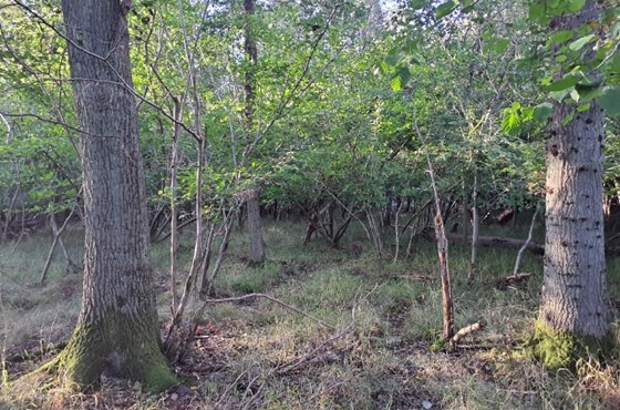
Ancient Woodland at Waterperry Wood, designated SSSI:
×![]()
Ancient Woodland at Waterperry Wood, designated SSSI:
Views to the M40 from the Oxfordshire Way:

×![]()
Views to the M40 from the Oxfordshire Way:
Description
Natural (landform, water, semi-natural land cover)
- A relatively low-lying but undulating landscape, between 60 and 70 metres Above Ordnance Datum (AOD), interspersed with a number of watercourses including Holton Brook, Moorbridge Brook and Danes Brook which drain to the River Thame.
- Underlying geology comprises extensive deposits of Oxford Clay associated with the Cherwell Valley and Otmoor lowlands.
- Woodland occurs in large blocks, with significant areas of Ancient Woodland at Waterperry Wood, Holly Wood, Holton Wood and Stanton Little Wood, most of which are designated as Sites of Special Scientific Interest (SSSI). Elsewhere, mixed broadleaf and coniferous plantations are often in angular blocks. Hursthill in Waterperry Wood is a localised high point at 75 metres AOD. A small part of the RSPB Otmoor Nature Reserve and Otmoor SSSI lies in the north of the character area. Otmoor is designated for its important wetland habitats including floodplain grazing marsh, lowland fens, purple moorgrass and rush pasture, and lowland meadows.
Cultural/social (land use, settlement, infrastructure, historic character)
- Land use is predominantly agricultural, comprising a mixture of arable and pasture with species-rich hedgerows distributed throughout parts of this character area.
- Fields are medium to large-sized, sometimes with irregular boundaries, (especially on sloping land) and are enclosed by hedgerows with mature hedgerow trees and open ditches in places.
- Sparsely settled. Part of the village of Holton, adjacent to Wheatley, lies in the Studley Middle Vale but beyond this there are only dispersed farmsteads and isolated dwellings. The former Oxford Brooks University campus, to be redeveloped for housing, is located on the edge of Wheatley. Aside from the tower block, which is to be demolished, it is well integrated into the landscape by mature trees and woodland.
- A network of public rights of way provide access to the landscape, including the Oxfordshire Way long distance footpath. Open Access Land at Waterperry Wood also provides recreational opportunities.
- The presence of a deserted medieval village site at Thomley (a Scheduled Monument), the Grade II* Beckley Park Registered Park and Garden (RPG)as well as a moated Tudor brick house on the site of a medieval hunting lodge, indicate a long history of settlement in the area. The woodlands in this area, along with Shabbington Wood and others to the east, are remnants of Bernwood Forest, a royal hunting ground from Anglo Saxon times until the early 17th century that once covered 400 square kilometres
Perceptual (views, tranquillity, associations)
- A predominantly rural character, with some localised intrusion of main roads (including the M40 in the east) and overhead electricity pylon routes.
- The busy M40 introduces audible and visual disruption in its locality, but, an absence of settlement and transport corridors elsewhere in the landscape results in a greater sense of tranquillity. The Tranquillity Assessment for South Oxfordshire and Vale of White Horse categorises 38% of the LCA in Zone 1 (‘areas of high tranquillity’) and 60% in Zone 2 (‘areas of some tranquillity’).
- The sparse settlement and limited urban influence result in dark night skies. Over 80% of this landscape is categorised as within the darkest band in the Dark Skies Assessment for South Oxfordshire and Vale of White Horse.
- Woodlands are distinctive landscape features providing structure, visual distinctiveness and height in parts of the landscape that are otherwise low or gently undulating. Hedgerow trees such as ash and oak make a positive contribution to enhancing distinctiveness in arable landscapes that have lost semi-natural vegetation to the enlarging of fields for agricultural production.
- Electricity pylons, telecommunications masts form prominent vertical structures on the skyline. The television masts near Beckley (Oxford transmitting station) are visible from miles around.
- Intimate, semi-enclosed and pastoral character, with woodland and roadside vegetation limiting intervisibility and providing a sense of enclosure. Large-scale woodland blocks create a sense of remoteness and strategic containment. Some longer views are possible from hillsides and higher ground across lower-lying vales (for example from Beckley towards Otmoor).
- The area associated with the Otmoor lowlands has a larger-scale, more open character but with a strong hedgerow structure.
Valued qualities
- Well-wooded, with significant areas of Ancient Woodland, such as Waterperry Wood, mostly designated as SSSI’s.
- Hedgerows and hedgerows trees add texture to the landscape and provide valuable ecological corridors within the farmed landscape.
- Intimate, semi-enclosed and predominantly rural character with limited intervisibility. The Dark Skies Assessment for South Oxfordshire and Vale of White Horse indicates that this area has some of the darkest skies in the district.
- Holton displays use of local Corallian limestone in walls and older buildings, and tile roofs. It retains an open, rural character, with little development off the principal village roads, which keeps it distinct from neighbouring Wheatley.
- The value of the low-lying floodplain landscape on the northern edge of the district, as part of the wider Otmoor area, is demonstrated by a Local Landscape Designation (it is included as part of the East Oxford Hills, being too small an area to designate in its own right).
Forces for change
- Pressure for residential development on the northern edge of Wheatley may impact on views from the vale, and have a suburbanising influence on the landscape.
- High levels of deer grazing are changing the species composition of the nationally designated areas of Ancient Woodland.
- Amalgamation of fields into lager parcels of arable land, changing the landscape character.
- Fragmentation of hedgerows along field boundaries, affects the wooded character and sense of enclosure, and reduces their function as ecological corridors.
- Increase in horse grazing and associated facilities, changing the agricultural character.
- Historic conversion of meadow and pasture fields to arable farming and a decline in active management of meadows and pasture on the floodplain, affecting the pastoral character of the landscape.
- Lack of pollarding, loss of boundary willows and decline in riparian vegetation along watercourses affecting the distinctive character of the river corridors and resulting in reduced biodiversity value.
- The Middle Vale landscapes may be susceptible to the impacts of climate change, including:
- Drier summers and wetter winters may lead to increased mortality and die-back of certain hedgerow tree species; an increased occurrence of insect pests and pathogens could lead to a potential loss or significant reduction in populations of key hedgerow tree species; and increased storm activity may lead to the loss of mature and veteran trees within hedgerows.
- Wetter winters may mean woody species in hedgerows are exposed to prolonged flooding in the growing season and will be at risk of dying, and winter trimming will become more difficult due to wet ground (preferred to autumn trimming to ensure food supply for birds).
- Intensification of adjacent land use leading to increased impacts on hedgerows such as pesticide drift and nutrient enrichment.
- Hotter drier summers and wetter winters and winter flooding could result in changes to wetland and riparian plant community composition; some non-native species may become invasive, and other currently geographically restricted species may spread more easily.
- Wetter winters and higher peak river flows may lead to increased flood defence activity, creating more physical habitat degradation and introducing potentially detracting features.
- Higher average temperatures and drier summers could lead to changes to community composition in arable field margins; an increase in bare ground and an increased risk of dieback in drought prone locations; the introduction of new crops and associated changes to management could alter the area and type of field margins; and an increase in agricultural use of summer insecticides which could reduce insect numbers and pollination.
- Hotter, drier summers and wetter winters will lead to changes in food production and growing seasons, and are likely to cause heat stress to livestock. Flooded land is only capable of supporting lower-value crops, pasture or woodland, which would impact important arable crops. Landscape appearance will likely also be altered, particularly if relocation of growing areas is required or crop diversification occurs (causing a need for changes in field pattern and the potential removal of field margins, hedgerows, woodlands).
Landscape strategy and guidelines
Maintain the intimate, enclosed rural character of the landscape, which forms part of the wider rural setting to Oxford.
- Maintain the sparse settlement pattern, containing the impact of any new development at Wheatley/Holton on local character. Retain distinction in character between Holton and Wheatley. Any new development should use materials which are in keeping with, or complement, the local vernacular of Corallian limestone, and red tile or thatch roofs.
- Avoid any additional lighting impact on night-time views in this landscape of dark night skies (refer to the guidance in the Dark Skies Assessment for South Oxfordshire and Vale of White Horse).
- Maintain the valued recreational use of the landscape including the network of public rights of way and Open Access Land at Waterperry Wood. Ensure recreational and nature conservation land uses are managed appropriately.
- Protect the setting of historic features (including Grade II* Beckley Park RPG) which add time-depth and historic character to the landscape.
Maintain existing woodland cover and look to increase this to provide ecological value – woodlands provide structure, visual distinctiveness and height in parts of the landscape that are otherwise low or gently undulating.
- Appropriately manage areas of Ancient Woodland (including those that are nationally designated) to protect it from deer grazing.
- Seek to prevent further loss or decline in the quality of remaining boundary hedgerows, including mature hedgerows trees such as oak and ash which are locally distinctive landscape features and contribute to the landscape structure. when establishing new hedges, aim to diversify the range of species and select species and provenances adapted to a wider range of climatic conditions.
- Explore opportunities to expand and connect existing woodland and tree cover through natural regeneration or small-scale planting, particularly around settlements. This will strengthen landscape character and bring benefits for biodiversity.
- Maintain and enhance existing tree cover along roads to maintain the intimate, semi-enclosed character.
- Use trees and woodland to integrate development into the landscape.
Protect and appropriately manage the wetland habitats associated with Otmoor Nature Reserve including the floodplain grazing marsh, lowland fens, purple moorgrass and rush pasture, and lowland meadows to enhance their contribution to landscape character and their nature conservation and biodiversity value.
- Manage grazing marsh habitats to enhance their biodiversity value and appearance; ensure best practice management through suitable grazing regimes and avoiding agrochemical and fertiliser inputs; manage recreational routes to avoid/minimise disturbance; and manage scrub vegetation appropriately to maintain the open character.
- Encourage adjacent land uses which strengthen ecological networks, contribute to creating a mosaic of habitats, and enhance landscape character.
- Seek opportunities to enhance connectivity with other habitats nearby by creating green corridors and networks.
- Manage arable land to enhance its biodiversity value and connectivity, by maintaining and expanding the area of land available for uncultivated arable field margins; seek to maximise the diversity of margins to provide a range of habitats and to assist in the movement of species through the landscape and include species and cultivars that are able to tolerate and flower under hotter, drier summers.
LCA 12G: Cherwell Middle Vale
It should be noted that the lines used to denote where LCAs border settlements are approximate and should not be used for planning purposes.
LCA 12G - View the map full screen in a new tab
Character Area Summary and Location
A small area located in the north of South Oxfordshire district, close to Oxford, comprising low-lying land associated with the River Cherwell. It rises gently eastwards towards the adjacent more elevated Oxford East Ridge Hilltops (LCA 7C).
Key characteristics
- Distinctively flat, low-lying farmland to the east of the River Cherwell; features a network of drainage ditches and Bayswater Brook, a tributary of the Cherwell.
- Woodland cover is relatively sparse, occurring in small areas within field margins, along the River Cherwell and parts of Bayswater Brook and at the foot of the hill beneath the village of Elsfield.
- Land use is predominantly arable, with small areas of pasture and equestrian use close to the A40 in the south; fields are irregular and of varying size, bound by dense beech hedgerows often with mature trees.
- Mature hedgerow trees are a notable feature of this landscape, and in combination with the small woodland blocks, provide ecological connectivity and add texture to the landscape.
- Good levels of recreational access to landscape via a number of public rights of way, including the Oxford Greenbelt Way long distance footpath.
- Sparse settlement pattern which, combined with the agricultural land use, relatively limited road access and absence of modern development, results in a strongly rural character; although the A40 to the south has some influence.
- Views across the landscape are generally screened or heavily filtered by mature hedgerow vegetation and woodland, but there are strong views towards Oxford from the slopes beneath Elsfield in which this landscape forms the middle ground.
View towards Oxford from higher ground near Elsfield:

×![]()
View towards Oxford from higher ground near Elsfield:
Woodland blocks provide some visual containment within the arable landscape (near Sescut Farm):

×![]()
Woodland blocks provide some visual containment within the arable landscape (near Sescut Farm):
Bayswater Brook helps to drain the low-lying farmland:

×![]()
Bayswater Brook helps to drain the low-lying farmland:
Large power pylons form vertical features through the flat topography (near Marston Common):

×![]()
Large power pylons form vertical features through the flat topography (near Marston Common):
Description
Natural (landform, water, semi-natural land cover)
- An area of distinctively flat farmland to the east of the River Cherwell. Lying around 60 metres Above Ordnance Datum (AOD), much of the area is in the functional floodplain. The topography rises slightly to the south-west towards the A40 as it passes Marston. The bedrock is Oxford Clay, with extensive alluvium deposits on the floodplain.
- The River Cherwell, which forms the western edge of South Oxfordshire district), is fed by Bayswater Brook and by a network of drainage ditches which cross the arable farmland.
- Woodland cover is relatively sparse, occurring in small areas within field margins and along the larger watercourses. Long Wood, an Ancient Woodland, extends down onto flatter ground from the slopes of the hill on which Elsfield is located.
Cultural/social (land use, settlement, infrastructure, historic character)
- Land use is predominantly arable, with small areas of pasture and equestrian land use close to the A40. The lower Cherwell valley is characterised by an irregular field pattern, with varying degrees of enclosure from hedgerows.
- Aside from Sescut Farm, near the confluence of Bayswater Brook and the Cherwell, the only built development is on the slightly higher ground close to Marston, where Mill Lane provides access from the A40 to several farmsteads and a few residential dwellings. Farm diversification has led to some storage land uses which have a suburbanising influence in this area.
- Two minor roads provide the only public road access through the area but public rights of way enable further access to the landscape, including the Oxford Greenbelt Way long distance footpath and a footpath from Elsfield to the edge of Oxford at Barton Fields.
Perceptual (views, tranquillity, associations)
- Pylons introduce large vertical features that are prominent in views across the low-lying landscape.
- Proximity to the A40 main road results in low levels of tranquillity locally,. but trees and hedgerows alongside the A40 and Bayswater Brook means there little visual intrusion from the road and only limited visibility of the settlement edge of Oxford (including the Barton Park development).
- Limited road access, the absence of settlement and in places the containing role of trees and hedgerows results in higher levels of tranquillity further north. The Tranquillity Assessment for South Oxfordshire and Vale of White Horse categorises 78% of the LCA in Zone 2 (‘areas of some tranquillity’) and 19% in Zone 4 (‘areas of low tranquillity’).
Valued qualities
- Mature, well-treed hedgerows provide valuable ecological corridors and contribute to the structure of the landscape.
- Provides an open rural setting to the north-east of Oxford. Strong vegetation along the A40 and Bayswater Brook limit the urbanising influence of Oxford.
- Recreational access to the landscape provided by public rights of way, including the Oxford Greenbelt Way long distance footpath.
- Rural character arising from the sparse settlement pattern, limited road access, and agricultural land use.
- The northern and eastern fringes of the Cherwell Middle Vale are included within the East Oxford Hills Local Landscape Designation, reflecting principally the increased association of these areas with high ground that is important to the historic setting of Oxford.
Forces for change
- The ‘Land north of Bayswater Brook’ Strategic Allocation would expand Oxford across Bayswater Brook, negating the role of the well-treed watercourse as a boundary to the urban area and potentially increasing urbanising influence on the countryside beyond.
- Amalgamation of fields into lager parcels of arable land, changing the landscape character.
- Fragmentation of hedgerows along field boundaries, which affects the wooded character of the landscape and reduces their function as ecological corridors.
- Intensification of equine activity and other farm diversification, changing the agricultural character and creating a slightly suburban character through entrance gates and additional structures (such as field shelters and containers).
- Historic conversion of meadow and pasture fields to arable farming and a decline in active management of meadows and pasture on the floodplain, affecting the traditional pastoral character of the landscape.
- Lack of pollarding, loss of boundary willows and decline in riparian vegetation along watercourses, resulting in reduced biodiversity value and affecting the distinctive character of the river corridors
- The Middle Vale landscapes may be susceptible to the impacts of climate change, including:
- Drier summers and wetter winters may lead to increased mortality and die-back of certain hedgerow tree species; an increased occurrence of insect pests and pathogens could lead to a potential loss or significant reduction in populations of key hedgerow tree species; and increased storm activity may lead to the loss of mature and veteran trees within hedgerows.
- Wetter winters may mean woody species in hedgerows are exposed to prolonged flooding in the growing season and will be at risk of dying, and winter trimming will become more difficult due to wet ground (preferred to autumn trimming to ensure food supply for birds).
- Intensification of adjacent land use leading to increased impacts on hedgerows such as pesticide drift and nutrient enrichment.
- Hotter drier summers and wetter winters and winter flooding could result in changes to wetland and riparian plant community composition; some non-native species may become invasive, and other currently geographically restricted species may spread more easily.
- Wetter winters and higher peak river flows may lead to increased flood defence activity, creating more physical habitat degradation and introducing potentially detracting features.
- Higher average temperatures and drier summers could lead to changes to community composition in arable field margins; an increase in bare ground and an increased risk of dieback in drought prone locations; the introduction of new crops and associated changes to management could alter the area and type of field margins; and an increase in agricultural use of summer insecticides which could reduce insect numbers and pollination.
- Hotter, drier summers and wetter winters will lead to changes in food production and growing seasons, and are likely to cause heat stress to livestock. Flooded land is only capable of supporting lower-value crops, pasture or woodland, which would impact important arable crops. Landscape appearance will likely also be altered, particularly if relocation of growing areas is required or crop diversification occurs (causing a need for changes in field pattern and the potential removal of field margins, hedgerows, woodlands).
Landscape strategy and guidelines
Maintain the rural character of the landscape, which forms a rural setting to the City of Oxford.
- Maintain the sparse settlement pattern away from the edge of Oxford. Seek to limit the urbanising impact of development on adjacent farmland and avoid any sense of the city extending upslope into the hills that form a key part of its setting.
- Avoid suburbanisation in the vicinity of Mill Lane, considering building materials, structure and land uses.
- Bayswater Brook and the A40, with associated hedgerows and tree cover, create a degree of separation from the rest of Oxford so the design of any new development, in terms of siting, scale, style, layout and materials, should respond to this.
- Maintain the valued recreational use of the landscape (including the Greenbelt Way long distance footpath) and consider opportunities to introduce additional public rights of way connectivity to enhance appreciation of views and landscape character.
Seek to increase woodland cover to provide ecological value and help to limit the urbanising influence from Oxford .
- Protect mature hedgerow trees which provide valuable ecological corridors and contribute to the structure of the landscape. Seek to enhance and restore existing lengths of hedgerow; when establishing new hedges, aim to diversify the range of species and select species and provenances adapted to a wider range of climatic conditions.
- Explore opportunities to expand and connect existing woodland and tree cover through natural regeneration or small-scale planting, particularly around settlements. This will strengthen landscape character and bring benefits for biodiversity.
- Maintain and enhance existing tree cover along the A40 to buffer visual and audible disruption from traffic.
- Use trees and woodland to integrate any new development into the landscape including renewable energy developments and residential expansion on the edge of Oxford.
Consider opportunities to enhance the ecological value and appearance of intensively farmed arable land.
- Manage arable land to enhance its biodiversity value and connectivity, by maintaining and expanding the area of land available for uncultivated arable field margins; seek to maximise the diversity of margins to provide a range of habitats and to assist in the movement of species through the landscape and include species and cultivars that are able to tolerate and flower under hotter, drier summers.
- Seek opportunities to enhance connectivity with other habitats nearby by creating green corridors and networks.