LCT 11: Upper Vale
Landscape character type summary
The clay vales, which form the majority of the land area within South Oxfordshire and Vale of White Horse, are located beneath the chalk downlands and Midvale Ridge. They are divided into Upper, Middle and Lower Vales. The Upper Vales are clay-based landscapes associated with the higher reaches of the River Ock and its tributaries, with the margins of the clay vale above the Thames and River Cole west of Faringdon, and with tributaries of the River Thame. The latter also includes some sandstone and limestone areas which geologically relate to the Ridge Hilltops to the north-west but topographically have more in common with adjacent claylands. Generally at elevations of above 70 metres Above Ordnance Datum (AOD), these areas are typically more undulating than the Middle Vale areas further downstream. This is a transition rather than a clear change. Arable farming on medium-sized fields is the dominant land use.
Three Landscape Character Areas (LCA) are identified:
- LCA 11A: Thames Upper Vale
- LCA 11B: Western Upper Vale
- LCA 11C: Eastern Upper Vale.
LCA 11A: Thames Upper Vale
It should be noted that the lines used to denote where LCAs border settlements are approximate and should not be used for planning purposes.
LCA 11A - View the map full screen in a new tab
Character Area Location
Located on the north-western edge of Vale of White Horse District, the LCA forms a transitional area between the low-lying Thames floodplain (within West Oxfordshire and Cotswold districts) to the north, and the Faringdon Ridge Hilltops (LCA 7A) to the south. The LCA comprises relatively flat and open land, with some localised areas of higher ground.
Key characteristics
- A gently undulating landform rising gradually to the south and east, forming a transitional area between the low-lying valleys of the River Thames and River Cole and limestone ridge.
- Features predominantly large-scale open arable fields, with some smaller-scale fields pasture fields associated with settlements and near the rivers. Hedgerows vary, with some low and clipped, gappy or removed.
- Scattered small woodland blocks and copses, and larger blocks of woodland in the east, create a moderately wooded landscape. Tree belts and mature trees and along roads enhance the overall tree cover.
- Sparse settlement pattern of occasional small hamlets and scattered farmsteads, many of which are listed. Small rural lanes connect settlements and contribute to the rural character of the area.
- Recreational access to the landscape is provided via a number of public rights of way including the D’Arcy Dalton Way long distance footpath.
- Open views across much of the area due to the gently undulating landform and open fields; the wooded slopes of the Corallian Limestone Ridge form a backdrop to the south and east. Woodlands and tree belts limit views in some places.
- A rural, agricultural landscape with a predominantly peaceful and tranquil character. A sense of remoteness is experienced from public rights of way and along the rivers; however, areas close to the A417 are influenced by traffic.
Small-scale pastoral fields on the floodplain near Buscot:

×![]()
Small-scale pastoral fields on the floodplain near Buscot:
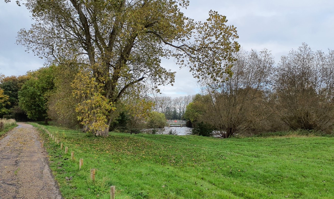
Buscot Weir Pool is locally valued for its natural and tranquil qualities, as well as for recreation:
×![]()
Buscot Weir Pool is locally valued for its natural and tranquil qualities, as well as for recreation:
Mature trees lining the A419 are a locally distinctive feature:

×![]()
Mature trees lining the A419 are a locally distinctive feature:
The Grade II Listed village hall, well and cottages in Buscot Conservation Area:

×![]()
The Grade II Listed village hall, well and cottages in Buscot Conservation Area:
Description
Natural (landform, water, semi-natural land cover)
- A gently undulating landscape underlain by the Oxford Clay Mudstone Formation, with alluvial deposits on the low-lying floodplain areas.
- The landform rises gently from the floodplain of the River Cole in the west and River Thames in the north, from 70 to 90 metres Above Ordnance Datum (AOD). The rivers form the northern and western extents of the Vale of White Horse District boundary, although the landscape beyond is similar in character.
- Open water is present in the form of rivers, streams and brooks. There are also occasional small pools and ponds.
- On the floodplain, wet meadows provide texture and ecological value to the landscape. Unimproved, neutral grassland at Grafton Lock Meadows is designated as a Site of Special Scientific Interest (SSSI), . Riparian vegetation along the river corridor includes willow and alder. Floodplain fields are drained by ditches which discharge north into the Thames.
- Larger blocks of woodland are found in the east, including Northfield Old Covert and Northfield New Covert. A number of small woodland blocks and tree groups are scattered across the area, including Snowswick Copse and Fern Copse (both Ancient Woodland).
- Belts of trees along field boundaries, roads and minor watercourses, as well as large individual mature trees such as oak and ash within field boundaries add to the tree cover of the area. Large, regularly spaced mature trees, such as horse chestnuts, are a distinctive feature along the A417.
Cultural/social (land use, settlement, infrastructure, historic character)
- The area predominately consists of large-scale arable and pasture fields, with occasional smaller parcels of land, such as rough grass paddocks, and gardens, associated with farmsteads.
- Hedges along field boundaries and roads are varied, comprising a mixture of low clipped hawthorn hedges and lengths of gappy and degraded hedgerows. A number of field boundaries have been removed completely.
- The medieval hamlet of Buscot is the largest settlement within the area and contains a significant number of Listed Buildings within its Conservation Area, including the Grade II Listed Village Hall and Reading Rooms, and Grade II* Buscot Tree cover helps to assimilate the settlement into the surrounding countryside. Corallian limestone, slate and stone roofs and some use of brick form a strong local vernacular.
- Elsewhere, settlement predominantly consists of scattered farmsteads and occasional large dwellings or cottages, many of which are listed.
- The A417 main road traverses the character area between Buscot and Faringdon, enclosed by woodland or lined by regularly-spaced mature trees along its length. Elsewhere, vehicular access to the majority of the area is provided by occasional small rural lanes and farm tracks.
- A network of public rights of way covers the landscape, including the D’Arcy Dalton Way long distance footpath which connects the River Thames to the North Wessex Downs. The Thames is navigable, and waterborne craft add activity and colour to the winding river.
- Post-medieval fieldscape patterns dominate, although some areas are identified as modern fieldscapes which have been subject to greater amalgamation.
Perceptual (views, tranquillity, associations)
- Views are relatively open and wide-ranging due to the large-scale fields, low hedges, and gently undulating landform. There are views of the Corallian Limestone Ridge to the south, and the woodland on rising ground to the east.
- On the floodplain to the north, the route of watercourse is tranquil, semi- enclosed and sparsely settled.
- This is a rural, farmed landscape, with sense of peace and tranquillity, particularly experienced from public rights of way. Traffic on the main roads is locally disruptive. The Tranquillity Assessment for South Oxfordshire and Vale of White Horse categorises 38% of the LCA in Zone 1 (‘areas of high tranquillity’) and 62% in Zone 2 (‘areas of some tranquillity’).
- The rural landscape and distance from urban edges result in dark night skies. Over 90% of this landscape is categorised as within the darkest two bands in the Dark Skies Assessment for South Oxfordshire and Vale of White Horse.
Valued qualities
- The varying network of hedgerows along field boundaries and roads, including large mature trees which provide landscape structure and provide ecological corridors within the farmed landscape.
- Scattered small blocks of woodland, including Ancient Woodland at Snowshill Copse and Telhards Copse, provide natural heritage and visual interest and contribute positively to the landscape.
- The historic hamlet of Buscot with Listed Buildings and a designated Conservation Area provides historic character and a sense of time-depth.
- Sparse settlement pattern, consisting predominantly of scattered farmsteads, large houses and isolated dwellings.
- Recreational value of public rights of way which provide public access across the area, including the D’Arcy Dalton Way long distance footpath and water-based recreation on the Thames.
- A rural landscape with a sense of peace and tranquillity, and strong experience of dark night skies, particularly along the meandering watercourses of the Thames and away from the influence of traffic on the A417.
- Views south to the wooded Corallian Limestone Ridge, which provides some sense of enclosure.
- The valued qualities of the upper vale area between the Midvale Ridge and the River Thames are recognised in a Local Landscape Designation.
Forces for change
- Historic conversion of meadow and pasture fields to arable farming, and a decline in active management of remaining floodplain pasture meadows, affecting the pastoral character of the landscape.
- Increase in agricultural infrastructure, such as large sheds, which are visually intrusive and dilute the traditional rural character of the landscape and are incongruous with the traditional vernacular.
- Poor maintenance and loss of field boundaries, resulting in fragmentation of important ecological corridors and diminished integrity of landscape structure.
- Lack of pollarding, loss of boundary willows and decline in riparian vegetation along watercourses, affecting the distinctive character of the river corridors and resulting in reduced ecological value and reduced flood management functioning.
- Increased water-based recreation on the River Thames may result in demand for moorings, boat storage and jetties. This would erode the tranquil, naturalistic qualities of the river corridor.
- The Upper Vale landscapes may be susceptible to the impacts of climate change, including:
- Drier summers and wetter winters may lead to increased mortality and die-back of certain hedgerow tree species; an increased occurrence of insect pests and pathogens could lead to a potential loss or significant reduction in populations of key hedgerow tree species; and increased storm activity may lead to the loss of mature and veteran trees within hedgerows.
- Intensification of adjacent land use leading to increased impacts on hedgerows such as pesticide drift and nutrient enrichment.
- Hotter drier summers and wetter winters and winter flooding could result in changes to wetland and riparian plant community composition; some non-native species may become invasive, and other currently geographically restricted species may spread more easily.
- Wetter winters and higher peak river flows may lead to increased flood defence activity, creating more physical habitat degradation and introducing potentially detracting features.
- Higher average temperatures and drier summers could lead to changes to community composition in arable field margins; an increase in bare ground and an increased risk of dieback in drought prone locations; the introduction of new crops and associated changes to management could alter the area and type of field margins; and an increase in agricultural use of summer insecticides which could reduce insect numbers and pollination.
- Hotter, drier summers and wetter winters will lead to changes in food production and growing seasons and are likely to cause heat stress to livestock. Flooded land is only capable of supporting lower-value crops, pasture or woodland, which would impact important arable crops. Landscape appearance will likely also be altered, particularly if relocation of growing areas is required or crop diversification occurs (causing a need for changes in field pattern and the potential removal of field margins, hedgerows, woodlands).
Landscape strategy and guidelines
The network of hedgerows along field boundaries and roads, small blocks of woodland (including Ancient Woodland), and large mature trees should continue to contribute to the rural character, providing landscape structure and acting as ecological corridors within the farmed landscape.
- Conserve and manage the Ancient Woodland sites to improve landscape character and encourage biodiversity.
- Explore opportunities to expand and connect existing woodland and tree cover through natural regeneration or small-scale planting. This will strengthen landscape character and bring benefits for biodiversity.
- Seek to prevent further loss or decline in the quality of remaining boundary hedgerows and encourage their restoration/reinstatement, whilst maintaining characteristic open views; when establishing new hedges, aim to diversify the range of species and select species and provenances adapted to a wider range of climatic conditions.
- Use trees and woodland to integrate development into the landscape.
Floodplain meadows should be retained as ecologically important landscape features and extended where possible.
- Consider opportunities to increase the area of lowland meadow habitat through restoration and recreation around existing areas, including on the floodplain.
- Encourage adjacent land uses which strengthen role as ecological corridors and enhance landscape character.
- Seek opportunities to enhance connectivity with other habitats nearby by creating green corridors and networks, including through restoration of hedgerow field boundaries, replanting lengths that have been lost and gapping up fragmented sections.
Watercourses (including the River Thames, River Cole and smaller unnamed watercourses) should be retained as distinctive landscape elements with high biodiversity value, and enhanced where possible.
- Retain riparian vegetation along watercourses to maintain their distinctive character and ecological value, replacing locally-distinctive willow trees where they have been lost.
- Use appropriate management techniques such as pollarding to maintain existing riparian trees.
- Encourage adjacent land uses which strengthen role as ecological corridors and enhance landscape character.
- Seek opportunities to enhance connectivity with adjacent habitats, including the wooded ridge to the south and east, by creating ecological corridors.
- Carefully consider any new applications for boat storage, moorings or jetties along the Thames, to retain the naturalistic character of the river, while ensuring it retains its recreational value. Ensure recreational use of the River Thames and smaller watercourses does not negatively impact on the biodiversity value and tranquil character.
Historic villages should retain a relationship with their rural landscape settings which contribute to their distinctive historic character.
- Maintain physical and visual connectivity between the Conservation Area of Buscot village and features that are important to the settlement setting, including the estate parkland of Buscot Park to the south.
Maintain the sparsely settled, rural character of the landscape and protect characteristic long views outwards and over the LCA from higher ground to the south.
- Maintain the sparse settlement pattern, centred on Buscot, and minimise the impact of any new development on local character and on views from other areas.
- Any new development should use materials which are in keeping with, or complement, the local vernacular of Corallian limestone, brick and stone or slate roofs.
- Consider the impact of any new lighting on night-time views in this area of dark night skies (refer to the guidance in the Dark Skies / Light Impact Assessment for South Oxfordshire and Vale of White Horse).
- Protect and where possible enhance views south towards the Corallian Ridge on the horizon. Also protect views northward from the Corallian ridge.
LCA 11B: Western Upper Vale
It should be noted that the lines used to denote where LCAs border settlements are approximate and should not be used for planning purposes.
LCA 11B - View the map full screen in a new tab
Character Area Location
Located in the west of Vale of White Horse District, between the Faringdon Ridge Hilltops (LCA 7A) to the north, and the Western Vale Edge Slopes (LCA 9A) to the south. The area forms a broad, low-lying undulating area of farmland associated with the River Ock and its tributaries.
Key characteristics
- Gently undulating landscape associated with the River Ock, lying between the Corallian Limestone Ridge to the north and chalk downs to the south.
- A pattern of arable fields, with smaller waterside pasture meadows on the floodplain. A varying network of hedgerows enclose fields, with mature hedgerow trees in places, and gappy or removed hedgerows elsewhere.
- The meandering course of the River Ock and its tributaries, marked by riparian vegetation, contribute to the naturalistic character of the landscape and provide biodiversity value.
- Important semi-natural habitats include deciduous woodland, neutral grassland and fen habitat at Fernham Meadows Site of Special Scientific Interest. Small copses of ancient woodland are scattered across the farmed landscape.
- Historic settlement pattern of small villages and scattered farmsteads set within the surrounding countryside.
- Rural lanes and a network of public rights of way (including the D’Arcy Dalton and Vale Way long distance footpaths) enable recreational access to the landscape.
- Distinctive views to rising ground to the north and south, including the Corallian Limestone Ridge to the north, and the North Wessex Downs National Landscape on the horizon to the south.
- The area forms part of the wider northern setting to the North Wessex Downs National Landscape, with a high level of intervisibility with the south of the area.
- A rural and generally peaceful landscape, particularly along the meandering watercourses of the River Ock and its tributaries. Areas close to larger settlements and the busy A420 are influenced by human activity.
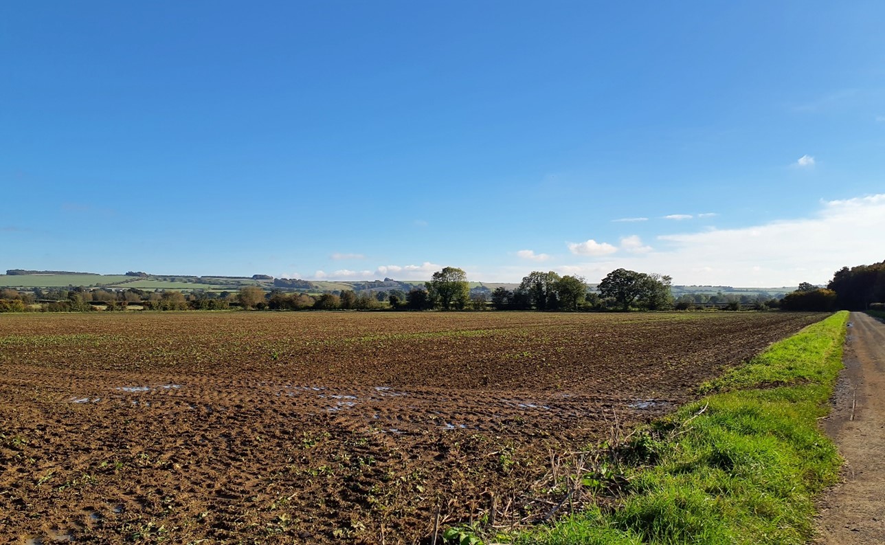
Flat, large-scale arable fields with open boundaries (near Bourton):
×![]()
Flat, large-scale arable fields with open boundaries (near Bourton):
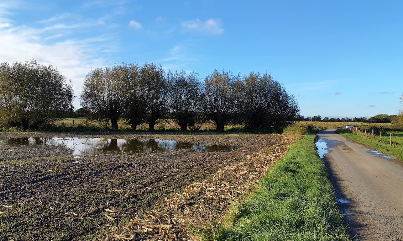
Watercourses are often lined by willow trees (near Compton Beauchamp):
×![]()
Watercourses are often lined by willow trees (near Compton Beauchamp):
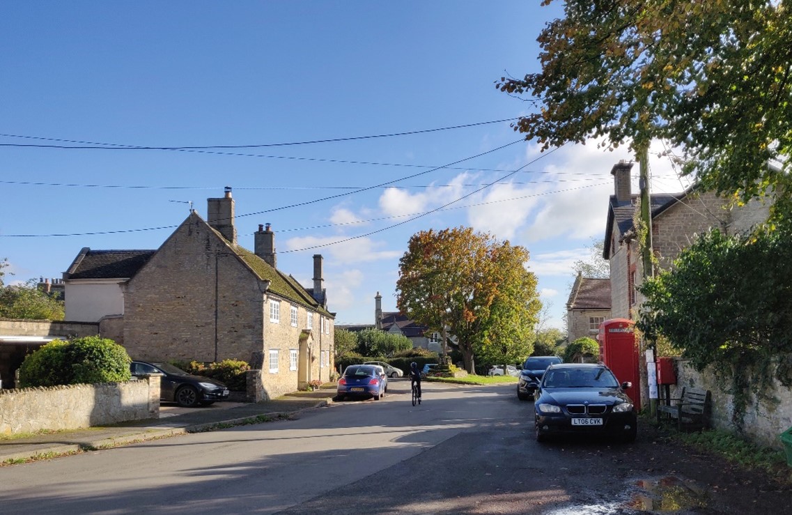
The historic village centre of Bourton (Conservation Area):
×![]()
The historic village centre of Bourton (Conservation Area):
View south towards the chalk escarpment of the North Wessex Downs (near Fernham):

×![]()
View south towards the chalk escarpment of the North Wessex Downs (near Fernham):
Description
Natural (landform, water, semi-natural land cover)
- A relatively low-lying, gently undulating landscape associated with the River Ock, lying between 75 and 90 metres Above Ordnance Datum (AOD). The landscape rises slightly to meet the footslopes of the North Wessex Downs to the south and to higher ground to the north, including Barrowbush Hill (99 metres AOD) and Baulking Hill (90 metres AOD).
- Underlain by a combination of Gault Formation Mudstone Sedimentary Bedrock, Ampthill Clay Formation and Kimmeridge Clay Formation, with areas of Lower Greensand Group Sandstone.
- The River Ock runs through the centre of the area and is fed by streams and ditches which flow from the higher ground to the north and south, including the Tutmill Brook, Stutfield Brook and Land Brook.
- Hedgerows along field boundaries and roads vary in intactness, ranging from intensively managed, low clipped hawthorn hedges south of Longcot, to outgrown hedgerows with large individual mature trees, including ash and oak.
- Woodland occurs in small, scattered blocks and is predominantly broadleaved. Ancient Woodland occurs in frequent small copses, including at Swainswick Copse, Bower Copse, Round Spinney and Long Spinney Copses, and Rosey Copse. Occasional mature oak trees within fields are a notable feature.
- Riparian vegetation and mature trees including willow, alder and ash delineate the meandering course of the River Ock and provide a valuable ecological corridor between adjacent semi-natural habitats and areas of arable farmland.
- Pockets of semi-natural habitat exist among the farmland, including a species-rich mosaic of wet fen meadow habitats, woodland and dry grassland at Fernham Meadows Site of Special Scientific Interest (SSSI).
Cultural/social (land use, settlement, infrastructure, historic character)
- Land use is predominantly well-maintained farmland, with a pattern of arable fields in varying sizes. On the floodplain of the River Ock there are small to medium sized waterside pasture meadows.
- Lightly settled, with an even spread of scattered settlements, often focused on small greens of common land. These include the villages Bourton, Baulking, Uffington (all of which have Conservation Areas) and Longcot. Buildings often use local Corallian limestone, brick, and slate or tile roofs.
- Outside of the settlements, scattered farmsteads are often Listed Buildings. The Royal Military College in the north-west includes the Grade I Listed China House within the grounds of Beckett Hall (Grade II Listed).
- The Great Western Mainline railway line crosses east-west through the landscape, raised slightly above the surrounding farmland on embankment. Overhead electrification infrastructure along the railway line is a prominent feature in views across adjacent fields.
- The A417, A420 and B4000 form major road routes through the east and west of the area. Elsewhere there is a network of minor roads and rural lanes.
- The disused, partly overgrown, but partially restored, Wilts and Berks canal winds from east to west through the south-east.
- Public rights of way cross the area, including the Vale Way and the D’Arcy Dalton Way long distance footpaths.
- The landscape predominantly comprises fieldscapes identified as post-Medieval, although there are also significant areas of modern field patterns which have been subject to further amalgamation.
Perceptual (views, tranquillity, associations)
- Boundary vegetation and woodland frequently shorten views within the landscape. However, in between tree cover, there are views to high ground of the Corallian Limestone Ridge to the north including Faringdon Folly, and the Downs to the south, emphasising the location of the character area within a wider vale.
- The area forms a significant part of the wider northern setting to the North Wessex Downs National Landscape, with the area visible from vantage points within the National Landscape including from The Ridgeway and Open Access land around Uffington Castle. The area between Uffington and the downland ridge provides some of the best views of the White Horse.
- This is a pleasant rural landscape, which can be appreciated from the public rights of way. The sense of peace and tranquillity is reduced within the vicinity of human influences such as the western edge of Grove, villages, main roads, agricultural structures and transport infrastructure. The Tranquillity Assessment for South Oxfordshire and Vale of White Horse categorises 93% of the LCA in Zone 2 (‘areas of some tranquillity’).
- Overhead electrification infrastructure associated with the Great Western Mainline railway line is a prominent vertical feature across the landscape and contributes to the perception of human influence across the landscape.
Valued qualities
- Small historic settlements centred on village greens provide historic character and time-depth, including Conservation Areas at Bourton, Baulking and Uffington.
- Watercourses including the River Ock and its tributaries, with associated riparian vegetation and floodplain pastures which add visual and ecological diversity.
- Deciduous woodland, including frequent small copses of Ancient Woodland at Swainswick Copse, Bower Copse, Round Spinney and Long Spinney Copses and Rosey Copse, create a strong landscape structure.
- Wet fen meadows, woodland and dry grassland at Fernham Meadows SSSI provide ecological value and contribute positively to the landscape.
- Strong intervisibility with the North Wessex Downs National Landscape means this landscape forms part of the northern setting to the National Landscape. The role the area south of Uffington as a setting to the White Horse, Dragon Hill and The Manger, and location for views to those features, is reflected in its inclusion within the West of Wantage Local Landscape Designation.
- Views of the Corallian Limestone Ridge to the north including Faringdon Folly on Faringdon Hill.
- Recreational value of the network of public rights of way, including the Vale Way and the D’Arcy Dalton Way long distance footpaths.
- Provides a rural setting to settlements of Bourton, Baulking, Uffington and Longcot, as well as to the southern edge of Shrivenham.
Forces for change
- Historic conversion of meadow and pasture fields to arable farming, which has eroded the traditional pastoral character.
- Increase in agricultural infrastructure, such as large sheds, which are visually intrusive and discordant with the traditional vernacular.
- Increase in horse grazing and associated facilities including stabling, hard standing areas and fencing, changing the agricultural character.
- Poor maintenance and loss of field boundaries, resulting in fragmentation of important ecological corridors and diminished integrity of landscape structure.
- Lack of pollarding, loss of boundary willows and decline in riparian vegetation along watercourses, affecting the distinctive character of the river corridors and resulting in reduced ecological value and flood management function.
- Pressure for further residential development on the edges of Shrivenham, Uffington and Grove. This could further reduce the sense of peace and tranquillity.
- The restoration of the Wilts and Berks Canal will open up new recreational routes within the landscape, which will enable greater recreational access to the landscape, However this may also impact on the sense of tranquillity and loss of vegeation along the watercourses.
- The Upper Vale landscapes may be susceptible to the impacts of climate change, including:
- Drier summers and wetter winters may lead to increased mortality and die-back of certain hedgerow tree species; an increased occurrence of insect pests and pathogens could lead to a potential loss or significant reduction in populations of key hedgerow tree species; and increased storm activity may lead to the loss of mature and veteran trees within hedgerows.
- Intensification of adjacent land use leading to increased impacts on hedgerows such as pesticide drift and nutrient enrichment.
- Hotter drier summers and wetter winters and winter flooding could result in changes to wetland and riparian plant community composition; some non-native species may become invasive, and other currently geographically restricted species may spread more easily.
- Wetter winters and higher peak river flows may lead to increased flood defence activity, creating more physical habitat degradation and introducing potentially detracting features.
- Higher average temperatures and drier summers could lead to changes to community composition in arable field margins; an increase in bare ground and an increased risk of dieback in drought prone locations; the introduction of new crops and associated changes to management could alter the area and type of field margins; and an increase in agricultural use of summer insecticides which could reduce insect numbers and pollination.
- Hotter, drier summers and wetter winters will lead to changes in food production and growing seasons, and are likely to cause heat stress to livestock. Flooded land is only capable of supporting lower-value crops, pasture or woodland, which would impact important arable crops. Landscape appearance will likely also be altered, particularly if relocation of growing areas is required or crop diversification occurs (causing a need for changes in field pattern and the potential removal of field margins, hedgerows, woodlands).
Landscape strategy and guidelines
Watercourses (including the River Ock and its tributaries) with associated riparian vegetation should be retained as distinctive landscape elements with high biodiversity value, and enhanced where possible.
- Retain riparian vegetation along watercourses to maintain their distinctive character and ecological value. Replace willow trees where they have been lost.
- Encourage adjacent land uses which strengthen role as ecological corridors and enhance landscape character, such as locally distinctive floodplain meadows.
- Seek opportunities to enhance connectivity with other habitats nearby by creating green corridors and networks, including the mosaic of grassland habitats at Fernham Meadows SSSI.
Woodland blocks and mature tree cover should continue to contribute to rural character by helping to limit the urbanising visual influence of adjacent settlements, and provide landscape structure and a sense of enclosure.
- Retain and enhance woodland blocks and tree lines; conserve and manage the Ancient Woodland sites to improve landscape character and encourage biodiversity.
- Encourage the appropriate management of woodland, including to reduce the impacts of pests and diseases and to increase its age structure and structural heterogeneity. Consider the promotion of natural colonisation adjacent to existing woodland, allowing locally native species to develop resilience to the pressures of climate change through natural processes.
- Explore opportunities to expand and connect existing woodland and tree cover through natural regeneration or small-scale planting, particularly around settlements. This will strengthen landscape character and bring benefits for biodiversity.
- Seek to prevent further loss or decline in the quality of remaining boundary hedgerows and encourage their restoration/reinstatement. When establishing new hedges, aim to diversify the range of species and select species and provenances adapted to a wider range of climatic conditions.
- Use trees and woodland to integrate new and existing development into the landscape.
Maintain the open character of farmland which forms gaps between individual settlements and contributes positively to the setting of North Wessex Downs National Landscape.
- Consider the impacts of any new development, including new agricultural buildings, on views from vantage points within the North Wessex Downs National Landscape including from The Ridgeway National Trail, and the Open Access land surrounding the Uffington White Horse. Also, from the Corallian Limestone Ridge to the north including Faringdon hill and Folly.
- Maintain the distinctive nucleated settlement pattern focused on small greens, and minimise the impact of any new development on local character and on views from other areas.
- Any new development should use materials which are in keeping with, or complement, the local vernacular of Corallian limestone, brick and slate or tile roofs.
Historic villages should retain a relationship with their rural landscape settings which contribute to their distinctive historic character.
- Maintain physical and visual connectivity between Conservation Areas and prominent features in settlement setting, including views to The Ridgeway, White Horse Hill, Faringdon Hill and Folly.
- Maintain the rural, undeveloped gaps between settlements to preserve their individual identities and characteristics.
LCA 11C: Eastern Upper Vale
It should be noted that the lines used to denote where LCAs border settlements are approximate and should not be used for planning purposes.
LCA 11C - View the map full screen in a new tab
Character Area Summary and Location
Located in the east of South Oxfordshire District, to the south of Thame. It lies to the west of the rising Chiltern Chalk Escarpment Footslopes (LCA 6B) and comprises an area of undulating clay farmland with some localised areas of higher ground.
Key characteristics
- Although part of the broader vale landscape, land in this area slopes down both to the north, towards the River Thame, and south towards th Thames. The gently rolling topography featuring a network of small watercourses which feed into more substantial brooks and then into the main rivers.
- Scattered small blocks, copses and linear belts of woodland , contrast with more open areas.
- Predominantly large-scale arable farmland, with some pasture on lower ground and along watercourses. Hedgerows are in variable condition, with some being closely clipped, some gappy with few hedgerow trees, and others are species-rich.
- A dispersed settlement pattern of nucleated villages and farmsteads; the characteristic local vernacular includes the use of Corallian Limestone and thatched roofs. Some isolated historic manors and churches, such as Ryecote.
- Good level of access, with a network of public rights of way, including the Oxfordshire Way, open access land at Tetsworth Common, and National Cycle Route 57 (The Phoenix Way).
- Predominantly rural character, particularly away from settlements and main roads; some localised disruption from overhead power lines and the M40, A40, A329 and A418.
- Expansive views from elevated and open areas, with long distance intervisibility with the wooded hills of the Chilterns National Landscape to the east; forms part of the setting to the Chilterns National Landscape.
- Greater sense of enclosure within the more wooded areas.
Large-scale arable field with the Chiltern hills forming a wooded backdrop (near Emmington):

×![]()
Large-scale arable field with the Chiltern hills forming a wooded backdrop (near Emmington):
Pasture fields with electricity pylons on the edge of the M40 south of Tetsworth:
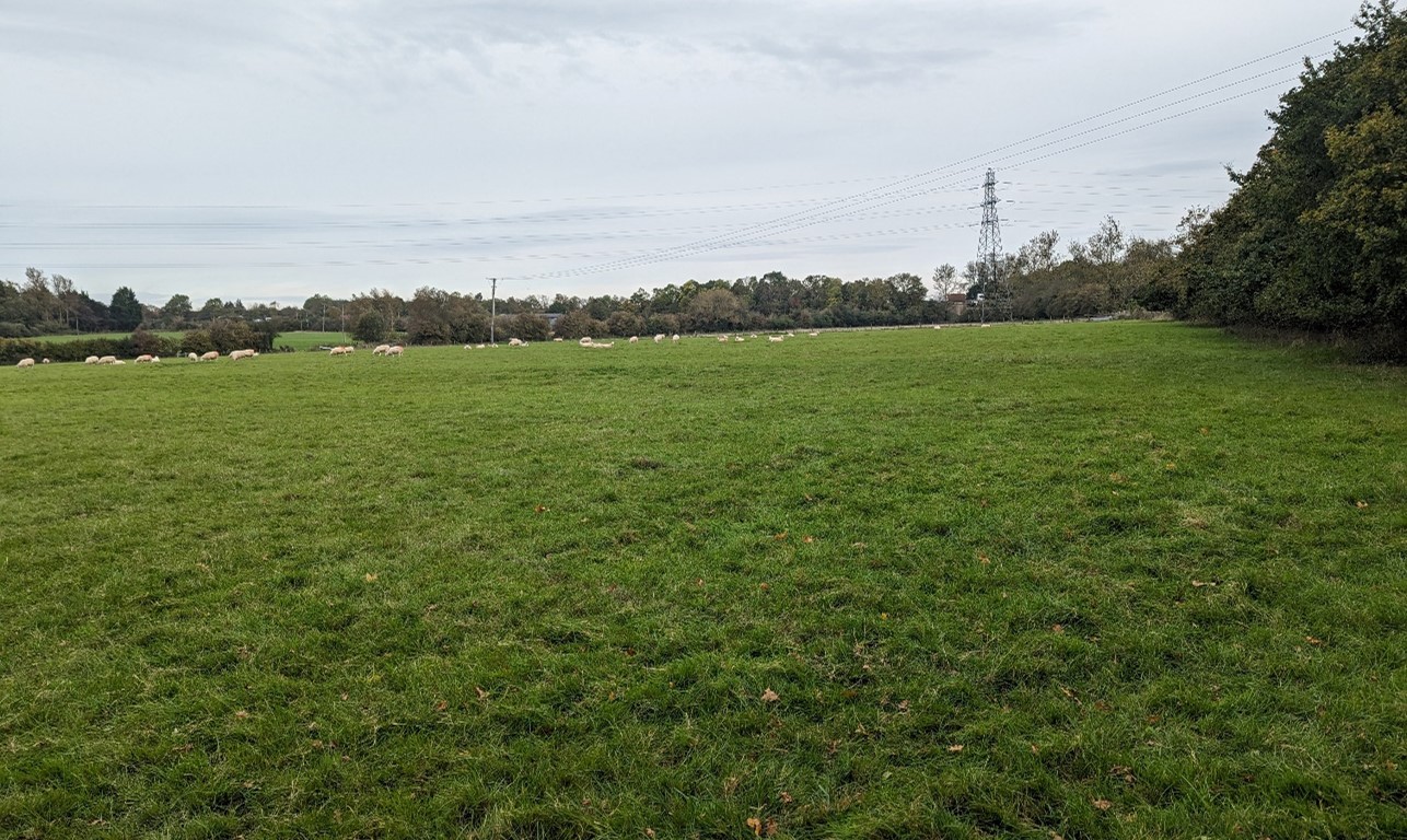
×![]()
Pasture fields with electricity pylons on the edge of the M40 south of Tetsworth:
Arable fields with varied hedgerows (near Chalford):
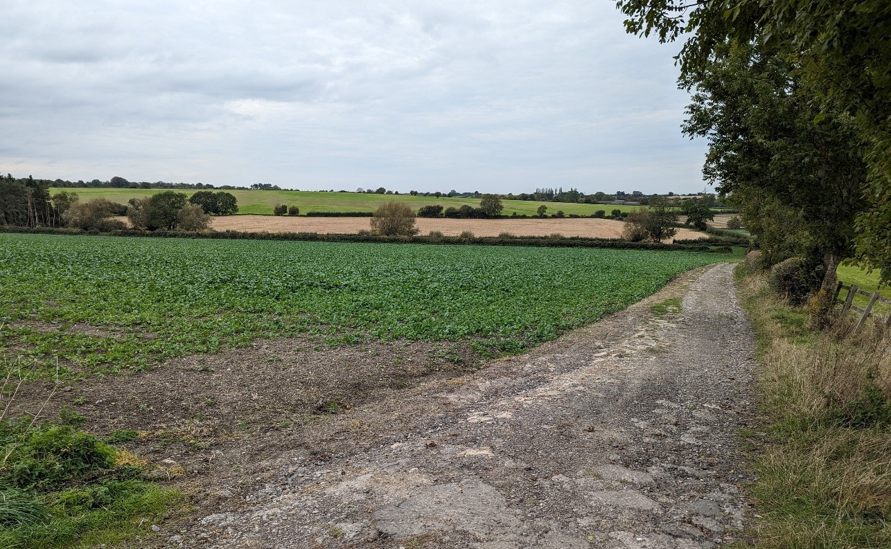
×![]()
Arable fields with varied hedgerows (near Chalford):
Historic village of Great Milton:

×![]()
Historic village of Great Milton:
Description
Natural (landform, water, semi-natural land cover)
- Underlying geology is dominated by heavy blue-grey Gault Clay, giving rise to a gently rolling topography which, although relatively low, sits above lower-lying areas close to the River Thame to the north and the River Thames to the south. The undulating landform ranges between 50 and 110 metres Above Ordnance Datum (AOD).
- Small watercourses cross the landscape, feeding into more substantial tributaries of the River Thame and River Thames (Cuttle Brook to the north and Haseley Brook to the south).
- Small blocks of mixed woodland are scattered across the landscape, commonly in copses and linear belts. Ancient Woodland exists in small areas including at Fernhill Wood and Great Covert.
- Tree and woodland planting associated with historic parklands comprises formal designed features such as avenues, free-standing mature trees within pasture, and small clumps of woodland.
Cultural/social (land use, settlement, infrastructure, historic character)
- Land use is predominantly intensive arable cultivation within a pattern of large-scale rectilinear fields. Some pasture land, predominately sheep, occurs in lower-lying areas along watercourses where drainage is impeded.
- Hedgerows are in variable condition, with some being closely clipped and others gappy with few hedgerow trees; Species-rich hedgerows are also distributed throughout the character area, and arable field margins are widespread across the area.
- Fieldscapes are of post-medieval origin, with large areas of modern enclosure where fields have been subject to further amalgamation.
- A dispersed settlement pattern which is strongly influenced by the underlying geology, where risk of flooding has traditionally discouraged settlement on areas underlain by clay, favouring the better drained sandstones and mudstones. Examples include Great Milton and Great Haseley.
- Nucleated villages with stone walls and churches built in local Corallian limestone characterise the built form across much of the landscape. Red brick and tile roofs are also common. Thatched roofs are a feature in Great Haseley, which has a Conservation Area. Conservation Areas are also designated at Great Milton and Sydenham.
- Busy transport corridors cross through this area, including the M40 motorway, the A40, A329 and a small part of the A418.
- A corridor of urban influence around Milton Common and along A329/Ryecote Lane, including a large solar farm, timber works, golf course, and the new Christmas Hill business park development. This contrasts with the relatively rural character of the eastern part of the area.
- Small local manors retain a parkland character, for example Ryecote Park, with designed formal landscape features including tree avenues, formal gardens and mature specimen trees. Ryecote Chapel is Grade I Listed.
- The highly shaped and managed fairways and greens associated with The Oxfordshire Golf Course have limited visual influence as planting around the site provides significant screening.
- Recreational access to the landscape via a network of public rights of way including the Oxfordshire Way long distance footpath. Tetsworth Common is open access land. National Cycle Route 57 (The Phoenix Way) runs across the north of the area following the disused railway line.
Perceptual (views, tranquillity, associations)
- Predominantly rural character, but some localised disruption from main roads (including M40 and A40), overhead power lines and built development.
- Pockets of tranquillity exist away from settlements and main roads, but the presence of the M40, A40, settlement edge of Thame, and roadside settlements of Milton Common and Tetsworth limit the sense of tranquillity and remoteness. The Tranquillity Assessment for South Oxfordshire and Vale of White Horse categorises 85% of the LCA in Zone 2 (‘areas of some tranquillity’).
- Open to semi-enclosed character, with long views from higher ground, and a greater sense of enclosure within the more wooded farmland areas.
- Forms part of the setting to the Chilterns National Landscape, with a high level of intervisibility with the east of the area.
- Aircraft associated with RAF Benson (within adjacent landscape) are a common feature in the skies.
Valued qualities
- Predominantly rural, agricultural character of mixed arable and pastoral fields interspersed with hedgerow trees.
- Frequent scattered mixed woodlands, including Ancient Woodland in small blocks, provides ecological value and structure to the landscape.
- Dispersed rural settlement pattern of nucleated villages and separate small manors, often using local Corallian limestone as a building material which provides a sense of unity and local distinctiveness.
- Provides a rural landscape setting to villages and the nearby town of Thame.
- Recreational value of public rights of way including the Oxfordshire Way Long Distance footpath and National Cycle Route 57/Phoenix Way.
- The eastern side of the vale has strong intervisibility with the Chilterns National Landscape, and forms part of its wider setting.
Forces for change
- Pressure for residential development of the edge of Thame.
- Strong pressure for the introduction of significant solar energy developments around Tetsworth, both within the landscape and in adjacent LCAs, which would change views and the agricultural character of the landscape.
- An increase in traffic on the M40 leading to increased noise and light pollution.
- Historic conversion of meadow and pasture fields to arable farming which has resulted in a loss of the traditional pastoral character of the landscape, as well as loss of ecologically valuable grassland habitats.
- Increase in agricultural infrastructure, such as large sheds, which are visually intrusive and dilute the traditional rural character of the landscape and are incongruous with the traditional vernacular.
- Increase in horse keeping and associated facilities on the edge of settlements, changing the agricultural character including the introduction of stabling, hardstanding and fencing.
- Poor maintenance and loss of field boundaries, resulting in fragmentation and gaps in hedgerows.
- Lack of pollarding, loss of boundary willows and decline in riparian vegetation along watercourses. This has affected the distinctive character of the river corridors, resulting in reduced ecological value and reduced flood management function.
- The Upper Vale landscapes may be susceptible to the impacts of climate change, including:
- Drier summers and wetter winters may lead to increased mortality and die-back of certain hedgerow tree species; an increased occurrence of insect pests and pathogens could lead to a potential loss or significant reduction in populations of key hedgerow tree species; and increased storm activity may lead to the loss of mature and veteran trees within hedgerows.
- Intensification of adjacent land use leading to increased impacts on hedgerows such as pesticide drift and nutrient enrichment.
- Hotter drier summers, wetter winters and winter flooding could result in changes to wetland and riparian plant community composition; some non-native species may become invasive, and other currently geographically restricted species may spread more easily.
- Hotter, drier summers and wetter winters will also lead to changes in food production, and growing seasons and are likely to cause heat stress to livestock. Flooded land is only capable of supporting lower-value crops, pasture or woodland, which would impact important arable crops. Landscape appearance will likely also be altered, particularly if relocation of growing areas is required or crop diversification occurs (causing a need for changes in field pattern and the potential removal of field margins, hedgerows, woodlands).
- Wetter winters and higher peak river flows may lead to increased flood defence activity, creating more physical habitat degradation and introducing potentially detracting features.
- Higher average temperatures and drier summers could lead to changes to community composition in arable field margins; an increase in bare ground and an increased risk of dieback in drought prone locations; the introduction of new crops and associated changes to management could alter the area and type of field margins; and an increase in agricultural use of summer insecticides which could reduce insect numbers and pollination.
Landscape strategy and guidelines
Maintain the rural, agricultural character of farmland which forms gaps between individual settlements, helping to retain their individual identities and their rural character.
- Maintain the distinctive nucleated settlement pattern and minimise the impact of any new development on local character and on views from other areas.
- Any new development should use materials which are in keeping with, or complement, the local vernacular of Corallian limestone, brick and tile roofs.
- Limit the expansion of Thame, ensuring that the sense of separation between nearby settlements in maintained.
- Refer to the South Oxfordshire and Vale of White Horse Renewable Energy Study when considering any solar panel applications. Consider the impact on views of the solar arrays from the surrounding higher ground, including the Chilterns National Landscape.
Maintain the rural character of the landscape which contributes positively to the setting of the Chilterns National Landscape
- Consider the impact of development (including renewable energy developments) on views from the National Landscape, particularly in long views from elevated land where the transition from scarp to vale can be appreciated.
- Maintain the nucleated settlement pattern and minimise the impact of new housing development (particularly on the edge of Thame) through careful design, in terms of siting, scale, style, layout and materials to be in keeping with the existing settlement character and landscape setting.
- Maintain the valued recreational use of the landscape and consider opportunities to introduce additional connectivity to enhance appreciation of views and landscape character.
Maintain the wooded character of the landscape (including mature woodland and specimen trees associated with the parklands). Consider opportunities to increase woodland cover, linking with existing areas of deciduous woodland, whilst maintaining characteristic and valued open views across the landscape.
- Explore opportunities to expand and connect existing priority habitat deciduous woodland using hedgerows and mature trees to create ecological corridors, which will strengthen landscape character and bring benefits for biodiversity.
- Encourage the appropriate management of woodland, including to reduce the impacts of pests and diseases and to increase its age structure and structural heterogeneity. Consider the promotion of natural colonisation adjacent to existing woodland, allowing locally native species to develop resilience to the pressures of climate change through natural processes.
- Manage the veteran and specimen trees associated with the historic parklands as important ecological features and to conserve the historic character of the estate landscapes.
- Seek to prevent further loss or decline in the quality of remaining boundary hedgerows through restoration or new planting. Aim to diversify the range of species and select species and provenances adapted to a wider range of climatic conditions.
- Use hedgerows, trees and woodland to integrate development (including renewable energy development) into the landscape and to buffer audible and visual impacts of transport corridors.