LCT 9: Vale Edge Slopes
Landscape character type summary
The relatively steep Vale Edge Slopes have a strong visual relationship with the clay vales beneath but, other than at the western end of Vale of White Horse District where they directly adjoin the chalk escarpment, are separated from higher ground by the break of slope. In the North Wessex Downs the Vale Edge Slopes coincide with the emergence of springs at the base of the chalk layer, and so are the location of a number of settlements and connecting roads. There are also settlements on the vale edge in South Oxfordshire, although springs occur higher up in the chalk here so the larger settlements connected by the B4009 are within the Chalk Escarpment Footslopes. On the Midvale Ridge, villages are often located on the cusp of the Ridge Slope, above but sometimes extending onto the Vale Edge Slopes.
Seven Landscape Character areas (LCA) are identified:
- LCA 9A: Western Vale Edge Slopes
- LCA 9B: Wantage to Milton Hill Vale Edge Slopes
- LCA 9C: Milton Hill to Didcot Vale Edge Slopes
- LCA 9D: East of Didcot Vale Edge Slopes
- LCA 9E: Ewelme to South Stoke Vale Edge Slopes
- LCA 9F: Eastern Vale Edge Slopes
- LCA 9G: Northern Vale Edge Slopes.
LCA 9A: Western Vale Edge Slopes
It should be noted that the lines used to denote where LCAs border settlements are approximate and should not be used for planning purposes.
Character Area Location
Located between Wantage in the east and Idstone in the west, in the south-west of the Vale of White Horse district, the LCA comprises a narrow band of steep, north-facing slopes. It forms a transition between the low-lying Western Upper Vale (LCA 11B) to the north and the higher Wessex Downs Open Chalk Escarpment and Upper Slopes (LCA 1A) and the Wessex Downs Chalk Escarpment Footslopes (LCA 6A) to the south.
Key characteristics
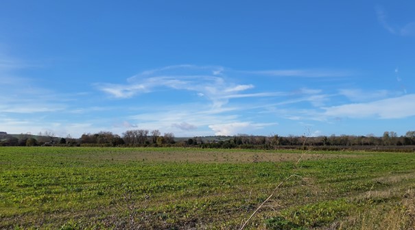
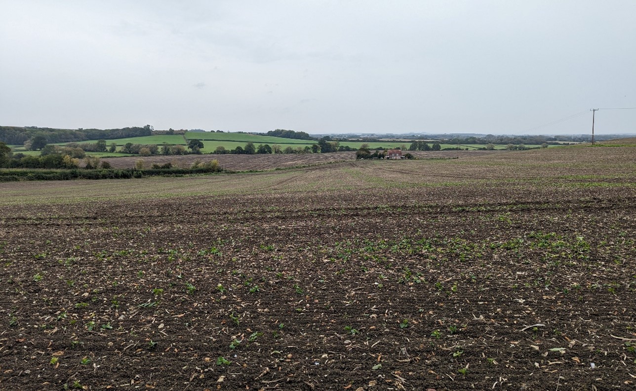
- An east-west band of relatively steep, north facing slopes that forms a transition between the chalk escarpment to the south and vale landscapes to the north; features numerous spring fed streams flowing north down into the vale and ultimately feeding the River Ock.
- Relatively well-wooded, contrasting with the more open downland to the south; features scattered woodland blocks, riparian woodland along watercourses, and other small tree groups and trees along field boundaries and on the edges of settlement.
- Relatively large arable fields, although smaller pastoral fields are common close to villages. Hedgerows around the large arable fields tend to be less intact than elsewhere on vale edge slopes.
- Settlement pattern of regularly spaced small, nucleated villages and hamlets, frequently located near the source of spring fed streams; the majority of these have medieval cores, covered by Conservation Area designations and contain clusters of Listed Buildings, which abut directly onto the surrounding countryside.
- Estates and parkland are also associated with some settlements, including the Grade II Compton Beauchamp Registered Park and Garden.
- A network of public rights of way, including the D’Arcy Dalton Way, provides recreational access to the landscape; all transport routes, including rural lanes, are generally oriented north-south, providing links between the Downs to the south and vale to the north.
- A rural area that provides part of the immediate northern setting to the North Wessex Downs National Landscape. The villages and the B4507, which follows the upper slopes along the southern boundary, often reduce the sense of remoteness and tranquillity.
- Gaps in tree cover allow panoramic views north across the slopes towards the lower-lying vale, particularly from more elevated positions; in contrast woodland and villages provide more enclosure and restricted views. The slopes form a backdrop and horizon for nearby land on the vale floor.
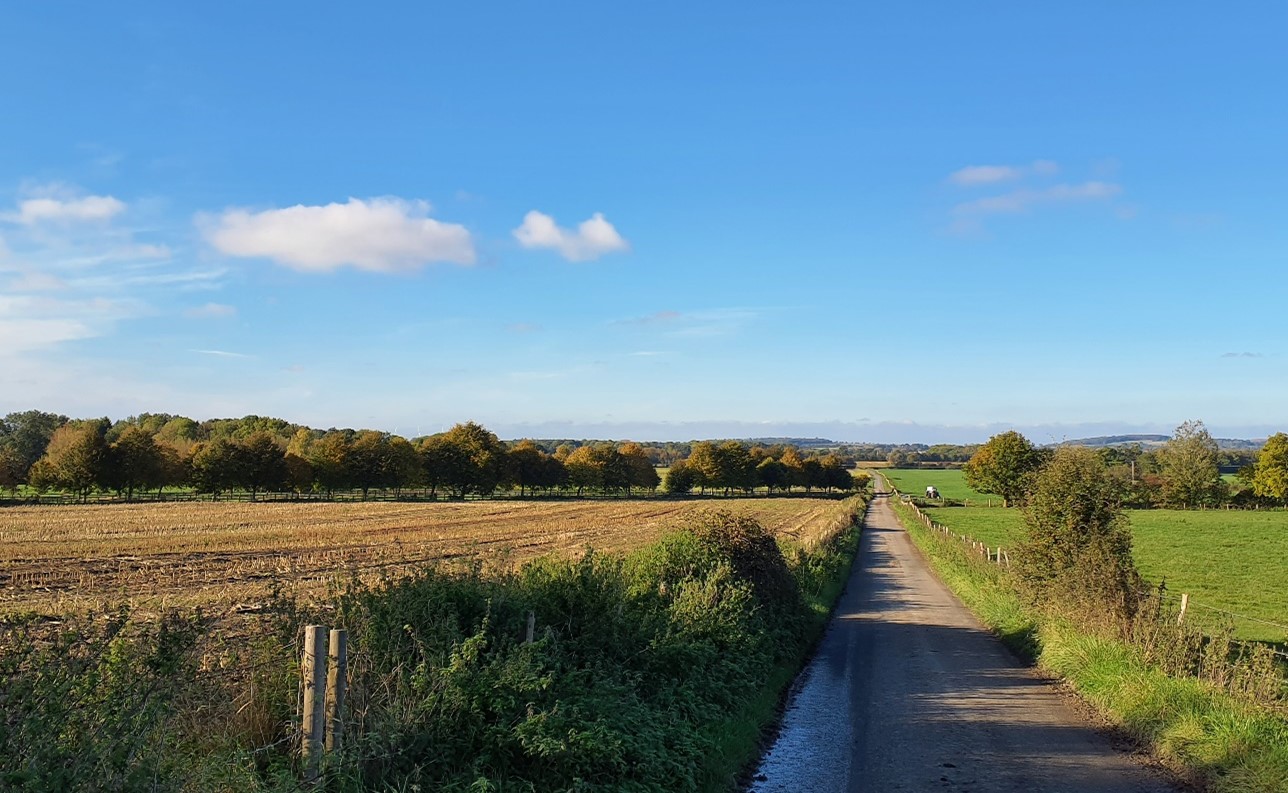
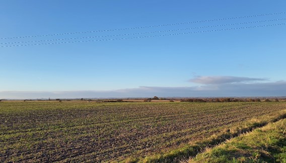
Trees line the large, arable fields (near Knighton):
×![]()
Trees line the large, arable fields (near Knighton):
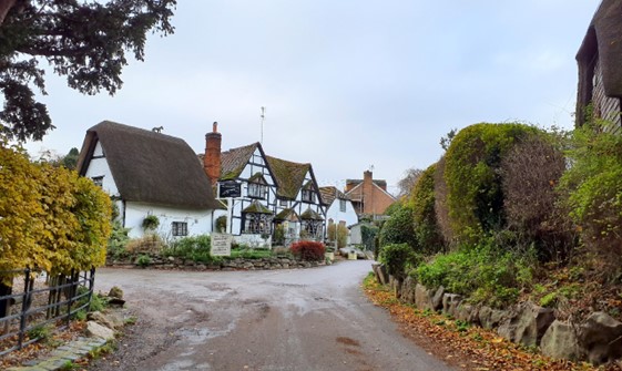
Thatched buildings in the low-lying settlements (Woolstone):
×![]()
Thatched buildings in the low-lying settlements (Woolstone):
Views to the chalk escarpment which rises to the south (looking towards Woolstone Wells):

×![]()
Views to the chalk escarpment which rises to the south (looking towards Woolstone Wells):
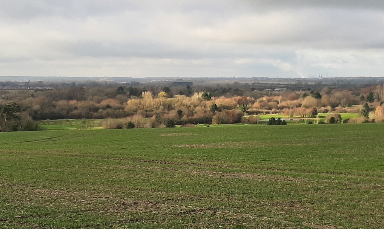
Panoramic views north across the slopes towards the lower-lying vale (near Childrey):

×![]()
Panoramic views north across the slopes towards the lower-lying vale (near Childrey):
Description
Natural (landform, water, semi-natural land cover)
- The upper parts of the footslopes are underlain by the West Melbury Marly Chalk Formation, consistent with the chalk scarp and downland to the south; as the slopes descend towards the Vale to the north, the bedrock geology turns to the Calcareous Sandstone and Siltstone of the Upper Greensand Formation.
- A band of relatively steep, north facing slopes running broadly east-west at the foot of the scarp; land rises from 90 to 105 metres Above Ordnance Datum (AOD) at the transition from the Vale, to approximately 135 metres AOD at the foot of the scarp to the south.
- Numerous spring fed streams, originating at the foot of the chalk scarp, flow north through the footslopes down into the Vale and ultimately feed the River Ock.
- Tree cover comprises small, dispersed blocks of woodland scattered along the footslopes, including areas of Ancient Woodland, riparian woodland along watercourses, and other small tree groups and trees along field boundaries, particularly in pastoral areas and on the edges of settlement.
Cultural/social (land use, settlement, infrastructure, historic character)
- Field pattern of relatively large arable fields, which continue north onto the gentler topography of the Vale. Smaller pastoral fields are also common close to the villages.
- Hawthorn and elm hedges are most common. However, vegetation along the boundaries of larger arable fields tends to be less intact than elsewhere on the footslopes.
- A mixture of post medieval, pre-18th century, and modern fieldscapes provides time-depth within the landscape.
- Historic settlement pattern of small, nucleated villages and hamlets located near the source of spring fed streams below the scarp.
- Open farmland forms gaps between each settlement, although recent development has reduced the gap between East Challow and Wantage.
- The majority of the settlements have historic cores dating back to the medieval period and are covered by Conservation Area designations and contain clusters of Listed Buildings; these mostly abut directly onto the surrounding countryside. Coarse chalk, brick, timber-framing and thatch or tiled roofs form the local vernacular.
- Estates and parkland are associated with some of these settlements, including the Grade II Registered Park and Garden (RPG) at Compton Beauchamp. Compton Beauchamp contains formal gardens and terraces and lawns enclosed by mature trees and shrubs.
- Deeper time-depth is provided by a Roman Villa near East Challow (Scheduled Monument).
- The principal road in the area is the B4507, which follows the upper slopes along the southern boundary; other road access comprises a network of rural lanes which connect areas of settlement and access farmland.
- A network of public rights of way provides recreational access to the landscape, including the promoted D’Arcy Dalton Way; public rights of way are generally oriented north-south, providing links between the Downs to the south and vale to the north.
Perceptual (views, tranquillity, associations)
- A rural area, with the scarp providing a strong backdrop to the south; some human influence from villages and the B4507 reduce the sense of remoteness and tranquillity. The Tranquillity Assessment for South Oxfordshire and Vale of White Horse categorises 88% of the LCA in Zone 2 (‘areas of some tranquillity’). The rural character and limited urban influence result in dark night skies. Over 90% of this landscape is categorised as within the darkest two bands in the Dark Skies Assessment for South Oxfordshire and Vale of White Horse.
- Gaps in tree cover allow panoramic views north across the slopes towards the lower-lying vale, particularly from more elevated positions; distant glimpses of the often-wooded Ridge Hilltops (LCA 7A) on the horizon to the north-west.
- Enclosed locations, such as within the vicinity of villages or woodland, have more restricted views.
- The slopes provide part of the immediate northern setting to the North Wessex Downs National Landscape.
Valued qualities
- Open farmland forms gaps between villages and hamlets, helping to retain their individual identities and the characteristic regular spacing of settlements along the spring-fed streams.
- Large, arable fields on the rolling footslopes serve as an undeveloped backdrop to views from the lower-lying vale in the north.
- Open higher ground allows long views north across the lower-lying vale landscapes towards the wooded limestone ridge in the distance.
- Provides an open, rural landscape setting to historic settlements, including the medieval cores of several villages covered by Conservation Area designations.
- Estate and parkland associated with settlements, such as the Grade II Compton Beauchamp RPG, provide historic character and landscape diversity.
- Numerous spring-fed streams with associated riparian vegetation add landscape and ecological diversity.
- Forms part of the immediate northern setting to the North Wessex Downs National Landscape, with the scarp forming a distinctive backdrop to the south.
- A good network of public rights of way, including the promoted D’Arcy Dalton Way, provide recreational value and north-south links between the Downs and vale.
- Relatively well-wooded compared to the open downland to the south, including blocks of woodland scattered along the footslopes, some of which are Ancient Woodland. Tree groupings are often associated with areas of settlement and provide screening, landscape structure, and a sense of enclosure.
- The value of the landscape is demonstrated by its inclusion (aside from the small area between East Challow and Wantage) within the West of Wantage Local Landscape Designation.
Forces for change
- Past intensification of farming has led to loss of hedgerows and woodland, particularly along the boundaries of the larger arable fields. This results in a greater sense of openness and increases the influence of development and busy roads. This also amplifies the contrasts with the more intact boundary hedges around the smaller scale pastoral fields closer to settlements.
- Pressure for residential development on the edges of villages and along roads. This could affect the distinctive nucleated settlement pattern and settlements’ individual identities (recent development on the eastern edge of East Challow has resulted in a reduced gap between East Challow and Wantage) and views of the undeveloped vale edge slopes from the vale below.
- The relatively recent introduction of development on the edges of villages, such as housing to the east of Ashbury, can weaken the relationship between historic village cores and their open, rural landscape setting.
- Increased need for renewable energy has led to solar farm developments at the foot of the vale edge slopes to the east of Wantage and Grove. The drive for net zero could lead to more solar farm applications in the adjacent vale landscapes to the north which could affect the rural character and characteristic views across the vale below.
- The Vale Edge Slopes landscapes may be susceptible to the to the impacts of climate change, including:
- Deciduous woodlands are facing decline due to warmer winters, altered rainfall patterns, drier summers and increased frequency of extreme events; there may be a shift in vegetation type and composition, increased competition from invasive species, greater numbers of insect and mammal pests, and a greater risk of wind-throw and loss of mature trees.
- Higher average temperatures and drier summers could lead to changes to community composition in arable field margins; an increase in bare ground and an increased risk of dieback in drought prone locations; the introduction of new crops and associated changes to management could alter the area and type of field margins; and an increase in agricultural use of summer insecticides which could reduce insect numbers and pollination.
- Drier summers and wetter winters may lead to increased mortality and die-back of certain hedgerow tree species; an increased occurrence of pests and pathogens could lead to a potential loss or significant reduction in populations of key hedgerow tree species; and increased storm activity may lead to the loss of mature and veteran trees within hedgerows.
- Increase in storm damage affecting veteran and mature trees, including within designed landscapes.
Landscape strategy and guidelines
character by helping to limit the urbanising visual influence of adjacent settlements, and provide landscape structure and a sense of enclosure.
- Retain and enhance woodland blocks and tree lines; conserve and manage the Ancient Woodland sites to improve landscape character and encourage biodiversity.
- Encourage the appropriate management of woodland, including to reduce the impacts of pests and diseases and to increase its age structure and structural heterogeneity. Consider the promotion of natural colonisation adjacent to existing woodland, allowing locally native species to develop resilience to the pressures of climate change through natural processes.
- Explore opportunities to expand and connect existing woodland and tree cover through natural regeneration or small-scale planting, particularly around settlements. This will strengthen landscape character and bring benefits for biodiversity.
- Seek to prevent further loss or decline in the quality of remaining boundary hedgerows and encourage their restoration/reinstatement, whilst maintaining characteristic long-distance views north; when establishing new hedges, aim to diversify the range of species and select species and provenances adapted to a wider range of climatic conditions.
- Use hedgerows, trees and woodland to integrate any new development into the landscape.
Maintain the open character of farmland which forms gaps between individual settlements, contributes positively to the setting of North Wessex Downs National Landscape, and forms an undeveloped backdrop to views back from the vale.
- Maintain the distinctive nucleated settlement pattern along the spring line and minimise the impact of new development on the widely visible vale-edge slopes.
- Any new development should use materials which are in keeping with, or complement, the local vernacular of coarse chalk, brick, timber-framing and thatch or tile roofs.
- Consider the impact of any new lighting on the dark skies within the landscape (refer to the guidance in the Dark Skies / Light Impact Assessment for South Oxfordshire and Vale of White Horse).
- Refer to the South Oxfordshire and Vale of White Horse Renewable Energy Study when considering any solar panel applications. Consider the impact on views of the solar arrays from the surrounding higher ground.
- Maintain the valued recreational use of the landscape and consider opportunities to introduce additional east-west public rights of way connectivity to enhance appreciation of views and landscape character.
- Consider impact of development on views from the National Landscape, both local views where there is no woodland screening along the B4507 and longer views from the higher downs, where the transition from scarp to vale can be appreciated.
Spring-fed streams with associated riparian vegetation should be retained as distinctive landscape elements with high biodiversity value, and enhanced where possible.
- Retain riparian vegetation along watercourses to maintain their distinctive character and ecological value.
- Encourage adjacent land uses which strengthen role as ecological corridors and enhance landscape character.
- Seek opportunities to enhance connectivity with other habitats nearby by creating green corridors and networks.
Estate and parkland associated with settlements, and the historic character and landscape diversity they provide, should be conserved and enhanced.
- Conserve and manage Compton Beauchamp historic parkland within the landscape, including their formal gardens and terraces, lawns and mature tree cover. Replant key ornamental tree species to retain the parkland character where necessary.
Historic parts of villages should retain a relationship with their rural landscape settings which contribute to their distinctive historic character.
- Maintain physical and visual connectivity between Conservation Areas and prominent features in settlement setting, including remnant parkland to the south and east of Kingston Lisle and the wooded stream valley to the east of Woolstone.
Protect characteristic long views outwards from the LCA.
- Protect and where possible enhance long views north across the lower-lying vale landscapes towards the wooded limestone ridge in the distance.
LCA 9B: Wantage to Milton Hill Vale Edge Slopes
It should be noted that the lines used to denote where LCAs border settlements are approximate and should not be used for planning purposes.
Character Area Location
Located between Wantage and Grove and Milton Hill, in the south-east of the Vale of White Horse district, this landscape forms a transition between the low-lying Western Middle Vale (LCA 12B) to the north and the higher Wessex Downs Chalk Escarpment Footslopes (LCA 6A) to the south. The slope, on Upper Greensand bedrock, forms a relatively narrow belt of land.
Key characteristics
- An east-west band of north sloping land; spring fed streams, including East Hendred Brook, flow north down into the vale and ultimately feed the River Ock.
- Land use is chiefly arable farmland, with relatively large, open fields.
- Moderately wooded landscape, with dispersed woodland blocks; more wooded in the east, where there are several tree belts/plantations in areas of former fruit growing and horticultural, and woodland around Steventon Hill and the parkland of Milton Hill House.
- Settlement is limited to scattered farmsteads and isolated properties, but several larger settlements – Wantage, Grove, East Hendred and Steventon – border the area.
- A network of public rights of way provides recreational access to the landscape; these are generally oriented north-south, providing links between the Downs to the south and vale to the north.
- Landform and tree cover limit visibility of nearby settlements, including recent developments on the eastern edge of Wantage (as part of the Crab Hill Strategic Allocation) and East Hendred.
- A relatively peaceful, rural character, even close to urban edges, although solar farms near the slope foot introduce a modern, geometric form into the landscape.
- Large, relatively flat arable fields have an open, exposed character, with woodland containing views to the south and only the distant ridge visible to the north. Sense of isolation on the crest of the slope is limited by the sight and sound of traffic on the A417.
- The upper vale-edge slopes provide expansive views northwards across the vale to the ridge beyond, and form a backdrop and horizon for nearby land on the vale floor. The landscape is part of the setting to the North Wessex Downs National Landscape, which forms a distinctive backdrop to the south.
Views over the vale edge slopes towards low-lying farmand in the north (north of West Hendred):
×![]()
Views over the vale edge slopes towards low-lying farmand in the north (north of West Hendred):
Deciduous woodland at Lain’s Row:

×![]()
Deciduous woodland at Lain’s Row:
Plateau land above the vale edge slopes north of Ardington:
×![]()
Plateau land above the vale edge slopes north of Ardington:
Open views north across the arable fields from The Vale Way:
×![]()
Open views north across the arable fields from The Vale Way:
Description
Natural (landform, water, semi-natural land cover)
- Upper Greensand Formation forms moderate slopes down to the clay vale, from 110 metres Above Ordnance Datum (AOD) in the south to 70 metres AOD in the north. There are flatter plateaus to the north of Ardington and East Hendred. The vale edge slopes extend further north in the area around Steventon Hill.
- Springs rise at several locations on the slopes; the principal watercourse is East Hendred Brook, which rises further south close to the chalk escarpment and forms a distinctive valley through the area. These streams feed either into the River Thames or its tributary the River Ock.
- Woodland is concentrated in the east, where there are significant tree belts/plantations, indicative of the areas former fruit growing and horticultural use, and woodland on Steventon Hill and around the parkland of Milton Hill House. The west contains a few dispersed woodland blocks.
- Riparian vegetation, including willow, poplar and ash, lines East Hendred Brook and the short stretch of disused canal east of Grove. The other watercourses are more open.
- Trees, including beech, sycamore, poplar and ash, line stretches of many of the roads, for example along Grove Park Drive and along the A4130 Abingdon Road.
- Priority habitats include deciduous woodland and small areas of traditional orchard at Quab Hill.
Cultural/social (land use, settlement, infrastructure, historic character)
- Slopes and flatter areas in the west and centre are predominantly large, open arable fields, which continue north onto the Vale. Field boundaries are prominently low-clipped hawthorn with occasional elm, and are often gappy. Some fields lack any clear boundary feature.
- A large solar farm at Crab Hill is a more modern land use.
- There are no settlements within the area. The settlement edges of Steventon, East Hendred, Grove and the recently expanded boundary at Wantage (Crab Hill Strategic Allocation) lie adjacent to the landscape.
- Historic features are limited to Grade II listed buildings at Ardington Wick Farm and Lains Barn.
- The busy A417 is the main road through the area, running along the upper slopes (the southern boundary). Road access is otherwise limited to farm tracks.
- Public rights of way provide north-south access across the area but there is little east-west connectivity.
Perceptual (views, tranquillity, associations)
- North-facing, open slopes across much of the area provide panoramic views north across the vale and from the flatter plateau between Wantage and East Hendred, towards the distant Corallian Limestone Ridge. Views south to the chalk escarpment (part of the North Wessex Downs National Landscape) are generally restricted by tree cover. Field boundary hedgerows and tree lines in the north limit northward views, so there is less of a sense of openness than is the case above or on the side of the vale edge slope.
- Solar farms beneath the vale edge slopes are prominent near Grove and Steventon.
- The busy A417 intrudes on the sense of tranquillity and remoteness along the southern edge of the area, and an electricity pylon route at Quab Hill is a noticeable vertical feature in views, but much of the area is rural and relatively tranquil, with limited settlement internally and landform and tree cover filtering views of the larger settlements. The Tranquillity Assessment for South Oxfordshire and Vale of White Horse categorises 92% of the LCA in Zone 2 (‘areas of some tranquillity’), and the Dark Skies Assessment for South Oxfordshire and Vale of White Horse categorises 70% of the area within its darkest assessment band.
Valued qualities
- The landscape retains a rural character with limited urbanising influence due to the gaps between settlements, and the screening role of tree cover and landform.
- Intervisibility with the vale to the north contributes to the rural character of both the vale edge slopes and vale itself.
- Long views north towards the Corallian Limestone Ridge due to the open character of the vale edge slopes.
- Tree cover around the adjacent settlements has a screening function which limits their urbanising influence, which would otherwise be prominent in views both from the vale and the higher downs.
- Streams with associated valley landforms and riparian vegetation, such as East Hendred Brook, add landscape and ecological diversity.
- Semi-natural habitats, including Ancient Woodland, deciduous woodland and small areas of traditional orchard at Quab Hill provide time-depth, ecological value and contribute positively to the landscape.
- Forms part of the northern setting to the North Wessex Downs National Landscape. Tree cover and topography limit the visual relationship between the adjacent National Landscape and these vale edge slopes.
- Recreational value of public rights of way which are generally oriented north-south, providing links between the downs to the south and vale to the north.
- The north-west facing slopes of Steventon Hill provide a distinctive elevated setting to the south of Steventon village and parts of its Conservation Area. Steventon Copse, on the side of Steventon Hill, contributes to the setting of the village. The slopes of Crab Hill in the west retain visual separation between Grove and the recent residential development of the Crab Hill Strategic Allocation.
Forces for change
- Past intensification of farming led to loss of hedgerows and woodland. On the higher escarpment, where development is more distant, this openness is seen as adding to the visual character of the downs; but in this character area it gives more intrusive exposure to adverse influences such as power lines, main roads and urban development.
- There has been significant development at Wantage (as part of the Crab Hill Strategic Allocation) and on the northern edge of East Hendred. Development and associated traffic, and the proximity of major through routes, have had a significant impact on tranquillity around Milton Hill in particular.
- Decline in orchards and other horticultural practices, which affects these rare and valued features in the landscape and the texture and visual interest they provide.
- Increased need for renewable energy has led to solar farm developments at the foot of the vale edge slope, and in the vale to the north. Drive for net zero could lead to more solar farm applications in this and the adjacent landscapes which could affect the rural character and views from the vale below.
- The Vale Edge Slopes landscapes may be susceptible to the impacts of climate change, including:
- Deciduous woodlands are facing decline due to warmer winters, altered rainfall patterns, drier summers and increased frequency of extreme events; there may be a shift in vegetation type and composition, increased competition from invasive species, greater numbers of insect and mammal pests, and a greater risk of wind-throw and loss of mature trees.
- Higher average temperatures and drier summers could lead to changes to community composition in arable field margins; an increase in bare ground and an increased risk of dieback in drought prone locations; the introduction of new crops and associated changes to management could alter the area and type of field margins; and an increase in agricultural use of summer insecticides which could reduce insect numbers and pollination.
- Drier summers and wetter winters may lead to increased mortality and die-back of certain hedgerow tree species; an increased occurrence of insect pests and pathogens could lead to a potential loss or significant reduction in populations of key hedgerow tree species; and increased storm activity may lead to the loss of mature and veteran trees within hedgerows.
- Drier summers and wetter winters may lead to a shift in the growing area of specific fruit species; waterlogged soils leading to crop loss; new pest and diseases may reduce the success of fruit crops; changes in fruit growing practices including increase in poly tunnels; and a reduction in available moisture during the growing season affecting the success of fruit trees.
Landscape strategy and guidelines
Woodland blocks and mature tree cover should continue to contribute to rural character by helping to limit the urbanising visual influence of adjacent settlements, and provide biodiversity.
- Retain and enhance hedgerows, woodland blocks and tree lines.
- Encourage landowners to manage woodland appropriately, including to reduce the impacts of pests and diseases and to increase the age structure and structural heterogeneity of woodland. Consider the promotion of natural colonisation adjacent to existing woodland, allowing locally native species to develop resilience to the pressures of climate change through natural processes.
- Seek to prevent further loss or decline in the quality of remaining boundary hedgerows and encourage their restoration/reinstatement; when establishing new hedges, aim to diversify the range of species and select species and provenances adapted to a wider range of climatic conditions.
- Use hedgerows, trees and woodland to integrate development, including any proposed solar farms, into the landscape.
Maintain the open character of central areas, which form gaps between settlements, provide long views northwards but retain a remote, rural character away from the immediate influence of the A417, contributing positively to the setting of North Wessex Downs National Landscape.
- Maintain the distinctive unsettled character of the area, avoiding any large-scale developments. Any new developments should be associated with the edges of Wantage or Steventon.
- Maintain the features in the landscape which are prominent in settlement setting, including woodland on Steventon Hill and open slopes of Crab Hill (between Wantage and Grove). Maintain the valued recreational use of the landscape and consider opportunities to introduce additional east-west public rights of way connectivity to enhance appreciation of views and landscape character.
- Consider impact of development on views from the National Landscape, both local views where there is no woodland screening along the A417 and longer views from the higher downs, where the transition from scarp to vale can be appreciated.
- Refer to the South Oxfordshire and Vale of White Horse Renewable Energy Study when considering any further solar panel applications. Consider the impact on views of the solar arrays from the surrounding higher ground and vales.
Watercourses such as East Hendred Brook should be retained as distinctive landscape elements with high biodiversity value, and enhanced where possible.
- Retain riparian vegetation along watercourses to maintain their distinctive character and ecological value.
- Encourage adjacent land uses which strengthen role as ecological corridors and enhance landscape character.
- Seek opportunities to enhance connectivity with other habitats nearby by creating green corridors and networks.
LCA 9C: Milton Hill to Didcot Vale Edge Slopes
It should be noted that the lines used to denote where LCAs border settlements are approximate and should not be used for planning purposes.
Character Area Summary and Location
Located on the boundary between Vale of White Horse district and South Oxfordshire, the area comprises the north and north-east facing slopes located between Milton Hill in the east, West Hagbourne in the west, the Great Western Main Line railway in the north and the A417 in the south. It forms a transition between the urban areas of Milton and Didcot to the north and east, and the chalk escarpment foot slopes in the south (LCA 6A).
Key characteristics
- An area of north and north-east facing sloping land incised by small streams and ditches.
- Arable farmland dominates, in medium-sized fields, with larger fields to the south-east around West Hagbourne. Fields around Milton Hill are typically smaller, and include grassland and orchards.
- Moderately wooded landscape, with dispersed woodland blocks; more wooded in the west, where there are also large areas of traditional orchard.
- Settlement comprises scattered farmsteads and the villages of Rowstock, Milton Hill and Milton Heights which include significant commercial and residential development. The edges of Steventon, Milton Park, Didcot and Harwell are visible within the landscape.
- A network of public rights of way provides recreational access to the landscape, linking between the Downs to the south and vale to the north.
- Busy road network including the A34 / A4130 interchange at Milton Hill creates significant traffic noise, limiting any sense of rural tranquillity. Trees and hedges provide visual containment on the flatter high ground, although recent residential expansion at Milton Heights and Harwell is also noticeable.
- The upper vale-edge slopes provide expansive views northwards across the vale to the ridge beyond but the landform limits views to the south. The slopes also form a backdrop and horizon for nearby land on the vale floor.
Sheep grazing across plateau land east of Harwell:

×![]()
Sheep grazing across plateau land east of Harwell:
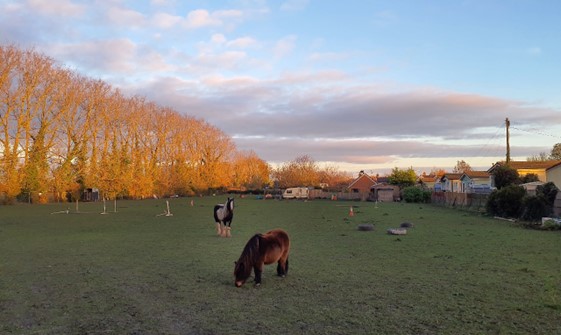
Horse grazing on Harwell’s settlement edge:
×![]()
Horse grazing on Harwell’s settlement edge:
Larger-scale arable farmland near West Hagbourne:
×![]()
Larger-scale arable farmland near West Hagbourne:
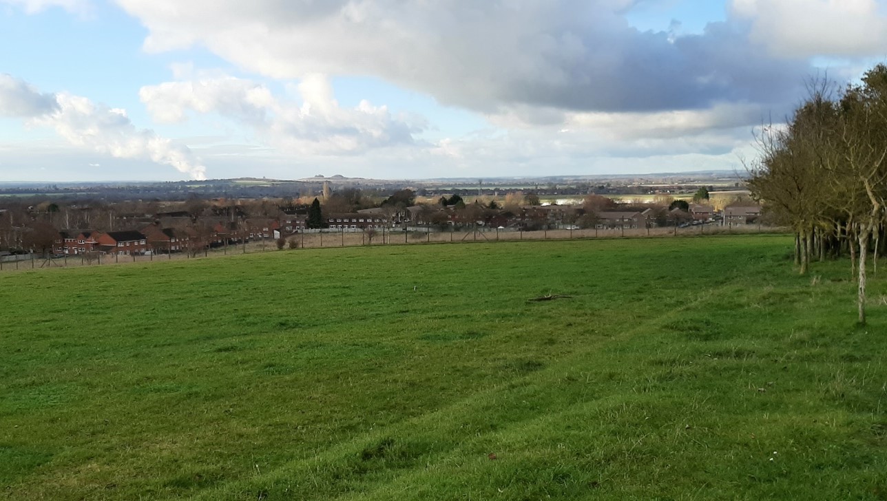
Long views north of Harwell down the vale-edge slopes to tall industrial structures in Didcot:

×![]()
Long views north of Harwell down the vale-edge slopes to tall industrial structures in Didcot:
Description
Natural (landform, water, semi-natural land cover)
- Upper Greensand Formation forms moderate slopes down to the clay vale, ranging from 110 metres Above Ordnance Datum (AOD) to 70 metres AOD. The vale edge slopes extend north around Steventon Hill and Milton Hill, and extend north-east around Harwell and West Hagbourne.
- The slopes are incised by a number of small streams and ditches flanked in places by narrow ribbons of riparian vegetation.
- Significant tree belts/plantations, indicative of the areas former fruit growing and horticultural use, as well as areas of woodland on around the parkland of Milton Hill House create a wooded character.
- Trees, including beech, sycamore, poplar and ash, line stretches of many of the roads, for example along Grove Road and along the A4130 Abingdon Road.
Cultural/social (land use, settlement, infrastructure, historic character)
- Fields are typically smaller in the area between Harwell and Milton Hill, with stronger boundary features and more variety of land uses, including arable, grassland and orchards. Away from the settlement edges there are some larger arable fields.
- Field boundaries are prominently low-clipped hawthorn with occasional elm, and are often gappy where the field size increases. Some fields lack any clear boundary feature.
- Distinctive urban influence owing to the proximity of large urban areas; Steventon and Milton Park Estate to the north, Didcot to the east and Harwell to the south. Recent development at Milton Heights does not have a strong character or distinctive vernacular, and there is significant commercial development at Milton Hill.
- Main roads are a notable feature – the A417 runs along the southern edge and the A34 and the A4120 feature in the east and west, with a large roundabout at their interchange at Milton Heights. Farm tracks also provide access between settlements.
- Public rights of way provide access across the area, linking to the vales to the north-west, and provide some recreational value.
- While there are no Listed Buildings or Scheduled Monuments within this landscape, Conservation Areas cover large parts of Harwell, West Hagbourne, and Steventon, with which the LCA has a visual connection. There is a remaining area of old orchard trees on the northern edge of Harwell.
Perceptual (views, tranquillity, associations)
- There are open views across the vale to the north and east. Views south towards the chalk escarpment are generally blocked by tree cover south of the A417, or by the vale edge slopes.
- The south has less of a sense of openness as field boundary hedgerows and tree lines limit northward views. On the flatter plateau west of Harwell the slope crest hides middle distance views, and tree cover limits longer views in the Milton Hill area.
- Limited sense of tranquillity due to the considerable residential, commercial and infrastructure development experienced across the landscape. The A417, A34 and A4130 aurally and visually intrude, though this is partially mitigated by the woodland which features along the southern side of the large A-road interchange. The Tranquillity Assessment for South Oxfordshire and Vale of White Horse categorises 49% of the LCA in Zone 2 (‘areas of some tranquillity’) but 41% in Zone 4 (‘areas of low tranquillity’).
Valued qualities
- There are open views across the vale to the north and east. Views south towards the chalk escarpment are generally blocked by tree cover south of the A417, or by the vale edge slopes.
- The south has less of a sense of openness as field boundary hedgerows and tree lines limit northward views. On the flatter plateau west of Harwell the slope crest hides middle distance views, and tree cover limits longer views in the Milton Hill area.
- Limited sense of tranquillity due to the considerable residential, commercial and infrastructure development experienced across the landscape. The A417, A34 and A4130 aurally and visually intrude, though this is partially mitigated by the woodland which features along the southern side of the large A-road interchange. The Tranquillity Assessment for South Oxfordshire and Vale of White Horse categorises 49% of the LCA in Zone 2 (‘areas of some tranquillity’) but 41% in Zone 4 (‘areas of low tranquillity’).
Forces for change
- Past intensification of farming led to loss of hedgerows and woodland. On the higher escarpment, where development is more distant, this openness is seen as adding to the visual character of the downs; but in this character area it gives more intrusive exposure to adverse influences such as power lines, main roads and urban development.
- Increased pressure for residential development around Milton Heights (including as part of the Milton Heights Strategic Allocation) and on the northern edge of Harwell (including as part of the Lands at Harwell Village Strategic Allocation), which could affect the sense of separation between individual settlements and the wider rural context of the vale below.
- Didcot has expanded significantly since the 1980s, and the planned Valley Park expansion will extend the town west to the A34, with potential impacts on views and tranquillity.
- Decline in orchards and other horticultural practices, reducing texture and visual interest in the landscape.
- Increased need for renewable energy has led to solar farm developments at the foot of the vale edge slope. The drive for net zero could lead to more solar farm applications in this and adjacent landscapes which could affect the rural character and views from the vale below.
- The Vale Edge Slopes landscapes may be susceptible to the impacts of climate change, including:
- Deciduous woodlands are facing decline due to warmer winters, altered rainfall patterns, drier summers and increased frequency of extreme events; there may be a shift in vegetation type and composition, increased competition from invasive species, greater numbers of insect and mammal pests, and a greater risk of wind-throw and loss of mature trees.
- Higher average temperatures and drier summers could lead to changes to community composition in arable field margins; an increase in bare ground and an increased risk of dieback in drought prone locations; the introduction of new crops and associated changes to management could alter the area and type of field margins; and an increase in agricultural use of summer insecticides which could reduce insect numbers and pollination.
- Drier summers and wetter winters may lead to increased mortality and die-back of certain hedgerow tree species; an increased occurrence of insect pests and pathogens could lead to a potential loss or significant reduction in populations of key hedgerow tree species; and increased storm activity may lead to the loss of mature and veteran trees within hedgerows.
Landscape strategy and guidelines
Woodland blocks and mature tree cover should continue to contribute to rural character by helping to limit the urbanising visual influence of adjacent settlements, and provide biodiversity.
- Retain and enhance woodland blocks and tree lines.
- Encourage landowners to manage woodland appropriately, including to reduce the impacts of pests and diseases and to increase the age structure and structural heterogeneity of woodland. Consider the promotion of natural colonisation adjacent to existing woodland, allowing locally native species to develop resilience to the pressures of climate change through natural processes.
- Seek to prevent further loss or decline in the quality of remaining boundary hedgerows and encourage their restoration/reinstatement; when establishing new hedges, aim to diversify the range of species and select species and provenances adapted to a wider range of climatic conditions.
- Use hedgerows, trees and woodland to integrate development, including any proposed solar farms, into the landscape.
Recent development has reduced gaps between Didcot, Harwell and Milton Heights. Maintain the open character of those areas which form gaps between these settlements and maintain separation between this area and East Hendred.
- Ensure any new development retains the open character of the landscape, and does not cause perceived coalescence between areas of residential and commercial development. Encourage the use of local materials to create a stronger sense of place.
- Consider opportunities to introduce additional public rights of way connectivity between settlements in this area, minimising the need to walk alongside busy roads, to enhance appreciation of views and landscape character.
- Consider impact of development on views from the National Landscape, both local views where there is no woodland screening along the A417 and longer views from the higher downs, where the transition from scarp to vale can be appreciated.
Maintain the variety of rural land uses on and around Milton Hill, with remnant orchards and a strong tree and hedgerow component to limit views of built development.
- Encourage traditional farming practice and maintain and restore orchards and horticultural uses where appropriate, including the remaining older orchard trees which have visual and biodiversity value and sense of time depth.
- Avoid spread of urban fringe uses (such as paddocks) into open land.
Historic parts of villages should retain a relationship with their rural landscape settings which contribute to their distinctive historic character.
- Maintain physical and visual connectivity between Conservation Areas and prominent features in settlement setting, including the former orchard north of Harwell, woodland on Steventon Hill.
LCA 9D: East of Didcot Vale Edge Slopes
It should be noted that the lines used to denote where LCAs border settlements are approximate and should not be used for planning purposes.
Character Area Summary and Location
The LCA is located to the south of Didcot, lying between the Vale of White Horse and South Oxfordshire districts, and is defined to the south by the foot of the scarp slopes (LCA 1B). It consists of large open arable fields, interspersed with small streams and ditches. Much of the LCA is within the North Wessex Downs National Landscape.
Key characteristics
- Gently rolling transitional landscape lying between the Chalk escarpment to the south and the lower-lying vale landscapes to the north; drained by a network of small watercourses, including Mill Brook in the north.
- Sparsely woodland, limited to occasional small deciduous woodland blocks and a few remaining traditional fruit orchards on the edges of villages.
- Topographical highpoints at Blewburton Hill and Lollingdon Hill provide visual landmarks and host ecologically important lowland calcareous grassland.
- Intensive arable farmland in large-scale fields bounded by a variety of field boundaries, with some missing. Smaller-scale pasture fields line the small watercourses in the north.
- Settlement is limited to the small, historic nucleated village of Upton, and the western halves of Aston Upthorpe and Aston Tirrold. Timber-framing, red brick, flint and tile roofs form the local vernacular.
- A good level of recreational access via a network of public rights of way and a cycle route on the dismantled railway line between Upton and Didcot.
- A rural character, with tranquillity locally impacted by proximity to Blewbury and the A417.
- An open landscape, with long views across the large-scale fields. The Downs scarp provides a strong backdrop to the south, and there are some glimpsed views of the wooded Corallian Limestone Ridge to the north.
Transition between lower-lying vale landscape and chalk escarpment in the south (Hagbourne Road):
×![]()
Transition between lower-lying vale landscape and chalk escarpment in the south (Hagbourne Road):
Views to the settlement edge of Aston Tirrold:

×![]()
Views to the settlement edge of Aston Tirrold:
Lollingdon Hill forms a local highpoint in the east:

×![]()
Lollingdon Hill forms a local highpoint in the east:
Large-scale arable with views to chalk scarp restricted by mature hedgerow trees (near Aston Upthorpe):
×![]()
Large-scale arable with views to chalk scarp restricted by mature hedgerow trees (near Aston Upthorpe):
Description
Natural (landform, water, semi-natural land cover)
- The south of the area is underlain by the West Melbury Marly Chalk Formation, which transitions to a band of calcareous siltstones and sandy limestones of the Upper Greensand. Small areas of Head deposits and alluvium provide sometimes ‘flinty’ soils.
- Rolling farmland falling gently to the north, mostly between 60 and 90 metres Above Ordnance Datum (AOD) but with Blewburton Hill (110 metres AOD) and Lollingdon Hill (96 metres AOD) forming topographical highpoints.
- A network of small watercourses in the north including Mill Brook which contains areas of Flood Zone 2 and 3.
Cultural/social (land use, settlement, infrastructure, historic character)
- Generally fertile soils mean that intensive arable farming is the predominant land use, in large-scale fields. Field boundaries vary, with some substantial tree belts, some gappy hedgerows and grass margins, and some reinforcement with post and wire fencing. An area of horse grazing and stud on the edge of Aston Upthorpe has a more regular field pattern, bounded by single-species hedgerows. Small-scale pasture is also associated with the small watercourses.
- Upton and the western halves of Astron Tirrold and Aston Upthorpe are the only areas of settlement. The small, nucleated villages are covered by Conservation Areas and contain a number of Grade II Listed Buildings, with timber-framing, red brick, flint and tile roofs common.
- There are considerable prehistoric earthworks on Blewburton Hill (a Scheduled Monument).
- Small rural lanes connect the villages, as well as Blewbury and Didcot. The busy A417 runs along the south of the LCA.
- The area has a good network of public rights of way, while a short section of the dismantled Didcot, Newbury and Southampton Railway is now used as a cycleway (National Cycle Network 544), linking Upton and Didcot. There is open access land on Blewburton Hill.
Perceptual (views, tranquillity, associations)
- Views across the LCA are generally open, due to the predominance of large-scale arable fields. The Downs scarp forms a prominent backdrop to the south, while there are glimpsed views of the wooded Corallian Limestone Ridge to the north.
- The settlement edges of Blewbury are well-integrated into the landscape, with shelterbelts along the B4016 restricting views from the east.
- Blewburton Hill is a local highpoint and visual landmark on approach to Blewbury. Lollingdon Hill is similarly prominent as an outlier from the higher downs to the south.
- A rural landscape with few detracting features, although development, proximity to Blewbury and the A417 reduce tranquillity and relative remoteness. The Tranquillity Assessment for South Oxfordshire and Vale of White Horse categorises 95% of the LCA in Zone 2 (‘areas of some tranquillity’). The rural character and limited urban influence also result in dark night skies. Over 90% of this landscape is categorised as within the darkest two bands in the Dark Skies Assessment for South Oxfordshire and Vale of White Horse.
Valued qualities
- Most of the area is within the North Wessex Downs National Landscape and displays several of the special qualities, including open landscape in arable land use, with medieval settlements, a light road network, and an extensive rights of way network.
- Open views across the landscape; the Downs scarp provides a strong backdrop to the south, and there are some glimpsed views of the wooded Corallian Limestone Ridge to the north. Round or flat-topped hills are distinctive amongst the gently rolling landscape.
- Open farmland forms the gaps between the villages of Blewbury, Upton, Aston Tirrold and Aston Upthorpe, helping to retain their individual identities and their rural character.
- Open landscape provides an immediate setting to settlements, including the historic core of Aston Upthorpe and Aston Tirrold containing clusters of Listed Buildings and covered by Conservation Area designations. This open rural setting contributes to their historic character.
- Open farmland provides a sense of separation between Blewbury, West Hagbourne, Upton and Aston Upthorne/Aston Tirrold.
- The rural character of small lanes connecting the villages.
- Remnant traditional fruit orchards on the edges of Aston Upthorpe and Aston Tirrold provide a link to historic land uses, contribute to historic landscape character, and provide texture and visual interest to the landscape.
- Prehistoric hillfort at Blewburton Hill provides significant time-depth.
- Occasional areas of deciduous woodland, traditional orchard and lowland calcareous grassland are natural features which provide ecological value and landscape diversity. Woodland on the slopes of Blewburton Hill and Lollingdon Hill is particularly distinctive.
- A network of public rights of way and the cycle route along the dismantled railway provide recreational value and connection to the broader landscape; much of the area lies within the North Wessex Downs National Landscape, which increases its recreational value.
- Timber-framing, red brick, flint and tile roofs form the local vernacular, contributing to a coherent character and distinctive sense of place.
- Smaller scale pastoral fields associated with watercourses, east of Upton, create a strong landscape structure (in comparison to the more open areas of large-scale arable fields). The sense of enclosure provided by boundary hedges, trees and riparian vegetation creates a tranquil, more remote character.
Forces for change
- Past intensification of farming has led to field amalgamation and loss of hedgerows and woodland. This, coupled with the introduction of agricultural infrastructure such as large sheds, results in an intensified agricultural character. Loss of hedgerows and woodland cover and the decline in their management also gives more intrusive exposure to adverse influences such as the southern edge of Didcot and other intrusive elements.
- Loss of traditional orchards around the edges of villages due to conversion to arable, pasture or equine uses. This affects these rare and valued features in the landscape and the texture and visual interest they provide.
- The lack of screening or enclosure typically provided by intervening vegetation means this landscape is visually sensitive to changes both in the nearby vale and on higher ground to the south. Tall structures, such as communication masts and electricity pylons, have had an impact in this way.
- The Vale Edge Slopes landscapes may be susceptible to the impacts of climate change, including:
- Deciduous woodlands are facing decline due to warmer winters, altered rainfall patterns, drier summers and increased frequency of extreme events; there may be a shift in vegetation type and composition, increased competition from invasive species, greater numbers of insect and mammal pests, and a greater risk of wind-throw and loss of mature trees.
- Higher average temperatures and drier summers could lead to changes to community composition in arable field margins; an increase in bare ground and an increased risk of dieback in drought prone locations; the introduction of new crops and associated changes to management could alter the area and type of field margins; and an increase in agricultural use of summer insecticides which could reduce insect numbers and pollination.
- Drier summers and wetter winters may lead to increased mortality and die-back of certain hedgerow tree species; an increased occurrence of insect pests and pathogens could lead to a potential loss or significant reduction in populations of key hedgerow tree species; and increased storm activity may lead to the loss of mature and veteran trees within hedgerows.
- Drier summers and wetter winters may lead to a shift in the growing area of specific fruit species; waterlogged soils leading to crop loss; new pest and diseases may reduce the success of fruit crops; changes in fruit growing practices including increase in poly tunnels; and a reduction in available moisture during the growing season affecting the success of fruit trees.
Landscape strategy and guidelines
Maintain the open character of farmland which forms gaps between individual settlements, helping to retain their individual identities and their rural character. Retain the rural character of small lanes between the settlements.
- Avoid urbanising development on the widely visible vale-edge crest and slopes.
- Maintain the distinctive nucleated settlement pattern and minimise the impact of new housing development or large-scale agricultural development through careful design. Any new development should use materials which are in keeping with, or complement, the local vernacular of brick, flint, timber-framing and tile roofs.
- Conserve the pattern of rural lanes, ensuring that their character is not lost through unsympathetic highway works, unnecessary signage, lighting, or removal of hedgerows and trees.
Protect the role of the vale edge slopes as a setting to the North Wessex Downs National Landscape.
- Consider the impact of any new development on views from the National Landscape.
- Maintain the valued recreational use of the landscape, including linkage to routes up to the escarpment, which allows appreciation of views and landscape character.
- Consider the impact of any new lighting on the dark skies within this area (refer to the guidance in the Dark Skies / Light Impact Assessment for South Oxfordshire and Vale of White Horse).
Consider opportunities to increase woodland cover, linking with existing areas of deciduous woodland, whilst maintaining characteristic and valued open views across the landscape.
- Explore opportunities to expand and connect existing priority habitat deciduous woodland and other tree cover to strengthen landscape character and bring benefits for biodiversity.
- Encourage the appropriate management of woodland, including to reduce the impacts of pests and diseases and to increase its age structure and structural heterogeneity. Consider the promotion of natural colonisation adjacent to existing woodland, allowing locally native species to develop resilience to the pressures of climate change through natural processes.
- Seek to prevent further loss or decline in the quality of remaining boundary hedgerows and encourage their restoration/reinstatement, whilst maintaining characteristic long-distance views north; when establishing new hedges, aim to diversify the range of species and select species and provenances adapted to a wider range of climatic conditions.
- Use trees and woodland to integrate development into the landscape.
Maintain and enhance remnant orchards on the edge of West Hagbourne and Upton and the historic character, texture and visual interest they provide.
- Encourage the traditional farming practice and maintain and restore orchards and other horticultural uses where appropriate, including the remaining older orchard trees which have visual and biodiversity value and sense of time depth.
- Avoid spread of urban fringe uses (such as paddocks) into open agricultural land.
Historic parts of villages should retain a relationship with their rural landscape settings which contribute to their distinctive historic character.
- Maintain physical and visual connectivity between conservation areas and features in settlement setting, including the remnant orchards and the smaller-scale pasture fields along Hakka’s Brook and Mill Brook.
LCA 9E: Ewelme to South Stoke Vale Edge Slopes
It should be noted that the lines used to denote where LCAs border settlements are approximate and should not be used for planning purposes.
Character Area Summary and Location
The LCA is located to the east of Ewelme and Crowmarsh Gifford in South Oxfordshire district, and is defined by the foot of the Chilterns scarp slopes to the east (LCA 6B) and the vale to the west. The majority of the area is within the Chilterns National Landscape.
Key characteristics
- Gently rolling transitional landscape lying between the chalk escarpment to the east and the lower-lying vale landscapes to the west.
- Tree cover limited to small rectangular deciduous woodland blocks and a few traditional fruit orchards that remain on the edges of villages.
- Intensive arable farmland in large-scale fields with a variety of field boundaries, often missing. Smaller-scale pasture fields are found along the small watercourses in the north.
- Small watercourses flow from chalk springs towards the River Thame, and form a focus for rural settlement, including the historic spring-line village at Ewelme.
- Network of parallel minor roads, often with no boundaries; busier roads also cross the area, including the A4130 and A4074, which create noise and visual intrusions and fragment the landscape.
- Holloways and ancient tracks link the chalk hills and clay lowlands of the vale. Strong recreational access, including a short stretch of historic promoted route The Ridgeway.
- An overriding rural character, although proximity to RAF Benson reduces tranquillity locally.
- Limited tree and woodland cover results in an open landscape, with long views across the large-scale fields. The chalk escarpment of the Chilterns provides a strong wooded backdrop, and there are long views west to the North Wessex Downs.
The valley setting of Ewelme, with strong wooded edge:

×![]()
The valley setting of Ewelme, with strong wooded edge:
Large arable fields look over wooded blocks, with long views (near North Stoke):
×![]()
Large arable fields look over wooded blocks, with long views (near North Stoke):
Arable fields with occasional in-field trees and tree clumps (near Crowmarsh):
×![]()
Arable fields with occasional in-field trees and tree clumps (near Crowmarsh):
RAF Benson, with Wittenham Clumps in the background:
×![]()
RAF Benson, with Wittenham Clumps in the background:
Description
Natural (landform, water, semi-natural land cover)
- Shelf of rolling landscape underlain by West Melbury Marly, Holywell Nodular and Zig Zag Chalk Formations.
- A smoothly rolling landform that rises to the east from the Thames valley, ranging from 50 metres Above Ordnance Datum (AOD) in the west to 105 metres AOD in the north-east.
- Watercourses are limited to small streams which flow north-west to join the Thames via Ewelme. The Ewelme watercress beds are designated as an LWS and provide habitats for a variety of species.
- Small linear belts, clumps and blocks of priority habitat deciduous woodland, coniferous woodland and tree cover are scattered across the area. One area of Ancient Woodland is recorded at Hyde Shaw north of Ewelme.
Cultural/social (land use, settlement, infrastructure, historic character)
- Large-scale intensive arable cultivation dominates, bounded by a comparatively intact structure of hedges with hedgerow trees, and some linear belts of planted woodland. Some hedgerows have been replaced by post and wire fencing, or are missing entirely. Smaller areas of permanent pasture or grassland are found close to the villages, although some have been converted to horse paddocks with associated fencing. Non-agricultural land uses in the area include an active landfill site to the south of Ewelme.
- The landscape has been a favoured area for settlement since prehistoric times. The prehistoric thoroughfare the Icknield Way followed the outcrop of dry, permeable rocks between the wet land of the vale and the steep Chilterns escarpment, and the numerous pure springs that emerge along the scarp foot attracted a long string of villages from Chinnor to Ewelme. The ancient Grim’s Ditch is a Scheduled Monument stretching east towards Nuffield.
- Built historic features are concentrated at Ewelme, which has been occupied since at least the Bronze Age, with Grade I listed medieval buildings at the church, alms houses and school, as well as numerous 19th century houses. The whole village is covered by a Conservation Area. The site of a medieval manor house and Tudor royal manor, in the south of the village, is a Scheduled Monument. Red brick, flint and tile roofs form the local vernacular.
- In contrast, the RAF base at Benson is surrounded by barbed wire, and does not fit with the settlement pattern of spring line villages.
- Ewelme was the hub of the British watercress industry in the 20th The cress beds ceased commercial production in 1989 and are now managed as a heritage asset and nature reserve.
- The whole countryside below the Chilterns is patterned by the intersection of transverse and parallel routes, visible in the existing lattice work of footpaths and bridleways. The Ridgeway and Swan’s Way cross through this area.
- The busy transport corridors of the A4130 and A4074 cross the area.
Perceptual (views, tranquillity, associations)
- The wooded chalk escarpment of the Chilterns forms a strong defining backdrop to views to the south and east.
- The open landscape results in high intervisibility with the Chiltern Hills to the east and extensive, sometimes panoramic, views across Oxfordshire, including to the North Wessex Downs.
- Red kites are often seen in the skies above.
- The LCA has a very rural character, with farmland leading right up to the edge of Ewelme. A local detraction from this is RAF Benson, to the south-west of Ewelme, with its barbed wire fences, lighting columns and institutional buildings. This is not in keeping with the character of the landscape, and locally reduces tranquillity, the experience of dark skies, and relative remoteness. Traffic on the A4074 and A4130 also has a localised effect on rural character causing noise and light pollution. The Tranquillity Assessment for South Oxfordshire and Vale of White Horse categorises almost 90% of the LCA in Zone 2 (‘areas of some tranquillity’) but almost none in Zone 1 (‘areas of high tranquillity’).
Valued qualities
- The majority of the LCA is located within the Chilterns National Landscape and displays several of the special qualities including panoramic views, ancient routeways, historic attractive villages and extensive public rights of way.
- The rolling landscape is prominent below the Chilterns escarpment in views from the lower-lying vale and provides a rural backdrop to Watlington and Chinnor. It has a clear sense of place as a transition between the escarpment and vale landscapes to the north.
- Scattered woodland, including Ancient Woodland, provides some enclosure in an otherwise very open landscape as well as ecological value.
- Ewelme has a distinct character as an historic village, covered by a Conservation Area which contributes to the time-depth of the area.
- Distinctive pattern of holloways, ancient tracks, footpaths and bridleways form a lattice work across the landscape, running transverse and parallel to the landform. Public rights of way including the Ridgeway and Swan’s Way provide recreational value.
- Panoramic and expansive views across the foothills from elevated public rights of way and roads.
Forces for change
- Loss of hedgerows and woodland due to intensification of farming and hedges intensively managed to low heights and/or species-poor. This is affecting the remaining areas of woodland, and sense of enclosure they provide in an otherwise open landscape.
- An increase in settlement-edge uses such as paddocks, which can also affect the rural setting of the medieval cores.
- Increase in horse grazing and associated facilities, changing the agricultural character of the landscape.
- Pressure for development within the lower vales, including on the edge of Cholsey, Wallingford and Benson, could affect panoramic views west.
- The Vale Edge Slopes landscapes may be susceptible to the to the impacts of climate change, including:
- Deciduous woodlands are facing decline due to warmer winters, altered rainfall patterns, drier summers and increased frequency of extreme events; there may be a shift in vegetation type and composition, increased competition from invasive species, greater numbers of insect and mammal pests, and a greater risk of wind-throw and loss of mature trees.
- Higher average temperatures and drier summers could lead to changes to community composition in arable field margins; an increase in bare ground and an increased risk of dieback in drought prone locations; the introduction of new crops and associated changes to management could alter the area and type of field margins; and an increase in agricultural use of summer insecticides which could reduce insect numbers and pollination.
- Drier summers and wetter winters may lead to increased mortality and die-back of certain hedgerow tree species; an increased occurrence of insect pests and pathogens could lead to a potential loss or significant reduction in populations of key hedgerow tree species; and increased storm activity may lead to the loss of mature and veteran trees within hedgerows.
- Drier summers and wetter winters may lead to a shift in the growing area of specific fruit species; waterlogged soils leading to crop loss; new pest and diseases may reduce the success of fruit crops; changes in fruit growing practices including increase in poly tunnels; and a reduction in available moisture during the growing season affecting the success of fruit trees.
Landscape strategy and guidelines
Discourage the trend towards intensive arable farming and manage arable land to enhance its biodiversity value and connectivity.
- Maintain and expand the area of land available for uncultivated arable field margins; seek to maximise the diversity of margins to provide a range of habitats and to assist in the movement of species through the landscape and include species and cultivars that are able to tolerate and flower under hotter, drier summers.
Woodland cover should continue to provide ecological value and enclosure within an otherwise open landscape.
- Retain and enhance small woodland blocks, tree belts and remnant fruit orchards.
- Encourage landowners to manage woodland appropriately, including to reduce the impacts of pests and diseases and to increase the age structure and structural heterogeneity of woodland. Consider the promotion of natural colonisation adjacent to existing woodland, allowing locally native species to develop resilience to the pressures of climate change through natural processes.
- Seek to prevent further loss or decline in the quality of remaining boundary hedgerows and encourage their restoration/reinstatement; when establishing new hedges, aim to diversify the range of species and select species and provenances adapted to a wider range of climatic conditions.
- Use trees and woodland to integrate development, including any proposed residential development on the edge of settlements, into the landscape.
Maintain and enhance smaller-scale remnant orchards and paddocks on the edge of villages and hamlets and the historic character, texture and visual interest they provide.
- Encourage the traditional farming practice and maintain and restore orchards and other horticultural uses where appropriate, including the remaining older orchard trees which have visual and biodiversity value and sense of time depth.
Maintain the open rural character of the landscape, which forms gaps between settlements and affords panoramic and expansive views outwards.
- Maintain the spring line settlement pattern concentrated at Ewelme, and minimise the impact of new development on the widely visible vale-edge slopes. Any new development should use materials which are in keeping with, or complement, the local vernacular of brick, flint and tile roofs.
- Maintain the valued recreational use of the landscape which allows an appreciation of views and landscape character.
- Consider impact of development in adjacent areas, including on the vale to the west, on outward panoramic views from this part of National Landscape.
Ewelme should retain its relationship with the rural landscape setting which contributes to its distinctive historic character.
- Maintain the village’s valley floor focus, and largely contained (by landform and tree cover) character.
LCA 9F: Eastern Vale Edge Slopes
It should be noted that the lines used to denote where LCAs border settlements are approximate and should not be used for planning purposes.
Character Area Summary and Location
The LCA is located in the east of South Oxfordshire district and forms a transitional area between the Chiltern chalk escarpment footslopes (LCA 6B) to the south-east, and the lower-lying vale landscapes to the north-west (LCA12C). It has a rolling topography and consists of arable and pasture fields interspersed with small woodland blocks.
Key characteristics
- Gently rolling landscape with small, localised hills that forms a transition between the vale landscapes to the north and chalk escarpments to the south.
- Large-scale arable fields generally bounded by species-rich hedgerows with some mature hedgerow trees; this is interspersed with frequent small areas of woodland.
- Parkland and estates are frequent, with characteristic tree avenues, estate fencing, grazing and mature individual trees standing in pasture.
- Small-scale nucleated historic villages have grown around the estates, many with listed buildings and a strong vernacular of brick and flint.
- A network of local roads and public rights of way, many of which are historic sunken lanes, connect the settlements and provide access between the chalk escarpment and vale.
- Strong intervisibility with the Chilterns National Landscape; the wooded chalk escarpment to the south-east provides a strong backdrop. Some long-distance views north towards the Corallian Limestone Ridge.
- A rural, and relatively tranquil landscape, with few detracting features or obtrusive developments. The M40 in the north-east is an audible detractor but is largely hidden from view by vegetation.
Long views from Poppets Hill over the vale to the west:
×![]()
Long views from Poppets Hill over the vale to the west:
Parkland character at Adwell:
×![]()
Parkland character at Adwell:
Grade II listed Church of the Holy Rood, Cuxham:
×![]()
Grade II listed Church of the Holy Rood, Cuxham:
Grazing cattle with views up to the Chiltern hills (near Cuxham):

×![]()
Grazing cattle with views up to the Chiltern hills (near Cuxham):
Description
Natural (landform, water, semi-natural land cover)
- A shelf of higher ground formed by an outcrop of West Melbury Marly and Zig Zag Chalk Formations, which transitions to a band of calcareous siltstones and sandy limestones of the Upper Greensand in the north. Drifts of Head deposits provide sometimes ‘flinty’ soils.
- The landform falls gently to the north, generally from 115 metres to 85 metres Above Ordnance Datum (AOD). Small local hills such as Gilton Hill at 132 metres AOD and Adwell Cop at 148 metres AOD create local topographic interest.
- Occasional small watercourses cross the landscape, which drain into the River Thame to the west, and are covered by Flood Zones 2 and 3. Small ponds are associated with the estate parklands.
- Small, isolated areas of woodland are a frequent feature across the landscape, much of which is identified as priority habitat deciduous woodland; there are also some areas of Ancient Woodland in the east, including Wheatfield Wood to the east of Stoke Talmage.
Cultural/social (land use, settlement, infrastructure, historic character)
- There is a mixture of arable and grazing land, with cattle and sheep both frequent. Smaller areas of pasture on the edges of settlements are now in use for horse grazing.
- Large-scale rectilinear fields are bounded by a mix of species-rich hedgerows and arable field margins, with mature hedgerow trees frequent. There is some reinforcement of field boundaries by post and wire fencing.
- Small settlements are typically from estates nucleated around the church and manor and have a parkland setting, with formal features such as avenues and free-standing mature trees in pasture. Many of the farmhouses and churches are now listed and Brightwell Baldwin and Cuxham have designated Conservation Areas. Brick and flint are widespread, with some examples of the local soft ‘clunch’ or chalk stone used.
- Some former villages were deserted in medieval times, such as Clare where a single farm now occupies the site of 37 former households.
- The local road network connecting the small villages and estates, some lined by high hedgerows and others open to provide long views across the landscape, contrasts with the busy M40 in the east.
- A strong network of public rights of way, including numerous holloways and ancient tracks, connects the vale to the north-west with the Chalk escarpment to the south-east. This includes Turner’s Green Lane and Stoney Lane. The Oxfordshire Way Long Distance Path runs through the east of the area.
Perceptual (views, tranquillity, associations)
- Rolling landform results in sequences of views and variation between openness and enclosure when travelling though the area. Expansive views are possible across the lower lying vale, and the distinct wooded scarp of the Chilterns National Landscape forms a prominent backdrop. There are also views north towards the wooded Corallian Limestone Ridge.
- The landscape forms part of the rural setting to the Chilterns National Landscape to the south.
- A rural and generally undeveloped landscape with few detracting influences, including a lack of vertical features in views. The Tranquillity Assessment for South Oxfordshire and Vale of White Horse categorises 87% of the LCA in Zone 1 (‘areas of high tranquillity’) and Zone 2 (‘areas of some tranquillity’).
- The M40 in the north-east is audibly detracting, although it is generally hidden from view by vegetation. Occasional low flying aircraft noise is heard from the nearby RAF base at Benson.
Valued qualities
- The gently rolling topography with some small, localised hills which add topographic interest and create a varied sense of openness and enclosure when travelling though the area.
- Expansive views across the lower lying vale, with glimpsed views north-west towards the wooded Corallian Limestone Ridge.
- The landscape forms part of the rural setting to the Chilterns National Landscape; the distinct wooded scarp of the Chilterns forms a prominent backdrop to the south-east.
- A series of distinctive historic holloways and tracks which connect settlements and link the vales with the escarpment.
- Frequent scattered woodlands provide natural heritage and visual interest within the landscape; includes areas of Ancient Woodland in the east.
- Parkland and estate landscapes provide a well-managed ornamental character, and a distinctive sense of place and historic value.
- A pattern of small, nucleated villages, with a strong vernacular of brick, flint and stone.
- Open landscape provides an immediate rural setting to settlements, including the historic cores at Brightwell Baldwin and Cuxham covered by Conservation Areas; and provide time-depth.
- A network of public rights of way which provide recreational value and connection to the broader landscape including the Chilterns National Landscape to the south-east.
- Highly rural character, with limited modern intrusions or developments.
- The value of the landscape is demonstrated by its inclusion within the Chiltern Chalk Escarpment Footslopes Local Landscape Designation.
Forces for change
- Decline in management of existing woodland, trees and parklands could affect the scenic value these features currently provide and reduce the structure and enclosure they provide.
- Past intensification of farming has led to field amalgamation and loss of hedgerows and woodland. This, coupled with the introduction of agricultural infrastructure such as large sheds, results in an intensified agricultural character.
- Increased need for renewable energy has led to solar farm developments at the foot of the vale edge slope, east of Chalgrove. Drive for net zero is also leading to more solar farm applications in the adjacent vale landscapes, including to the south of Tetsworth, which could affect the rural character and views from the vale edge slopes.
- Pressure for development within the lower vales, such as on the edge of Benson and Chalgrove (including as part of the Land at Chalgrove Airfield Strategic Allocation), could affect panoramic views west.
- The Vale Edge Slopes landscapes may be susceptible to the to the impacts of climate change, including:
- Deciduous woodlands are facing decline due to warmer winters, altered rainfall patterns, drier summers and increased frequency of extreme events; there may be a shift in vegetation type and composition, increased competition from invasive species, greater numbers of insect and mammal pests, a greater risk of infection by various soil and water-borne pathogens, and a greater risk of wind-throw and loss of mature trees.
- Higher average temperatures and drier summers could lead to changes to community composition in arable field margins; an increase in bare ground and an increased risk of dieback in drought prone locations; the introduction of new crops and associated changes to management could alter the area and type of field margins; and an increase in agricultural use of summer insecticides which could reduce insect numbers and pollination.
- Drier summers and wetter winters may lead to increased mortality and die-back of certain hedgerow tree species; an increased occurrence of insect pests and pathogens could lead to a potential loss or significant reduction in populations of key hedgerow tree species; and increased storm activity may lead to the loss of mature and veteran trees within hedgerows.
Landscape strategy and guidelines
Woodland blocks and mature tree cover should continue to contribute to landscape character by providing natural heritage and visual interest.
- Retain and enhance woodland blocks and tree lines; conserve and manage the Ancient Woodland sites to improve landscape character and encourage biodiversity.
- Encourage the appropriate management of woodland, including to reduce the impacts of pests and diseases and to increase its age structure and structural heterogeneity. Consider the promotion of natural colonisation adjacent to existing woodland, allowing locally native species to develop resilience to the pressures of climate change through natural processes.
- Seek to prevent further loss or decline in the quality of remaining boundary hedgerows and encourage their restoration/reinstatement, whilst maintaining characteristic long-distance views across the vale and towards the wooded Chilterns escarpment; when establishing new hedges, aim to diversify the range of species and select species and provenances adapted to a wider range of climatic conditions.
- Use hedgerows, trees and woodland to integrate development into the landscape, including any future solar development in the adjacent vale landscapes.
Maintain the open character of farmland which forms gaps between individual settlements.
- Maintain the distinctive, nucleated settlement pattern and minimise the impact of new development on the widely visible vale-edge slopes. Any new development should use materials which are in keeping with, or complement, the local vernacular of brick, flint and clunch chalk stone.
Parkland and estate landscapes and the historic value and a distinctive sense of place they provide, should be conserved and enhanced.
- Conserve and manage the historic parklands within the landscape, including their well-managed ornamental character. Replant key ornamental tree species to retain the parkland character where necessary.
Historic parts of villages should retain a relationship with their rural landscape settings which contribute to their distinctive historic character.
- Maintain physical and visual connectivity between conservation areas and their parkland features and setting in the rural landscape.
Maintain the open character of farmland which contributes positively to the setting of the Chilterns National Landscape, and forms a backdrop to views back from the vale.
- Conserve and enhance the distinctive pattern of elements (including panoramic views, ancient routeways, historic attractive villages and extensive public rights of way) which contributes positively to the setting of the Chilterns National Landscape.
- Protect and where possible enhance expansive views towards the distinct wooded scarp of the Chilterns.
LCA 9G: Northern Vale Edge Slopes
It should be noted that the lines used to denote where LCAs border settlements are approximate and should not be used for planning purposes.
Character Area Summary and Location
The LCA lies in the north-west of the Vale of the White Horse district, stretching between Botley and Cumnor in the east, and Faringdon in the west. It is defined by the relatively steep slopes transitioning from the Thames vale to the north (LCA 12A) to the gentle slopes of the Corallian Limestone Ridge to the south (LCA 8A). The area consists of arable fields, with small woodland blocks, a pattern of small settlements, and occasional parklands.
Key characteristics
- Gently rolling landscape marking the change from the chalk ridge to the lower lying vale landscape associated with the River Thames.
- Relatively well-wooded, with a strong pattern of woodland blocks across the area. Many of these are recorded as Ancient Woodland, although some have been replanted with conifers.
- Medium to large-scale arable fields bound by a strong network of hedgerows with occasional hedgerow trees.
- Large parkland estates, including Registered Park and Gardens at Hinton Manor and Buckland House, with characteristic tree avenues, estate fencing and mature individual trees in pasture fields.
- Small-scale, nucleated, historic villages lie close to the ridgetop, and have grown around the estates. The villages contain clusters of Listed Buildings and have a strong local vernacular of brick and flint.
- Small local roads and public rights of way connect the settlements and provide connections between the chalk ridge and vale; this includes the Oxford Greenbelt Way Long Distance Path and Thames Path National Trail.
- Views are sometimes restricted by woodland cover, although the sloping landform affords some long views north across the Thames valley.
- A rural, and relatively tranquil landscape, with few detracting features or obtrusive developments. However, electricity pylon routes run through the east and north of the area, and the A420 in the east is an audible detractor.
View north-east from north of Cumnor, looking across arable fields towards Hangmans Copse:
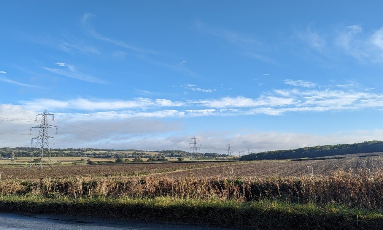
×![]()
View north-east from north of Cumnor, looking across arable fields towards Hangmans Copse:
Estate parkland associated with Hinton Manor at Hinton Waldrist:

×![]()
Estate parkland associated with Hinton Manor at Hinton Waldrist:
Sheep-grazed pastures on the lower slopes of the vale edge (south of Longworth):
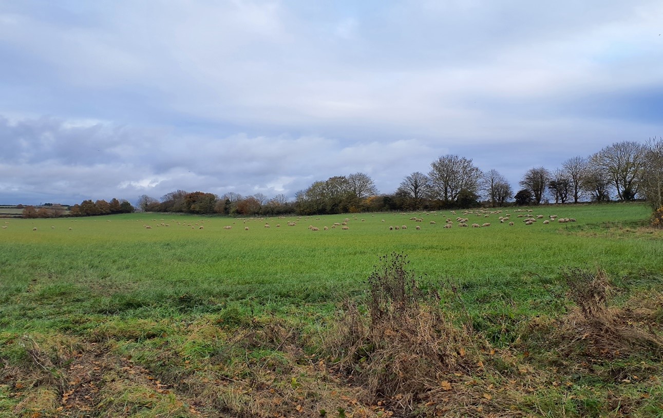
×![]()
Sheep-grazed pastures on the lower slopes of the vale edge (south of Longworth):
The River Thames near Bablock Hythe, with new tree planting on the floodplain:

×![]()
The River Thames near Bablock Hythe, with new tree planting on the floodplain:
Description
Natural (landform, water, semi-natural land cover)
- Underlain by sandstone, siltstone and mudstone of Hazelbury Bryan Formation in the south and mudstones of Oxford Clay Formation and West Walton Formation in the north. Bands of River Terrace deposits and alluvium in the north relate to the River Thames.
- The landform falls northwards and westwards towards the River Thames, with elevation ranging between 70 metres Above Ordnance Datum (AOD) and 110 metres AOD.
- The west-facing part of the Northern Vale Edge Slopes lies close to the Thames, which forms the administrative boundary with West Oxfordshire, and its floodplain. Ponds and water features are associated with the parkland estates within the area.
- Blocks of deciduous woodland (priority habitat) are found across the area, many of which are Ancient Woodland. Some Ancient Woodlands have since been replanted with conifers (Plantation on Ancient Woodland Sites).
- Appleton Lower Common is nationally designated as a Site of Special Scientific Interest (SSSI) for its broadleaved wet ash-wych elm woodland, which is relatively uncommon in Oxfordshire.
Cultural/social (land use, settlement, infrastructure, historic character)
- Medium to large-scale arable fields bounded by hedgerows, often hawthorn or elm, with occasional mature hedgerow trees, particularly oak.
- Parkland estates within the area contain significant areas of grassland, plantations, tree lines, groups of trees and lakes. Hinton Manor (Grade II) and Buckland House (Grade II*) are Registered Parks and Gardens (RPG). Hinton Castle was a royal residence in 14th and 15th centuries, with formal gardens and pleasure ground constructed in the mid-17th century, while Buckland has a mid-18th century country house (Grade II* listed), park and pleasure grounds with the addition of an early 20th century formal garden terrace.
- A number of small villages are regularly spaced along the top of the slope, towards the ridgetop, including Littleworth, Buckland and Eaton. Occasional large manor houses and farmsteads are grouped along the rural roads and lanes which cross the area. The villages all contain a number of Listed Buildings, and most are covered by Conservation Areas. Corallian limestone and brick and tile roofs form a local vernacular.
- Fieldscapes across the area have either a post-medieval pattern or are modern amalgamations.
- The area also provides a rural setting to the adjacent larger settlements of Cumnor and Botley, although the latter is largely obscured by vegetation along the A420, which passes in cutting though the north-east of the area.
- A network of public rights of way covers the area, including the Oxford Greenbelt Way long distance footpath and Thames Path National Trail; these routes connect the chalk ridge to the south with the Thames valley to the north; public rights of way access more limited in some areas, such as to the north-west of Longworth.
Perceptual (views, tranquillity, associations)
- Views are sometimes restricted by woodland cover, which provides areas of enclosure.
- In more open areas the sloping landform affords long views north across the Thames vale, and distant views to the North Wessex Downs are available from the ridge crest. The wooded Wytham Hill is also visible on the horizon to the north-east.
- The low rounded profile of Harrowdown Hill forms a locally distinctive landmark rising from the low-lying floodplain.
- A rural landscape with few modern detractors, with the exception of electricity pylon routes in the east and north. There is a sense of peace and tranquillity across the area, and relative remoteness away from the edges of settlements. Boating activity on the Thames reduces the sense of remoteness in places. The Tranquillity Assessment for South Oxfordshire and Vale of White Horse categorises 29% of the LCA in Zone 1 (‘areas of high tranquillity’) and 69% in Zone 2 (‘areas of some tranquillity’).
- The sparse settlement and limited urban influence result in dark night skies. 86% of this landscape is categorised as within the darkest two bands in the Dark Skies Assessment for South Oxfordshire and Vale of White Horse.
Valued qualities
- Frequent scattered woodlands provide natural heritage, visual interest and sense of enclosure within the landscape, including several blocks of Ancient Woodland and Appleton Lower Common SSSI.
- More open areas afford long views north across the vales and the Thames valley to the north, and distant views to the North Wessex Downs National Landscape on the horizon to the south, which creates a sense of place.
- Parkland and estate landscapes, particularly at Hinton Manor and Buckland House, provide a distinctive sense of place with characteristic tree avenues, estate fencing and mature individual trees standing in pasture.
- Historic small villages at the top of the slope have time depth, with many covered by Conservation Area and/or featuring clusters of Listed Buildings.
- The open landscape provides an immediate setting to settlements, including the historic cores. This preserves open rural setting contributes to their historic character.
- Open farmland forms gaps between villages and hamlets, helping to retain their individual identities and the characteristic regular spacing of settlements.
- A network of public rights of way, including the Oxford Greenbelt Way long distance footpath and Thames Path National Trail, provide recreational value, connecting the chalk ridge in the south with the Thames valley in the north.
- Highly rural character, with good levels of access and limited modern distractions or developments.
- The value of the landscape is demonstrated by the inclusion of most of the Northern Vale Edge Slopes within the Northern Thames Valley Local Landscape Designation.
Forces for change
- The past loss of woodland, hedgerows and hedgerow trees and the poor management of those remaining, is evident in some areas. The poor management could affect the scenic value and natural heritage value these features currently provide and reduce the sense of enclosure they provide.
- An increase in modern settlement-edge uses such as paddocks, can also affect the rural setting of the historic settlements.
- Increased demand for renewable energy and drive for net zero may lead to an increase in renewable energy developments (including wind energy and solar PV) in the adjacent vale landscapes to the north, which could affect the rural character and characteristic views across the vale.
- The Vale Edge Slope landscapes may be susceptible to the impacts of climate change, including:
- Deciduous woodlands are facing decline due to warmer winters, altered rainfall patterns, drier summers and increased frequency of extreme events; there may be a shift in vegetation type and composition, increased competition from invasive species, greater numbers of insect and mammal pests, and a greater risk of wind-throw and loss of mature trees.
- Higher average temperatures and drier summers could lead to changes to community composition in arable field margins; an increase in bare ground and an increased risk of dieback in drought prone locations; the introduction of new crops and associated changes to management could alter the area and type of field margins; and an increase in agricultural use of summer insecticides which could reduce insect numbers and pollination.
- Drier summers and wetter winters may lead to increased mortality and die-back of certain hedgerow tree species; an increased occurrence of insect pests and pathogens could lead to a potential loss or significant reduction in populations of key hedgerow tree species; and increased storm activity may lead to the loss of mature and veteran trees within hedgerows.
- Increase in storm damage affecting veteran and mature trees, including within designed landscapes.
Landscape strategy and guidelines
Woodland blocks and mature tree cover should continue to contribute to landscape character by providing natural heritage and visual interest.
- Retain and enhance woodland blocks and tree lines; conserve and manage the Ancient Woodland sites and the wet woodland at Appleton Lower Common SSSI to improve landscape character and encourage biodiversity.
- Explore opportunities to expand and connect existing woodland and tree cover through natural regeneration or small-scale planting. This will strengthen landscape character and bring benefits for biodiversity.
- Encourage the appropriate management of woodland, including to reduce the impacts of pests and diseases and to increase its age structure and structural heterogeneity. Consider the promotion of natural colonisation adjacent to existing woodland, allowing locally native species to develop resilience to the pressures of climate change through natural processes.
- Seek to prevent further loss or decline in the quality of remaining boundary hedgerows and encourage their restoration/reinstatement, whilst maintaining characteristic long-distance views north and south; when establishing new hedges, aim to diversify the range of species and select species and provenances adapted to a wider range of climatic conditions.
Maintain the open character of farmland which forms gaps between individual settlements.
- Maintain the distinctive nucleated ridgetop settlement pattern and minimise the impact of new development on the widely visible vale-edge slopes. Any new development should use materials which are in keeping with, or complement, the local vernacular of limestone, brick and tile roofs.
- Light pollution should be avoided in this landscape. Consider the impact of any new lighting on the dark skies in this landscape (refer to the guidance in the Dark Skies / Light Impact Assessment for South Oxfordshire and Vale of White Horse).
- Maintain the valued recreational use of the landscape and consider opportunities to introduce additional connectivity where public rights of way access is currently more limited, to enhance appreciation of views and landscape character.
Estate and parkland associated with settlements, and the historic value and landscape diversity they provide, should be conserved and enhanced.
- Conserve and manage historic parklands within the landscape, including their characteristic tree avenues, estate fencing and mature individual trees standing in pasture. Replant key tree species to retain the parkland character where necessary.
Historic parts of villages should retain a relationship with their rural landscape settings which contribute to their distinctive historic character.
- Maintain physical and visual connectivity between conservation areas and prominent features in settlement setting, including parkland to the west of Buckland and west of Hinton Waldrist.
Protect characteristic long views outwards from the LCA.
- Protect and where possible enhance long views north across the vales and the Thames valley, to Wytham Hill to the north-east, and south towards the North Wessex Downs National Landscape on the horizon.