LCT 8: Ridge Slope
Landscape character type summary
The Ridge Slope is the gentle south-facing slope down from the top of the limestone Midvale Ridge to the clay vale in Vale of White Horse District. A mix of arable and pastoral farmland with a relatively strong hedgerow structure and a scattering of settlements, some areas are also well-wooded.
Three Landscape Character Areas (LCA) are identified:
- LCA 8A: Faringdon to Frilford Ridge Slope
- LCA 8B: Frilford to Sandford Ridge Slope
- LCA 8C: Cumnor to Abingdon Ridge Slope.
LCA 8A: Faringdon to Frilford Ridge Slope
It should be noted that the lines used to denote where LCAs border settlements are approximate and should not be used for planning purposes.
Character Area Location
Located within the north-east of the Vale of White Horse District, this character area comprises a gently sloping ridge that rises above the Northern Vale Edge Slopes (LCA 9G) to the north, and the Upper Vale (LCA 11B), Western Middle Vale (LCA 12B) and Ock Lower Vale (LCA 13A) to the south.
Key characteristics
- A low ridge that slopes gently to the south; features several minor watercourses flowing from the ridge-top in the north towards the River Ock to the south.
- Generally well-vegetated with occasional small blocks of woodland, frequent dense boundary hedges and trees, and riparian woodland along meandering watercourses. Many of the woodlands are of ancient origin.
- Relatively large-scale arable farmland, with some pasture and paddocks close to settlements.
- Time-depth provided by remnant areas of medieval fieldscapes; several historic, nucleated villages and hamlets, scattered large country houses and farmsteads.
- Historic parklands associated with Pusey House and Buckland House.
- Recreational access provided by an extensive network of public rights of way, including the Vale Way long distance path.
- A rural area, with the rolling topography and tree cover providing a sense of enclosure, generally limiting long distance views and aiding a sense of peace and tranquillity.
- Human influences, including electricity pylons on the eastern edge of the area, traffic on the A420 and proximity to the larger settlements of Faringdon and Kingston Bagpuize, locally limit the sense of tranquillity and remoteness.
- The south facing slopes provide a backdrop to views from the vales to the south, and are part of the wider, albeit more distant, northern setting to the North Wessex Downs National Landscape. Views are also available from more open high points over the vale landscapes to the north.
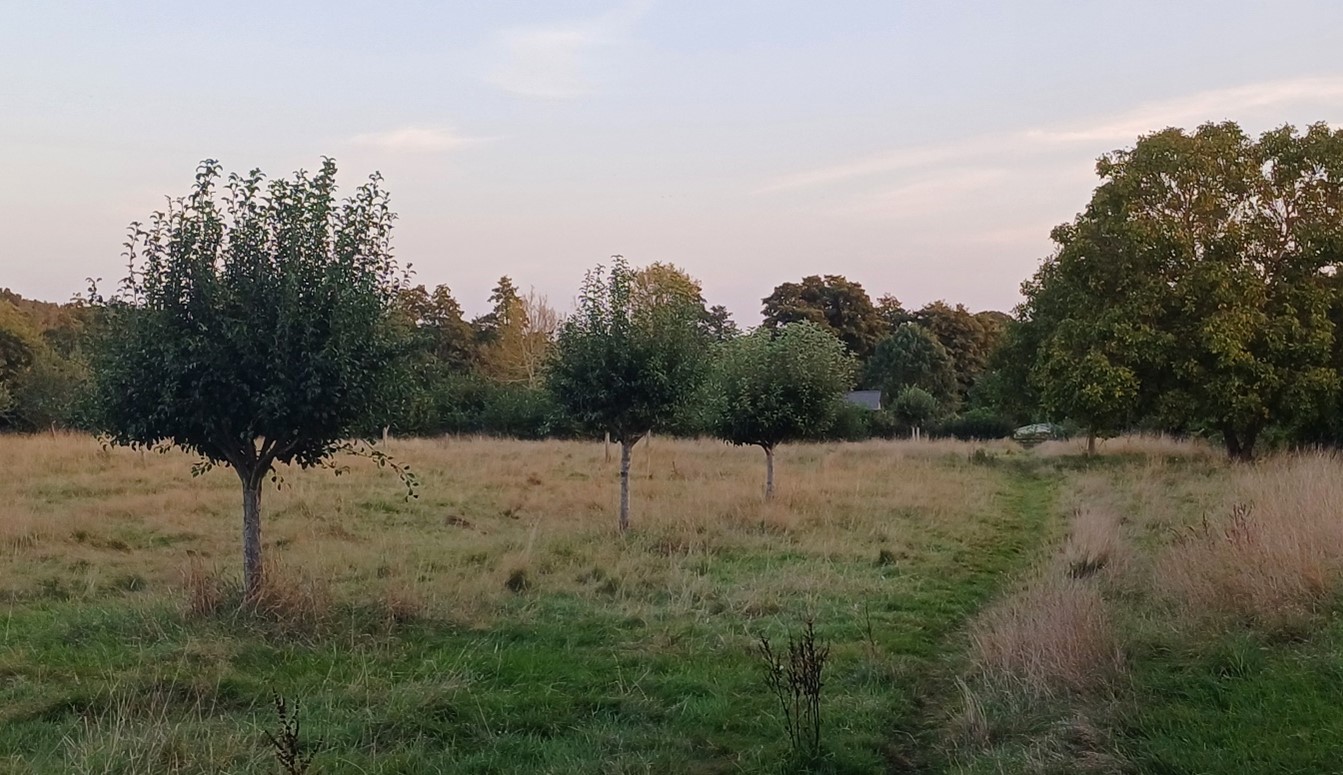
Looking east from Folly Hill, Faringdon, across arable farmland with strong treee cover:
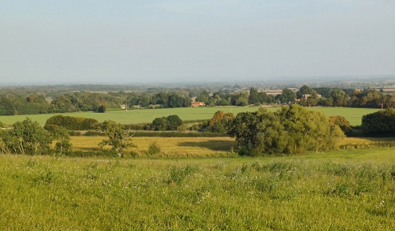
×![]()
Looking east from Folly Hill, Faringdon, across arable farmland with strong treee cover:
Looking south-east from Folly Hill, Faringdon, towards the North Wessex Downs escarpment:

×![]()
Looking south-east from Folly Hill, Faringdon, towards the North Wessex Downs escarpment:
High Street, Longworth:
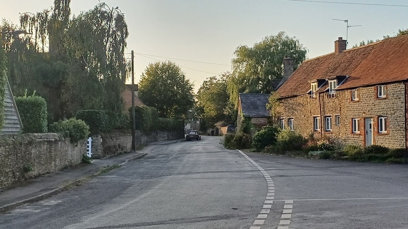
×![]()
High Street, Longworth:
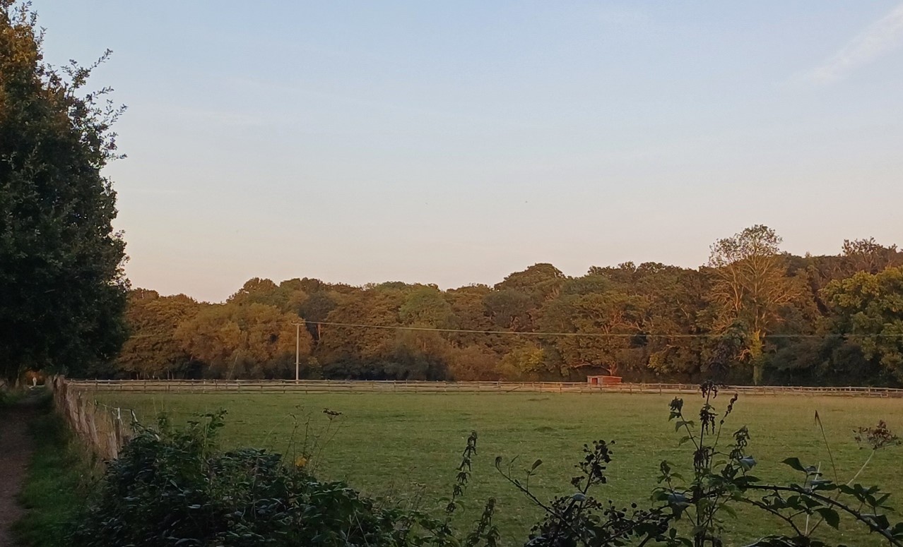
Arable fields with well-treed boundaries east of Longworth:
×![]()
Arable fields with well-treed boundaries east of Longworth:
Description
Natural (landform, water, semi-natural land cover)
- A low ridge, between 70 metres and 110 metres Above Ordnance Datum (AOD), which rises above the clay and alluvial landscapes associated with the River Thames to the north and the River Ock to the south.
- Predominantly Stanford Limestone and Kingston Sandstone Formations overlain by sandstone, siltstone and mudstone of the Hazelbury Bryan Formation. Shellingford Crossroads Quarry Site of Special Scientific Interest (SSSI) shows an important section of the Corallian rocks.
- The landform is rolling and falls generally from north to south; the north facing slopes towards the Thames are relatively steep, while the south facing slopes are gentler and form a transition to the vale landscapes to the south.
- Several minor watercourses flow south from the ridge towards the Ock, including the Frogmore Brook; ponds are often located in broad depressions within the gently rolling topography.
- The area is generally well-vegetated, with occasional small blocks of woodland and frequent dense boundary hedges and trees. There are some significant areas of Ancient Woodland at Pusey Common Wood and Buckland Warren.
- Linear lengths of riparian woodland, including areas of pollarded willows, follow the meandering watercourses, including Frogmore Brook.
- Buckland Warren SSSI cultivated land between a golf course and woodland, supports nationally rare broad-leaved cudweed.
Cultural/social (land use, settlement, infrastructure, historic character)
- Land use is a mix of relatively large-scale arable and pastoral farmland. Areas of estate land, and smaller scale parcels of land/paddocks are associated with settlement; hedgerows are generally intact when compared to other areas in the district.
- Fieldscapes are a mix of post medieval and modern origin. Around Halford, Littleworth and Buckland there is good survival of areas of medieval fieldscapes. Cherbury Camp Iron Age Hill Fort is a visible multivallate hillfort, designated as a Scheduled Monument.
- Settlement is located in nucleated villages and hamlets of varying size, across the area. Many of these are historic, and have Conservation Area designations, including Littleworth, Buckland, Pusey, Hirton Waldrist, Hatford, Longworth, Kingston Bagpuize, Netherton and Fyfield.
- The area forms a rural setting to the larger settlements of Faringdon, Stanford in Vale, Kingston Bagpuize and Southmoor.
- Strong parkland character around Buckland House and Pusey, with grassland, plantations, tree lines and groups, mature in-field trees, and lakes. Both are Registered Parks and Gardens.
- Outside of the villages, there are scattered large country houses and farmsteads, as well as small groups of houses along the rural lane network. Farmsteads are often located on high points with views over the vale landscapes to the north and south.
- A network of public rights of way enable recreational access to the LCA, including the Vale Way long distance footpaths. A golf course at Carswell also provides recreation in the landscape.
- The A420 provides the principal east-west link through the landscape, with other A roads providing north-west connections. Smaller B roads and country lanes provide access to the settlements.
Perceptual (views, tranquillity, associations)
- A rural area, with areas of tranquillity; the rolling topography and tree cover provides a sense of enclosure and limits distant views, aiding the sense of peace and tranquillity. The Tranquillity Assessment for South Oxfordshire and Vale of White Horse categorises 20% of the LCA in Zone 1 (‘areas of high tranquillity’).
- A variety of human influences, including pylons, proximity to the edge of Faringdon and busy roads, limit the sense of tranquillity and remoteness elsewhere. The Tranquillity Assessment for South Oxfordshire and Vale of White Horse categorises 68% of the LCA in Zone 2 (‘areas of some tranquillity’).
- The south facing slopes provide a backdrop to the Vale to the south, and are part of the wider, albeit more distant, northern setting to the North Wessex Downs National Landscape.
- The undulating landform and woodland help separate the surrounding settlements from each other, retaining their distinctive identities.
Valued qualities
- Blocks of woodland, including ancient woodland, provide ecological value and contribute positively to the landscape.
- Meandering watercourses and associated riparian woodland add landscape and ecological diversity.
- Time depth and historic character provided by remnant areas of medieval fieldscapes such as around Hatford, Littleworth and Buckland; by the historic settlement pattern of nucleated villages and hamlets and scattered country houses and farmsteads; and by historic parklands associated with Pusey House and Buckland House.
- The rural landscape, with a relatively intact network of hedgerows and mature hedgerow trees.
- Provides a rural setting to historic villages and hamlets, including those with Listed Buildings and Conservation Area designations, and a sense of separation between the settlements that helps to retain their distinctive identities.
- Recreational value of the extensive network of public rights of way, including the Vale Way long distance path.
- The undulating landform and woodland cover provides enclosure and a sense of peace and tranquillity; some views south over vales available from more open high points.
- Forms part of the wider northern setting to the North Wessex Downs National Landscape which is visible in distant views south, and provides a rural backdrop and skyline in views from the low-lying vale to the south.
- The northern fringe of the area also provides a backdrop and skyline in views from the Thames Valley to the north. The value of this role is recognised in its inclusion within the Northern Thames Valley Local Landscape Designation.
Forces for change
- Conifer shelterbelts appear incongruous in the landscape, affecting the overall rural character and sense of time-depth and historic character.
- Loss or poor management of woodland, hedgerows and hedgerow trees, which is affecting the well-vegetated character and valued sense of enclosure.
- New and proposed residential development on the edge of settlements, including Kingston Bagpuize (including East of Kingston Bagpuize with Southmoor Strategic Allocation). This will continue to alter the characteristic nucleated settlement pattern.
- An increase in traffic leading to noise and light pollution from the A-roads which has a localised affect the rural character and sense of tranquillity.
- Increased pressure for recreational facilities, including sports fields and golf courses, which would locally alter rural character of the landscape.
- Increase in horse grazing and associated facilities, changing the agricultural character and setting of settlements.
- The Ridge Slopes landscape may be susceptible to the impacts of climate change, including:
- Deciduous woodlands are facing decline due to warmer winters, altered rainfall patterns, drier summers and increased frequency of extreme events; there may be a shift in vegetation type and composition, increased competition from invasive species, greater numbers of insect and mammal pests, and a greater risk of wind-throw and loss of mature trees.
- Drier summers and wetter winters may lead to increased mortality and die-back of certain hedgerow tree species; an increased occurrence of insect pests and pathogens could lead to a potential loss or significant reduction in populations of key hedgerow tree species; and increased storm activity may lead to the loss of mature and veteran trees within hedgerows.
- Intensification of adjacent land use leading to increased impacts on hedgerows such as pesticide drift and nutrient enrichment.
- Increase in storm damage could affect veteran and mature trees, and designed landscapes.
Landscape strategy and guidelines
Woodland cover should continue to contribute to rural character by helping to limit views and reduce the urbanising visual influence of adjacent settlements, and providing landscape structure and a sense of enclosure.
- Retain and enhance woodland blocks and tree lines; conserve and manage the Ancient Woodland sites to improve landscape character and encourage biodiversity.
- Encourage the appropriate management of woodland, including to reduce the impacts of pests and diseases and to increase its age structure and structural heterogeneity. Consider the promotion of natural colonisation adjacent to existing woodland, allowing locally native species to develop resilience to the pressures of climate change through natural processes.
- Explore opportunities to expand and connect existing woodland and tree cover through natural regeneration or small-scale planting, particularly around settlements. This will strengthen landscape character and bring benefits for biodiversity.
- Discourage non-characteristic and incongruous coniferous planting. Where possible, replace coniferous planting with appropriate deciduous woodland species.
- Seek to prevent further loss and poor management of boundary hedgerows and encourage their restoration/reinstatement, whilst maintaining characteristic longer views south from more open high points; when establishing new hedges, aim to diversify the range of species and select species and provenances adapted to a wider range of climatic conditions.
- Use trees and woodland to integrate any new development into the landscape, including proposed housing development on the edge of settlements.
Maintain the open character of the landscape which forms gaps between individual settlements, contributes positively to the wider setting of North Wessex Downs National Landscape, and forms an undeveloped backdrop to views back from the vale to the south.
- Maintain the distinctive settlement pattern of nucleated villages and hamlets and minimise the impact of any new development on local character and on views from the vale to the north and south.
- Resist the spread of low-density development, including ribbon or sporadic development along roads, which might cause perceived coalescence between settlements including Kingston Bagpuize/Southmoor and Longworth, and Fyfield and Netherton.
- Maintain the valued recreational use of the landscape and consider opportunities to introduce additional public rights of way connectivity where possible to enhance appreciation of views and landscape character.
- Consider the impact of development on distant views from the National Landscape.
Meandering watercourses and associated riparian vegetation should be retained as distinctive landscape elements with high biodiversity value, and enhanced where possible.
- Retain riparian vegetation along watercourses to maintain their distinctive character and ecological value.
- Encourage adjacent land uses which strengthen role as ecological corridors and enhance landscape character.
- Seek opportunities to enhance connectivity with other habitats nearby by creating green corridors and networks.
The mosaic of semi-natural habitats (including rare and nationally designated habitats) should be protected and enhanced for their landscape and biodiversity value, and the ecosystem services they provide.
- Balance the need for continued positive conservation and management of the valuable habitats for flora and fauna with the provision of recreation and enjoyment of the landscape.
- Seek opportunities to enhance connectivity with other habitats nearby by creating green corridors and networks.
- Ensure new development does not cause loss of, or damage to grassland, woodland and wetland habitats.
Estate and parklands, and the historic value and landscape diversity they provide, should be conserved and enhanced.
- Conserve and manage historic parklands associated with Pusey House and Buckland House, including their grassland, plantations, tree lines and groups, trees within fields and lakes. Replant key tree species to retain the parkland character where necessary.
Historic parts of villages should retain a relationship with their rural landscape settings which contribute to their distinctive historic character.
- Maintain physical and visual connectivity between Conservation Areas and prominent features in settlement setting, including remnant parkland, Ancient Woodlands and the wooded stream valleys.
- Respect the setting to conservation areas and sensitivity historic settlement edges, by resisting changes to the landscape which are not in keeping with the landscape character, including horse grazing and unsympathetic housing developments.
LCA 8B: Frilford to Sandford Ridge Slope
It should be noted that the lines used to denote where LCAs border settlements are approximate and should not be used for planning purposes.
Character Area Location
Located within the north-east of the Vale of White Horse District, this character area comprises a gently sloping ridge that rises above the Northern Vale Edge Slopes (LCA 9G) to the north, and the Upper Vale (LCA 11B), Western Middle Vale (LCA 12B) and Ock Lower Vale (LCA 13A) to the south.
Key characteristics
- A low ridge that slopes gently to the south; features minor watercourses flowing from the ridge-top in the north towards the River Ock to the south.
- Significant tree cover including large Ancient Woodlands, frequent dense boundary hedges and mature trees, and riparian woodland along meandering watercourses.
- Features nationally rare habitats including calcareous fen, acid grassland and heathland across several sites designated as Sites of Special Scientific Interest, creating an unusual heathland character.
- Relatively large-scale arable and pastoral farmland, with some areas of estate land and smaller scale parcels of land/paddocks on the edges of settlements.
- A more limited settlement pattern, concentrated in the historic villages of Appleton and Marcham. Low density development is found along the local road network.
- More limited public access on public rights of way. A number of nature reserves are popular for recreation.
- A rural area, with the rolling topography and tree cover providing a sense of enclosure and generally limiting long distance views, and aiding a sense of peace and tranquillity.
- Human influences, including the A420 and proximity to the edges of larger settlements, such as Marcham and Appleton, locally limit the sense of tranquillity and remoteness.
- Woodlands provide a backdrop to longer views from the North Wessex Downs National Landscape, and from some more open locations in the vale, but slopes are not steep enough for the area to be prominent.
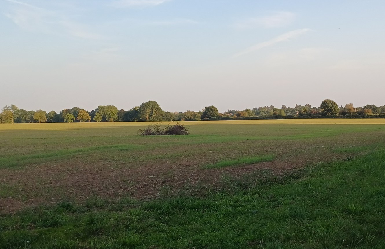
View west to the woodland edge of Appleton Upper Common:
×![]()
View west to the woodland edge of Appleton Upper Common:
Fen and woodland habitat at Dry Sandford Pit Nature Reserve:

×![]()
Fen and woodland habitat at Dry Sandford Pit Nature Reserve:
Paddocks on the eastern edge of Appleton, contained by woodland at New Copse:
×![]()
Paddocks on the eastern edge of Appleton, contained by woodland at New Copse:
Footpath across grassland near Appleton Manor and church:
×![]()
Footpath across grassland near Appleton Manor and church:
Description
Natural (landform, water, semi-natural land cover)
- A low ridge, between 70 metres and 100 metres Above Ordnance Datum (AOD), which rises above the clay and alluvial landscapes associated with the River Thames to the north and the River Ock to the south.
- Predominantly Stanford Limestone and Kingston Sandstone Formations overlain by Sandstone, Siltstone and Mudstone of the Hazelbury Bryan Formation.
- The landform is rolling and falls generally from north to south; the north facing slopes towards the Thames are relatively steep, while the south facing slopes are gentler and form a transition to the vale landscapes to the south.
- Several minor watercourses flow south from the ridge towards the Ock, including the Sandford Brook, with strong riparian vegetation including willow; ponds are often located in broad depressions within the gently rolling topography.
- The area is well-vegetated, with occasional small blocks of woodland and frequent dense boundary hedges and trees. There are significant areas of Ancient Woodland at Appleton Upper Common and Tubney Wood.
- Significant areas of heathland habitats are concentrated at Frilford Heath and Cothill Fen. Cothill Fen is internationally designated as a Special Area of Conservation (SAC) for its rare calcareous fen and moss-rich mire communities, and is also a National Nature Reserve. Both areas are designated as Sites of Special Scientific Interest (SSSI) due to the combination of acid grassland, heathland and associated valley fens. Other SSSI designations include Barrow Farm Fen (remnants of calcareous fen vegetation found within a matrix of dense wet and dry carr woodland).
Cultural/social (land use, settlement, infrastructure, historic character)
- A large part of this landscape is occupied by the three Frilford Heath Golf Club courses, and by blocks of Ancient Woodland. Elsewhere, land use is a mix of relatively large-scale arable and pastoral farmland, with intact hedgerows.
- Fieldscapes are a mix of post medieval and modern origin.
- This area has fewer settlements than the eastern and western parts of the Ridge Slope. Settlement is concentrated at the historic villages of Marcham in the south and Appleton in the north, both of which have designated Conservation Areas. Outside of these, low-density linear development, often Listed Buildings, lines the local road network.
- The densely tree-lined corridor of Sandford Brook forms a rural setting to the larger settlement of Wootton.
- A number of nature reserves, including Dry Sandford, Lashford Lane Fen and Cothill National Nature Reserve provide recreational opportunities within the landscape. Public access elsewhere is more limited, although public rights of way connect many of the small settlement areas.
- The A420 provides the principal east-west link through the landscape, with the A338 providing north-south connections. Smaller local roads provide access to the settlements.
- There is evidence of past and current quarrying in the area, including former workings at Hitchcopse Pit and Dry Sandford Pit (both now nature reserves) and the currently active Hills Quarry.
Perceptual (views, tranquillity, associations)
- A rural area; the rolling topography and tree cover provides a sense of enclosure and limits distant views, aiding the sense of peace and tranquillity. The Tranquillity Assessment for South Oxfordshire and Vale of White Horse categorises over 20% of the LCA in Zone 1 (‘areas of high tranquillity’).
- A variety of human influences, including electricity pylons, busy main roads and views of Abingdon Airfield, have some impact on the sense of tranquillity and remoteness, but the Tranquillity Assessment for South Oxfordshire and Vale of White Horse still categorises 75% of the LCA in Zone 2 (‘areas of some tranquillity’).
- The south facing slopes provide an occasional backdrop to views from the vale to the south, and are part of the wider, albeit more distant, northern setting to the North Wessex Downs National Landscape.
Valued qualities
- Rare, nationally important, semi-natural habitats, including Ancient Woodland and significant areas of valley fen, wet woodland, and wet fen meadow habitats, provide ecological value and contribute positively to the landscape.
- Meandering Sanford Brook and associated riparian woodland adds landscape and ecological diversity and forms a wooded settlement edge to Wootton.
- Historic character of Appleton and Marcham, with their designated Conservation Areas, and historic low-density development along the local roads provides time depth.
- The rural landscape, with limited development, a relatively intact network of hedgerows, and mature hedgerow trees.
- The undulating landform and woodland cover provide enclosure and a sense of peace and tranquillity, with some views south over vales available from more open high points.
- Forms part of the wider northern setting to the North Wessex Downs National Landscape which is visible in distant views north from the National Landscape. Provides a rural backdrop and skyline in views from the low-lying Vale to the south.
- A small area on the northern edge of the ridge, near Appleton, also forms a backdrop to views from the Thames Valley, and is included within the Northern Thames Valley Local Landscape Designation.
Forces for change
- Conifer shelterbelts appear incongruous in the landscape, affecting the overall rural character and sense of time-depth and historic character.
- Loss or poor management of woodland, hedgerows and hedgerow trees, which is affecting the well-vegetated character and valued sense of enclosure.
- New and proposed residential development on the edge of settlements, such as Marcham. This may alter the rural character of the landscape, with views to the new settlement edges.
- Linear development such as at Tubney leads to increased suburbanisation of the rural landscape and a reduction in sense of separation between settlements.
- An increase in traffic leading to noise and light pollution from the A roads which has a localised affect the rural character and sense of tranquillity.
- Increased pressure for recreational facilities, including sports fields and golf courses, which would locally alter rural character of the landscape.
- Increase in horse grazing and associated facilities, changing the agricultural character and setting of settlements.
- Exploitation of mineral resources, predominantly sand and gravel, physically alters the landscape and locally detracts from tranquillity.
- The Ridge Slopes landscape may be susceptible to the impacts of climate change, including:
- Deciduous woodlands are facing decline due to warmer winters, altered rainfall patterns, drier summers and increased frequency of extreme events; there may be a shift in vegetation type and composition, increased competition from invasive species, greater numbers of insect and mammal pests, and a greater risk of wind-throw and loss of mature trees.
- Drier summers and wetter winters may lead to increased mortality and die-back of certain hedgerow tree species; an increased occurrence of insect pests and pathogens could lead to a potential loss or significant reduction in populations of key hedgerow tree species; and increased storm activity may lead to the loss of mature and veteran trees within hedgerows.
- Intensification of adjacent land use leading to increased impacts on hedgerows such as pesticide drift and nutrient enrichment.
- Increase in storm damage could affect veteran and mature trees, and designed landscapes.
Landscape strategy and guidelines
Woodland cover should continue to contribute to rural character by helping to limit views and reduce the urbanising visual influence of adjacent settlements, and provide landscape structure and a sense of enclosure.
- Retain and enhance woodland blocks and tree lines; conserve and manage the Ancient Woodland sites to improve landscape character and encourage biodiversity.
- Encourage the appropriate management of woodland, including to reduce the impacts of pests and diseases and to increase its age structure and structural heterogeneity. Consider the promotion of natural colonisation adjacent to existing woodland, allowing locally native species to develop resilience to the pressures of climate change through natural processes.
- Explore opportunities to expand and connect existing woodland and tree cover through natural regeneration or small-scale planting, particularly around settlements. This will strengthen landscape character and bring benefits for biodiversity.
- Discourage the trend towards non-characteristic and incongruous coniferous planting. Where possible, replace coniferous planting with appropriate deciduous woodland species.
- Seek to prevent further loss and poor management of boundary hedgerows and encourage their restoration/reinstatement, whilst maintaining characteristic longer views south from more open high points; when establishing new hedges, aim to diversify the range of species and select species and provenances adapted to a wider range of climatic conditions.
- Use trees and woodland to integrate development into the landscape, including any proposed housing development on the edge of settlements.
Maintain the rural character of the landscape which contributes positively to the wider setting of North Wessex Downs National Landscape, and forms an undeveloped backdrop to views from the vales to the south and the north.
- Maintain the settlement pattern concentrated at Appleton and Marcham, with low-density development along the local roads. Avoid coalescence, or perceived coalescence, between the small historic areas of development.
- Maintain the valued recreational use of the landscape and consider opportunities to introduce additional public rights of way to increase connectivity away from the SAC, NNR and SSSI sites, to enhance appreciation of views and landscape character. Avoid placing additional pressure on sites valued for their biodiversity.
- Consider the impact of any large-scale new development on distant views from the North Wessex Downs National Landscape.
The meandering Sandford Brook and associated riparian vegetation should be retained as distinctive landscape elements with high biodiversity value, and enhanced where possible.
- Retain riparian vegetation along watercourses to maintain their distinctive character and ecological value.
- Encourage adjacent land uses which strengthen role as ecological corridors and enhance landscape character.
- Seek opportunities to enhance connectivity with other habitats nearby by creating green corridors and networks.
The mosaic of semi-natural habitats (including rare and nationally designated habitats) should be protected and enhanced for their landscape and biodiversity value, and the ecosystem services they provide.
- Appropriately manage the nationally rare calcareous fen and associated wetland habitats at Cothill Fen SAC, SSSI and National Nature Reserve as well as acid grassland, heathland and valley fens at Frilford Heath.
- Balance the need for continued positive conservation and management of the valuable habitats for flora and fauna with the provision of recreation and enjoyment of the landscape.
- Seek opportunities to enhance connectivity with other habitats nearby by creating green corridors and networks.
- Ensure new development does not cause loss of, or damage to grassland, woodland and wetland habitats or increase recreational pressures on the protected biodiverse areas.
Historic parts of Appleton and Marcham should retain a relationship with their rural landscape settings which contribute to their distinctive historic character.
- Maintain physical and visual connectivity between Conservation Areas and prominent features in settlement setting, including Ancient Woodlands and the wooded stream valleys.
- Respect the setting to Conservation Areas and sensitivity historic settlement edges, by resisting changes to the landscape which are not in keeping with the landscape character, including horse grazing and unsympathetic housing developments.
LCA 8C: Cumnor to Abingdon Ridge Slope
It should be noted that the lines used to denote where LCAs border settlements are approximate and should not be used for planning purposes.
Character Area Summary and Location
Located within the north of the Vale of White Horse district, this character area comprises a gently sloping ridge that rises above the Northern Vale Edge Slopes (LCA 9G) to the north, and the Lower Vale (LCA 13A) to the south. The rising slopes of the Ridge Hilltops lie to the east (LCA 7B).
Key characteristics
- A low ridge that slopes gently to the south towards the River Ock floodplain.
- Generally well-vegetated with occasional small blocks of woodland, frequent dense boundary hedges and trees.
- Relatively large-scale arable farmland, with pasture and paddocks on the edges of Wootton and Cumnor.
- Settlement is concentrated on the rural roads leading out of Wootton.
- Abingdon airfield forms a significant area in the south, with grassland, runways, hardstanding and large hangers. Boundaries feature security fencing.
- Recreational access provided by a good network of public rights of way, including the Oxford Greenbelt Way.
- A rural area, with the rolling topography and tree cover providing a sense of enclosure and generally limiting long distance views, and aiding a sense of peace and tranquillity. There are some longer views to wooded high ground around Boars Hill.
- Human influences, including electricity pylons, the airfield and proximity to Abingdon and Cumnor locally limit the sense of tranquillity and remoteness.
Farmland south of Cumnor with the wooded Hurst Hill forming a backdrop:

×![]()
Farmland south of Cumnor with the wooded Hurst Hill forming a backdrop:
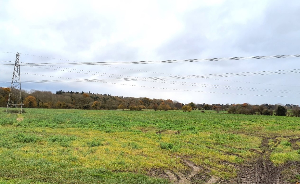
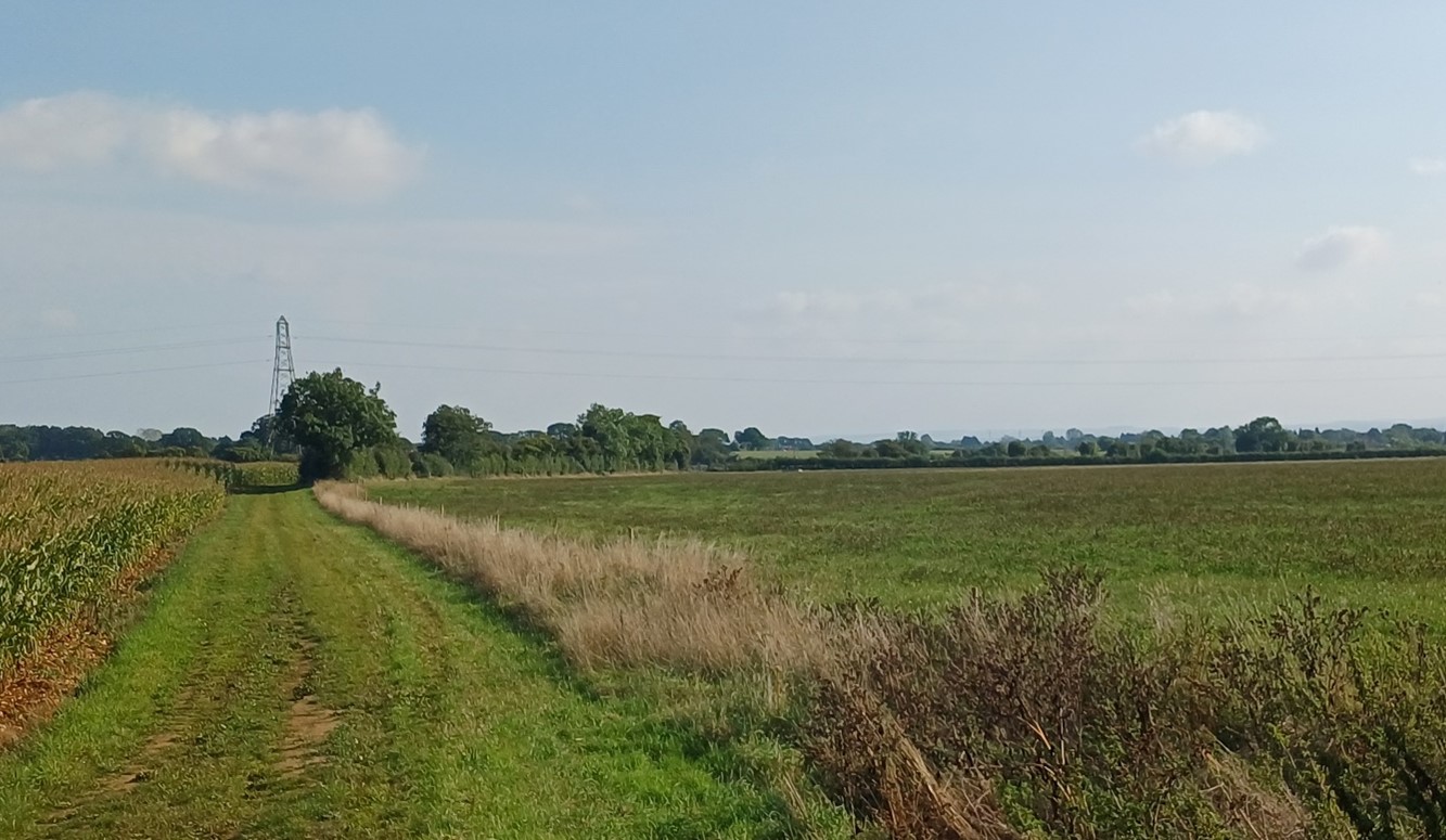
Large arable fields with some well-treed boundaries, south of Cumnor, but an electricity pylon line intrudes:
×![]()
Large arable fields with some well-treed boundaries, south of Cumnor, but an electricity pylon line intrudes:
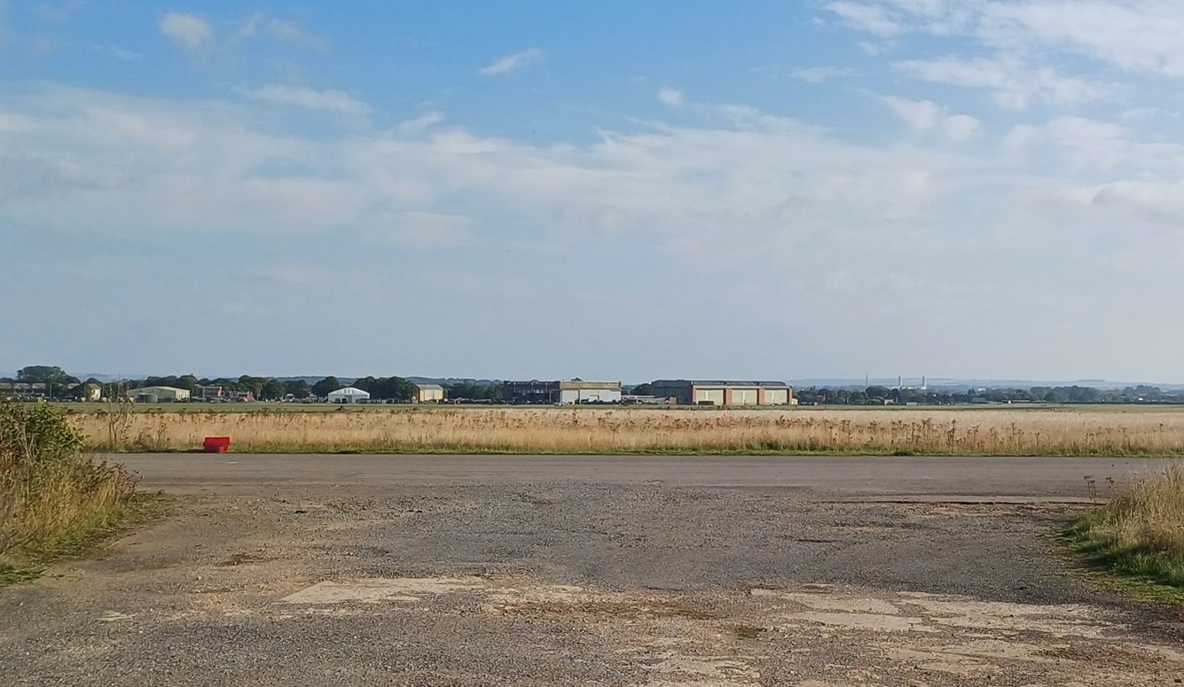
Abingdon Airfield with chimneys at Milton Park (Didcot) visible in the background:
×![]()
Abingdon Airfield with chimneys at Milton Park (Didcot) visible in the background:
Linear development extending up from the core of Wootton on the B4017 towards the wooded Boars Hill area:

×![]()
Linear development extending up from the core of Wootton on the B4017 towards the wooded Boars Hill area:
Description
Natural (landform, water, semi-natural land cover)
- A low ridge, between 70 metres and 125 metres Above Ordnance Datum (AOD), which forms the transition between the slopes above the River Thames to the north, the River Ock floodplain and the wooded limestone hills to the west of Oxford. The landform is rolling and falls generally from north to south
- Predominantly Stanford Limestone and Kingston Sandstone Formations overlain by Sandstone, Siltstone and Mudstone of the Hazelbury Bryan Formation. Cumnor Site of Special Scientific Interest (SSSI) is designated for its exposed sequence demonstrating the complex geology.
- The north of the area is more open, while the south is generally well-vegetated, with occasional small blocks of woodland and frequent dense boundary hedges and trees.
- Several small watercourses flows south, from Cumnor and from the ridge hilltops to the east (around Youlbury, Foxcombe and Boars Hill). These are bounded by riparian vegetation, including areas of pollarded willows.
Cultural/social (land use, settlement, infrastructure, historic character)
- Land use is a mix of relatively large-scale arable farmland, with pasture and paddocks on the edges of Wootton. Hedgerows for the arable fields are often missing or in poor repair, while the pasture fields tend to have dense boundary hedgerows with mature trees. Fieldscapes are a mix of post medieval and modern origin.
- The area has a significant amount of development, focused on Wootton and Shippon. Wootton has seen significant expansion from its original nucleated form, with linear development to the south and north-east in particular. There are only narrow gaps between Wootton and the smaller linear settlements of Dry Sandford, Henwood and Whitecross. the
- The southern end of Whitecross is very close to Dalton Barracks, the former RAF Abingdon air station allocated for redevelopment, and Dalton Barracks in turn sits alongside the village of Shippon, the southern edge of which lies immediately across the A34 from Abingdon-on-Thames.
- The airfield itself also has an adverse impact on rural character. It has significant areas of grassland but also lengths of runway, hard standings, hangers and associated buildings. Boundaries feature security fencing and perimeter warning notices.
- Elsewhere the area forms a rural setting to Wootton, Cumnor and Abingdon.
- A network of public rights of way enable recreational access to the LCA, including the Oxford Greenbelt Way. Abingdon Airfield is a large area of private land in the south, with no public access.
- The B4017 provides the principal north-south link through the landscape, connecting Cumnor, Wootton and Abingdon. The A420, the principal east-west route along the Midvale Ridge, passes through the north of the area and the A34 marks the southern edge.
Perceptual (views, tranquillity, associations)
- A variety of human influences, including major roads, the principal settlements, linear development along other routes, electricity pylons and Abingdon Airfield limit the sense of tranquillity and remoteness, including from the Oxford Greenbelt Way long distance footpath. The Tranquillity Assessment for South Oxfordshire and Vale of White Horse categorises 68% of the LCA in Zone 2 (‘areas of some tranquillity’) but over 25% in Zone 4 (‘areas of low tranquillity’).
- The south-facing slopes provide a backdrop to the vale to the south, and are part of the wider, albeit more distant, northern setting to the North Wessex Downs National Landscape.
Valued qualities
- Meandering watercourses and associated riparian woodland add landscape and ecological diversity.
- Away from settlement edges the landscape retains a rural character, with a relatively intact network of hedgerows and mature hedgerow trees helping to retain some tranquillity and wooded higher ground to the east providing a scenic backdrop.
- Provides a rural setting to Cumnor (including its Conservation Area), Botley, Wootton, and Abingdon. Open countryside is playing an important role in maintaining a sense of separation between settlements, helping to retain their distinct identities.
- Recreational value of the network of public rights of way, which is strongest in the area east of Wootton and between Wootton and Cumnor (where it includes the Oxford Greenbelt Way).
- Some long views south over the vale to the North Wessex Downs National Landscape.
Forces for change
- Loss or poor management of woodland, hedgerows and hedgerow trees, which is affecting the well-vegetated character and valued sense of enclosure.
- New and proposed residential development on the edge of settlements, including the Dalton Barracks Strategic Allocation, and increased development pressure on the northern and western edges of Abingdon, with a sizeable area of recent development between the A34 and Dunmore Road.
- Ribbon development has left only narrow gaps between settlements, particularly on the roads radiating from Wootton, leading to suburbanisation of the rural landscape.
- An increase in traffic leading to noise and light pollution from roads which has a localised affect the rural character and sense of tranquillity.
- Increase in horse grazing and associated facilities, changing the agricultural character and setting of settlements.
- The Ridge Slopes landscape may be susceptible to the impacts of climate change, including:
- Deciduous woodlands are facing decline due to warmer winters, altered rainfall patterns, drier summers and increased frequency of extreme events; there may be a shift in vegetation type and composition, increased competition from invasive species, greater numbers of insect and mammal pests, and a greater risk of wind-throw and loss of mature trees.
- Drier summers and wetter winters may lead to increased mortality and die-back of certain hedgerow tree species; an increased occurrence of insect pests and pathogens could lead to a potential loss or significant reduction in populations of key hedgerow tree species; and increased storm activity may lead to the loss of mature and veteran trees within hedgerows.
- Intensification of adjacent land use leading to increased impacts on hedgerows such as pesticide drift and nutrient enrichment.
- Increase in storm damage could affect veteran and mature trees, and designed landscapes.
Landscape strategy and guidelines
Tree cover should continue to contribute to rural character by helping to limit views and reduce the urbanising visual influence of adjacent settlements, and providing landscape structure and a sense of enclosure.
- Encourage the appropriate management of the small areas of woodland, including to reduce the impacts of pests and diseases and to increase its age structure and structural heterogeneity. Consider the promotion of natural colonisation adjacent to existing woodland, allowing locally native species to develop resilience to the pressures of climate change through natural processes.
- Explore opportunities to expand and connect existing woodland and tree cover through natural regeneration or small-scale planting, particularly around settlements. This will strengthen landscape character and bring benefits for biodiversity. Seek opportunities to enhance connectivity with other habitats nearby by creating green corridors and networks, including woodland of the ridge hilltops to the west.
- Discourage non-characteristic and incongruous coniferous planting. Where possible, replace coniferous planting with appropriate deciduous woodland species.
- Seek to prevent further loss and poor management of remaining boundary hedgerows in the north and encourage their restoration/reinstatement, whilst maintaining characteristic longer views south from more open high points. When establishing new hedges, aim to diversify the range of species and select species and provenances adapted to a wider range of climatic conditions.
- Use trees and woodland to integrate development into the landscape, including any proposed housing development on the edge of settlements.
Maintain the open character of the landscape which forms gaps between individual settlements and forms an undeveloped backdrop to views from the vale to the south.
- Ensure any new development avoids the perceived coalescence of the distinct settlements, particularly between Cumnor and Botley, and Wootton and Shippon / Abingdon.
- Resist the spread of further low-density development, including ribbon or sporadic development along roads.
- Maintain the valued recreational use of the landscape and consider opportunities to introduce additional public rights of way connectivity, particularly in the south around Abingdon Airfield, where possible to enhance appreciation of views and landscape character.
- Consider the impact of any new large-scale development on distant views from the National Landscape.
Meandering watercourses and associated riparian vegetation should be retained as distinctive landscape elements with high biodiversity value, and enhanced where possible.
- Retain riparian vegetation along watercourses to maintain their distinctive character and ecological value.
- Encourage adjacent land uses which strengthen role as ecological corridors and enhance landscape character.