LCT 5: Wooded Chalk Ridges and Valleys
Landscape character type summary
The Wooded Chalk Ridges and Valleys form part of the chalk dipslope falling eastwards from the Chilterns escarpment. The landscape is incised by a series of steep valleys, characterised by woodland, leaving narrow intervening ridges.
One landscape character area (LCA) is identified:
- LCA 5A: Chiltern Wooded Chalk Ridges and Valleys.
LCA 5A: Chiltern Wooded Chalk Ridges and Valleys
It should be noted that the lines used to denote where LCAs border settlements are approximate and should not be used for planning purposes.
Character Area Location
Located along the eastern edge of South Oxfordshire district, this LCA comprises part of the Chilterns dipslope and comprises an undulating plateau that falls gently eastwards away from the Chilterns Wooded Chalk Escarpment (LCA2A). It lies entirely within the Chilterns National Landscape.
Key characteristics
- A gently sloping plateau incised by steep valleys and narrow ridges resulting in a strongly undulating landform. Notable topographical features are the Assendon and Stonor Valleys which merge to form the distinctive straight approach into Henley known as the Fair Mile.
- A mosaic of farmland and woodland; steep valley sides typically support woodland and distinctive valley top beech hangers and lower slopes and valley bottoms support arable or pasture farmland.
- Sparse settlement pattern of small villages, hamlets and farms connected by a distinctive pattern of winding rural roads.
- Features an extensive network of public rights of way, including the Chiltern Way, Oxfordshire Way and Shakespeare’s Way, and areas of Open Access Land, including at Russell’s Water Common. Stonor Park, a Grade II* Registered Park and Garden, is also open to the public.
- A generally rural and unspoilt landscape, with a strong structure of woodland and incised valley landforms creating an intimate and enclosed character and restricting long range views; a small section of the M40 motorway crosses through the area to the north which is a localised visual and aural detractor. Red kites are often seen in the skies above the area.
The Fair Mile approach to Henley:

×![]()
The Fair Mile approach to Henley:
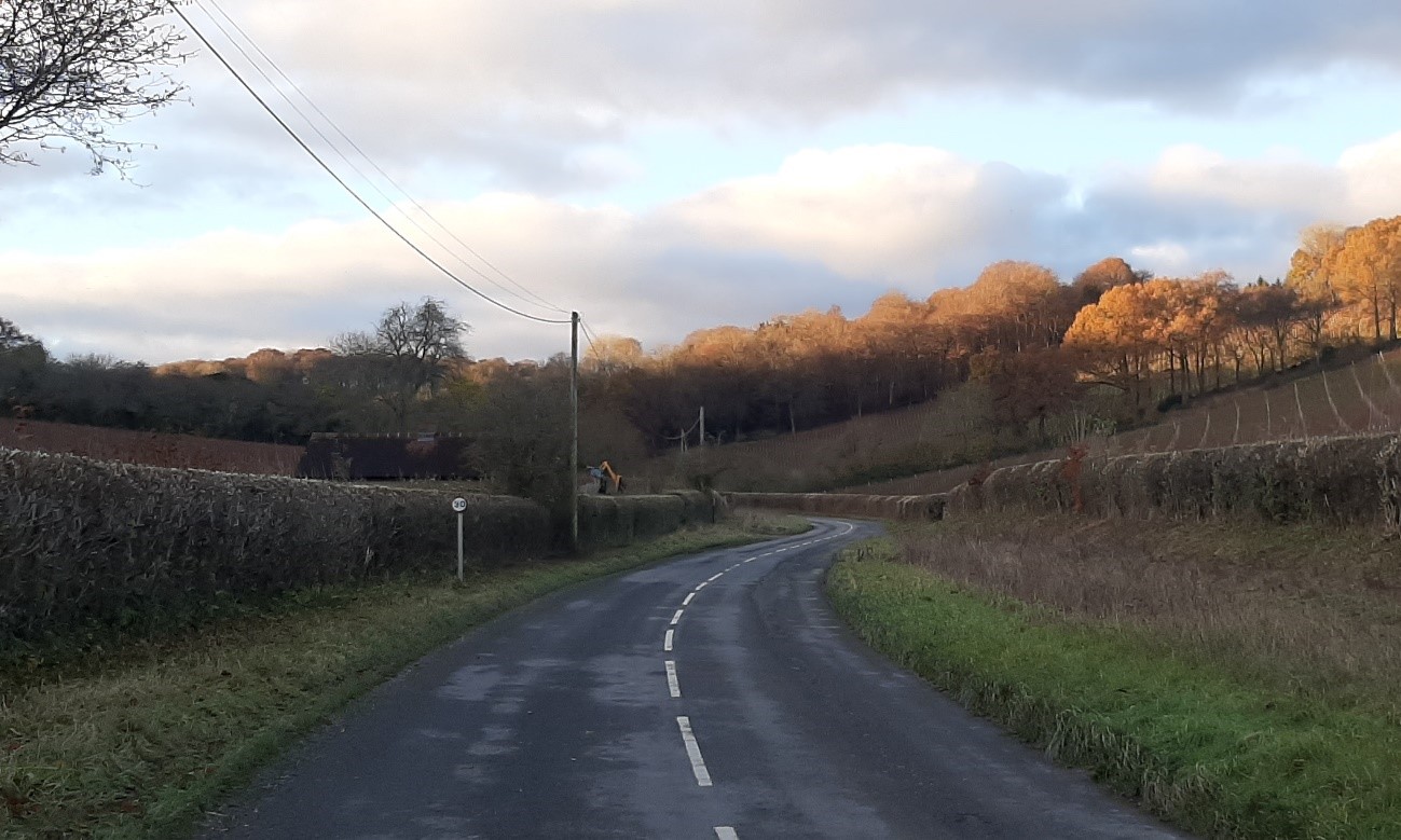
Modern land uses include a vineyard in the Stonor Valley:
×![]()
Modern land uses include a vineyard in the Stonor Valley:
Valley south of Maidensgrove:

×![]()
Valley south of Maidensgrove:
Typical local vernacular, between Stonor and Turville Heath:

×![]()
Typical local vernacular, between Stonor and Turville Heath:
Description
Natural (landform, water, semi-natural land cover)
- The Chilterns dipslope falls imperceptibly eastwards from the scarp giving the slope the character of a plateau; this is heavily dissected by steeply incised valleys, with only narrow ridges between, resulting in a strongly undulating landform. The underlying geology of Upper Chalk bedrock overlain by deposits of clay-with-flints and pockets of Reading Beds.
- The steeply incised valleys result in a large variation in heights; the lowest areas are located to the far south around the River Thames and the highest areas include Britwell Hill at 230 metres Above Ordnance Datum (AOD) and Cowleaze Wood at 257 metres AOD.
- The local topography is dominated by the Assendon and Stonor Valleys which merge to form the distinctive straight approach into Henley known as the ‘Fair Mile’.
- Valleys are predominantly dry with a limited number of watercourses.
- A strong mosaic of farmland and woodland; steep valley sides typically support woodland, with distinctive valley top beech hangers, recorded as priority habitat deciduous woodland, framing the valley and emphasising its depth.
- Contains a variety of Nature Conservation designations, including Sites of Special Scientific Interest (SSSIs) and extensive areas of ancient woodland. The internationally designated Aston Rowant and Chilterns Beechwoods Special Areas of Conservation (SACs) extend into this area, designated for their flower-rich chalk grassland, beech woodland and juniper scrub. Aston Rowant is also designated as a National Nature Reserve (NNR).
- Outside of the woodlands, small areas are recorded as priority wood-pasture and parkland, traditional orchards, semi-improved grassland and lowland calcareous grassland.
- Small areas of open common or heath occur within the area, at Russell’s Water and at Bix.
Cultural/social (land use, settlement, infrastructure, historic character)
- Comparatively open fields contained within a strong structure of woods, species-rich hedgerows or trees to form a loose mosaic; dominance of arable cultivation with pasture more typical of lower slopes or valley bottoms. There are also an increasing number of vineyards located on the valley sides.
- Stonor Park, a Grade II* Registered Park and Garden, is located to the east; this is a highly distinctive well-managed parkland landscape with formal features such as avenues and free-standing mature trees in pasture, blocks of mature woodland and estate boundaries.
- A sparsely settled landscape of farms, hamlets and small villages, with the latter located mainly within the narrow valleys and so typically having a linear form (for example, Middle Assendon and Stonor). These are connected by a distinctive pattern of winding rural roads.
- The Fair Mile forms part of an ancient trade route between the Thames at Henley and again at Wallingford.
- Many settlements date from the early middle ages, which saw enclosure and clearance and colonisation of previously unpopulated areas with new fields ‘assarted’ from extensive common woods; further enclosure through the Tudor and Jacobean periods was accompanied by the development of grand mansions and manor houses, such as Stonor Park.
- An extensive network of public rights of way provides strong recreational access, including the Chiltern Way, Oxfordshire Way and Shakespeare’s Way.
- Traditional building materials are typical of the Chilterns as a whole, and include red brick, silver-grey flint, oak timber framing, black weather boarding, thatch and plain tiles.
Perceptual (views, tranquillity, associations)
- The strong structure of woodlands and incised valley landforms creates an intimate and enclosed character. Tree-lined ridges are a common feature in the area.
- Some long views are available from ridges into and across valleys but landform, woods and hedgerows generally provide visual containment.
- A small section of the M40 motorway crosses through the area at the eastern side of the Stokenchurch Gap; this is a visual and aural detractor.
- Generally rural and unspoilt character, with a strong sense of tranquillity and good experience of dark night skies. The Tranquillity Assessment for South Oxfordshire and Vale of White Horse categorises 80% of the LCA in Zone 1 (‘areas of high tranquillity’). Almost all of this landscape is categorised within the darkest two bands in the Dark Skies Assessment for South Oxfordshire and Vale of White Horse.
Valued qualities
- Aside from some houses along the Fairmile on the outskirts of Henley, the LCA is located entirely within the Chilterns National Landscape. It displays many of the National Landscape’s special qualities, including distinctive beech yew woodlands, rare chalk grassland, tranquillity and dark night skies, extensive recreational routes and a strong structure of hedgerows, parkland and farmland.
- The steep, wooded valley sides and valley top ‘beech hangers’ are distinctive and characteristic features creating a strong sense of place.
- National and international nature conservation designations, including SSSI and extensive areas of Ancient Woodland, provide ecological value and contribute positively to the landscape. Aston Rowant SAC, SSSI and NNR is designated for its distinctive flower-rich chalk grassland, beech woodland and juniper scrub, and Chilterns Beechwoods SAC for its dry grasslands, scrub, and beech woodland; habitats strongly associated with the Chilterns.
- The local vernacular of brick and flint, linear settlement pattern and setting within the woodland and farmland mosaic creates the distinctive small historic villages, hamlets and farm. They are linked by a network of winding roads and sunken narrow lanes, with valley sides and woodlands typically dominating their setting.
- Winding rural lanes and irregular field boundaries, associated with assarted and piecemeal enclosure on steep slopes adjacent to woodland give a strong sense of time-depth.
- Stonor Park (Grade II* RPG) is a distinctive element in the Stonor Valley landscape. Its managed parkland landscape, with features such as avenues and free-standing mature trees in pasture, blocks of mature woodland and estate boundaries, is visually prominent on the steep valley side and its long history adds to the sense of continuity in the landscape.
- The strong structure of woodland and incised valley landforms, with an absence of significant urbanising influences, creates an intimate, enclosed and unspoilt rural character, with a strong sense of tranquillity and dark night skies.
- The extensive network of public rights of way and areas of Open Access Land provide recreational value.
Forces for change
- Agricultural intensification, diversification (including the introduction of vineyards) and farm amalgamation is leading to loss of hedgerows, trees and woodland. This impacts the characteristic mosaic of farmland and woodland and the intimate and enclosed character.
- Decline in management of existing woodlands and trees affecting the characteristic mosaic of farmland and woodland and the intimate and enclosed character.
- Climate change is one of the factors that has led to an increase in the number of vineyards on Chiltern valley sides, with a focus in particular on sparkling, champagne-style wines (which are typically associated with chalk soils).
- The Wooded Chalk Ridges and Valleys landscapes are susceptible to the to the impacts of climate change, including:
- Changing temperatures and extreme weather events are creating vulnerabilities in grassland landscapes, leading to increased soil erosion and run-off.
- Drier summers and wetter winters could cause changes in plant and animal species and community composition of grassland (for example loss of perennials, expansion of drought-tolerant ephemerals and dominance of grasses in the sward of chalk grassland).
- Drier summers leading to an increased fire risk affecting grassland habitats.
- Deciduous woodlands are facing decline due to warmer winters, altered rainfall patterns, drier summers and increased frequency of extreme events; there may be a shift in vegetation type and composition, increased competition from invasive species, greater numbers of insect and mammal pests, a greater risk of infection by various soil and water-borne pathogens, and a greater risk of wind-throw and loss of mature trees.
- Higher average temperatures and drier summers could lead to changes to community composition in arable field margins; an increase in bare ground and an increased risk of dieback in drought prone locations; the introduction of new crops and associated changes to management could alter the area and type of field margins; and an increase in agricultural use of summer insecticides which could reduce insect numbers and pollination.
- Drier summers and wetter winters may lead to increased mortality and die-back of certain hedgerow tree species; an increased occurrence of insect pests and pathogens could lead to a potential loss or significant reduction in populations of key hedgerow tree species; and increased storm activity may lead to the loss of mature and veteran trees within hedgerows.
- Intense rainfall events and increased winter rainfall resulting in flooding, erosion and damage to buildings and structures, including heritage assets.
Landscape strategy and guidelines
Conserve and enhance the distinctive pattern of elements (including beech woodlands, chalk grassland, historic lanes, public rights of way and distinctive local building materials) which contributes positively to the character and special qualities of the National Landscape.
Conserve and enhance the area’s distinctive wooded character.
- Retain and enhance characteristic woodland cover and explore opportunities to expand and connect this through natural regeneration or small-scale planting to strengthen landscape character and bring benefits for biodiversity. Conserve and manage the Ancient Woodland sites.
- Encourage the appropriate management of woodland, including to reduce the impacts of pests and diseases and to increase its age structure and structural heterogeneity. Consider the promotion of natural colonisation adjacent to existing woodland, allowing locally native species to develop resilience to the pressures of climate change through natural processes.
- Seek to prevent further loss or decline in the quality of boundary hedgerows and encourage their restoration/reinstatement; when establishing new hedges, aim to diversify the range of species and select species and provenances adapted to a wider range of climatic conditions.
Increase the quantity and biodiversity of chalk grasslands.
- Manage chalk grassland to enhance its biodiversity value and appearance; ensure best practice management through suitable grazing regimes and avoiding agrochemical and fertiliser inputs; manage recreational routes to avoid/minimise disturbance; and manage scrub vegetation appropriately to maintain the open character (a certain amount of scrub can be beneficial, especially on sites that are prone to heat stress or drought, due to its shading effect potentially providing refuge for invertebrates).
- Consider opportunities to increase the area of chalk grassland through re-creation and restoration around existing areas, and ensure that areas that might act as refugia from climate change (such as areas with north facing slopes, complex micro-topography and/or low nitrogen levels) are under optimal management.
Maintain the historic character of the landscape and its public accessibility.
- Maintain the valued recreational use of the landscape which allow appreciation of landscape character but avoid tourism-related development that could have a significant impact on traffic along the typically narrow and winding lanes.
- Conserve the pattern of narrow rural lanes, ensuring that their character is not lost through unsympathetic highway works, unnecessary signage, lighting, or removal of hedgerows and trees.
Maintain the unspoilt, rural character of the landscape, which forms gaps between individual settlements, helping to retain their individual identities and the distinctive Chilterns settlement pattern.
- There is very limited scope for development that would not detract from the valued qualities of the Chiltern Wooded Chalk Ridges and Valleys. Maintain the distinctive linear valley-floor settlement pattern and avoid adverse impact from new development on local character and on views. Ensure any new development along valley roads does not cause perceived coalescence of existing settlements, for example between Middle Assendon and Lower Assendon.
- Any new development should be small-scale, and should use materials which are in keeping with, or complement, the local vernacular of red brick, flint, timber-framing, weatherboarding and thatch or tile roofs.
- Light pollution should be avoided in this landscape and existing light pollution reduced. Consider the impact of any new lighting schemes, external or internal, on dark skies and tranquillity (refer to the guidance in the Dark Skies / Light Impact Assessment for South Oxfordshire and Vale of White Horse).
Historic parts of villages should retain a relationship with their rural landscape settings which contribute to their distinctive historic character.
- Maintain physical and visual connectivity between Conservation Areas and prominent features in settlement setting.
Parklands and the historic value and distinctive sense of place they provide, should be conserved and enhanced.
- Conserve and manage the landscape at Stonor Park, with its formal features such as avenues and free-standing mature trees in pasture, blocks of mature woodland and estate boundaries. Replant key ornamental tree species to retain the parkland character where necessary.