Candidate LLD: West Oxford Hills and Thames floodplain LLD
Summary information
Extent of area
This area is located to the west of Oxford. The Candidate LLD encompasses a distinctive ridge of higher land, separated into two sections by Botley, and the surrounding Thames floodplain. The boundaries are defined by the borough boundary with Cherwell and West Oxfordshire to the north and west, and the settlement edges of Botley. The northern section of the LLD is defined by the change in gradient of the topography and transition towards the more suburban character around the Farmoor Reservoir. The southern section of the LLD is also defined by the change in gradient of the topography.
Landscape character context
The LLD includes parts of the following Landscape Character Areas:
- LCA 7B: Oxford West Ridge Hilltops
- LCA 14A: Farmoor Reservoir Valley
- LCA 14B Eynsham to Oxford Thames River Valley
Location of West Oxford Hills and Thames Floodplain LLD - View map full screen
Statement of significance
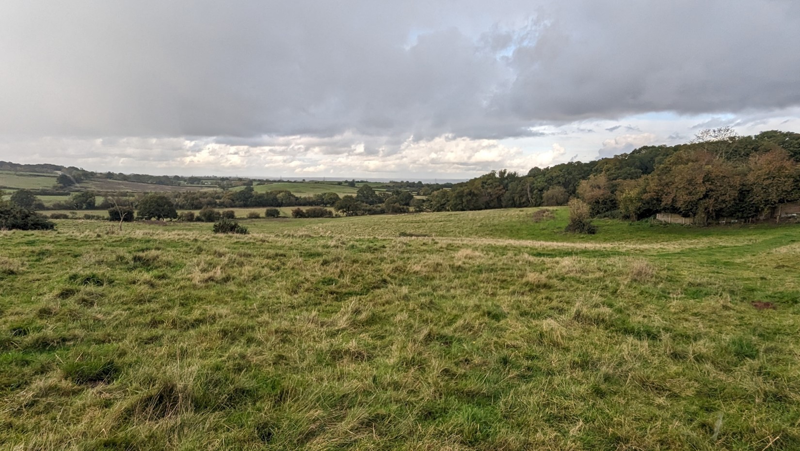
A distinctive wooded ridge which forms an important element in views from the surrounding landscape, including the Thames floodplain. It also forms a backdrop to adjacent settlements, including Oxford. The considerable woodland cover includes extensive areas of ancient woodland, which gives the landscape structure and creates a sense of intactness. The floodplain forms an important setting to the wooded ridge, with small tributaries and floodplain grazing marsh. Well-managed arable and pasture fields with intact hedgerows punctuate the woodlands, contrasting with the rough grassland and pasture bounded by ditches and hedgerows on the floodplain, which all contribute to a sense of place. Development within the area is largely set back from roads and hidden from view, resulting in a tranquil and peaceful character. Wytham village, the only settlement in the north, has a small historic linear settlement form, and strong vernacular of local limestone and thatch. Occasionally panoramic views out of the area provide a sense of place, and have provided inspiration for painters and poets, including William Turner. Public rights of way the Oxford Greenbelt Way and Thames Path, and open access land owned by the Oxford Preservation Trust provide access, although there is more limited access in the northern section, which is owned by the University of Oxford.
Summary of special landscape qualities
- Distinctive ridge landform, which forms a wooded backdrop to adjacent settlements at Farmoor, Botley and Wytham, as well as being prominent in strategic views from Oxford.
- Contrast between the wooded ridge and the flat, open floodplain of the River Thames.
- Mosaic of ecologically important ancient woodlands, wood pasture, floodplain grazing marsh and grasslands create a distinctive sense of place.
- Recreational value of the Oxford Greenbelt Way and the Thames Path.
- Long, sometimes panoramic, views across Oxford and the wider county, contrast with the enclosure along narrow lanes and within woodland.
- Historic linear settlement at Wytham, with strong limestone vernacular, designated as a Conservation Area. Wytham Park within Wytham Woods also adds time depth.
- Limited development and enclosure in woodlands result in a relatively tranquil and rural landscape, providing good opportunities to experience dark night skies.
Wytham Woods seen from the Thames Path

×![]()
Wytham Woods seen from the Thames Path
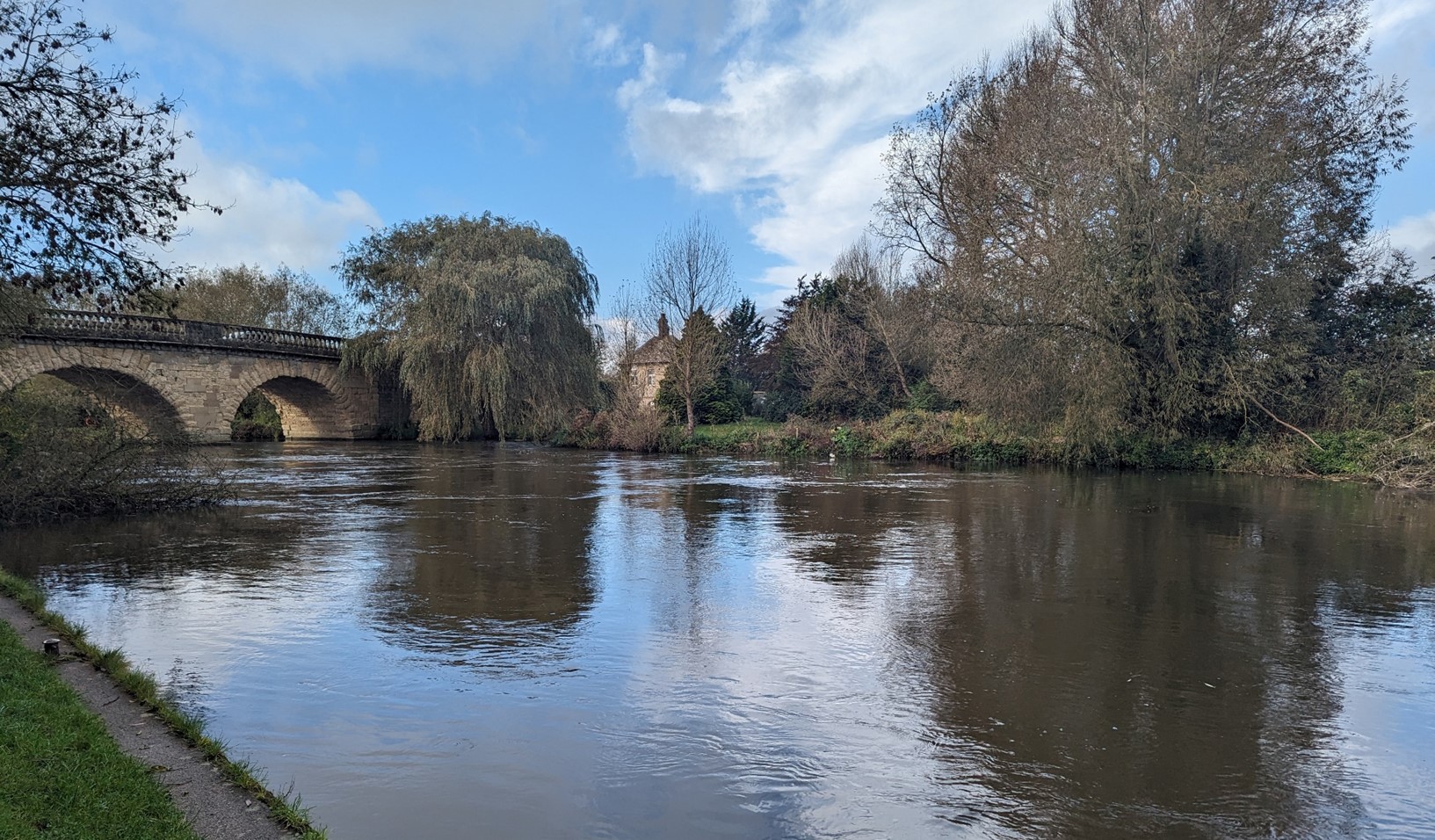
Swinford toll bridge
×![]()
Swinford toll bridge
Full evaluation
Local distinctiveness and sense of place
- Distinct combination of a steep ridge rising from the Thames valley floodplain, which is visible in views across South Oxfordshire and Vale of White Horse districts and beyond, and forms a discrete and recognisable area.
- Extensive woodlands on higher ground form a special character in the local context, and confer a recognisable sense of place.
- The landscape contributes to the river valley setting of Wytham.
Landscape quality (condition and intactness)
- Extensive woodland coverage across the ridge, often identified as ancient woodland in good condition. This is interspersed with considerable coniferous coverage.
- Naturalistic floodplain of the Thames, which is a functioning floodplain.
- The lowland calcareous grassland and population of nationally scarce butterfly species Strymonidia pruni which make up the Wytham Woods SSSI designation are in favourable condition. The lowland mixed deciduous woodland and vascular plant assemblages are in unfavourable – recovering condition.
- Wytham Ditches and Flushes SSSI supports species-rich eutrophic aquatic and fen flora, now rare in Oxfordshire, as well as priority habitat floodplain grazing marsh. The ditches and lowland fens are in unfavourable – recovering condition.
- Medium to large scale arable and pasture fields are defined by intact hawthorn hedgerows or ditches on the floodplain.
- Limited incongruous features within the landscape, with the exception of occasional detracting views towards, and the sound of, the A34.
Scenic qualities and perceptual aspects
- The contrast between the flat floodplain and wooded steep ridge creates a strong visual character. The ridge provides a backdrop and focal point for views in the vicinity (e.g. Wytham, Botley, Cumnor and Farmoor reservoir), and further afield, including an important backdrop to views from Oxford.
- Panoramic views from the highest points of the ridge are possible, with long views towards the ‘dreaming spires’ of Oxford city, as well as over the wider Oxfordshire countryside, including to the North Wessex Downs National Landscape to the south and Chilterns National Landscape to the south-east.
- Visual contrast between the enclosure and seclusion within woodlands, and expansive views on the floodplain and in non-wooded areas of the ridge.
- The wooded nature of the landscape and development pattern in the south of individual houses set back from the lanes (e.g. around Boar’s Hill) creates a sense of limited development, which results in a sense of tranquillity and remoteness.
- Wytham is a historic village, where the strong local vernacular of limestone, which appeals to the senses.
- The A34 to the east is audibly and sometimes visually detracting, although is often hidden from view by vegetation.
Natural and cultural qualities
- The underlying Corallian and Stanford limestone formations form the distinctive ridge of higher ground.
- Extensive woodland cover across the area is largely identified as ancient woodland, with woodland in the northern section largely covered by the Wytham Woods SSSI.
- Floodplain grazing marsh, lowland meadow, species-rich eutrophic aquatic and fen flora on the floodplain form important wetland habitats, including the Wytham Ditches and Flushes SSSI.
- Wytham Estate, comprising wood pasture, parkland and Wytham Woods, was formerly owned by the Earls of Abingdon, before being acquired by the University of Oxford in the 1940s. The parkland character is still evident.
- Settlement is concentrated at Wytham, a linear village, with a historic nucleus around Wytham Abbey and church. The village is covered by a Conservation Area and contains a number of listed buildings. Outside of Wytham, development is limited. A few buildings are registered as Grade II listed, including Swinford toll bridge, Youlbury House, Templeton College and Chilswell Farm.
- Low-density development along roads at Boars Hill and Fox Lane does not make a particular contribution to sense of place, as houses tend to be large, detached and have no specific vernacular. However, they are set back from the minor roads and often screened by fencing and hedges, and so have a limited negative influence on the landscape.
Recreation value
- Access is concentrated in the southern section of the LLD, including along the Oxford Greenbelt Way. Areas of open access land are owned by the Oxford Preservation Trust, including Old Berkley Golf Course and Jam Mound. The golf course at Hinksey Heights now also includes a nature trail, allowing more public access. The Thames Path provides access along the floodplain in the north, while there are permissive paths within Wytham Woods, which require a permit from the University of Oxford.
Associations
- The ‘dreaming spires’ of Oxford as seen from Hinksey Hill were painted by William Turner.
- Boars Hill was home to numerous poets and artists, and inspired Philip Pullman’s His Dark Materials and Matthew Arnold’s The Scholar Gypsy and Thyrsis, which mentions Wytham, Cumnor and other local landmarks.
- Jam Mound is a historic viewpoint, set within associated gardens on Boars Hill. However, tree cover now restricts the majority of distant views from the mound.
- The Wytham Estate, was purchased in 1920 by the ffennell family, who established Hill End Camp, visited by many school children. The estate was gifted to the University of Oxford in 1942. The John Krebs Field Station University Farm has studied the estate including Wytham Woods ever since.
Long views to Oxford city and the eastern hills

×![]()
Long views to Oxford city and the eastern hills
Old Berkely Golf Course, Boars Hill, owned by the Oxford Preservation Trust
×![]()
Old Berkely Golf Course, Boars Hill, owned by the Oxford Preservation Trust
Landscape guidelines
Guidance to protect/conserve current landscape character
- Retain and enhance woodland cover across the ridge, particularly that on higher ground.
- Conserve the wetland habitat of the Thames floodplain, including by protection against harmful effects of livestock grazing and drainage for agricultural use.
- Protect and manage the valued recreational use of the landscape on public rights of way, particularly along promoted routes. Consider opportunities to improve public right of way connections, infrastructure and signage.
- Maintain physical and visual connectivity between Wytham, including its Conservation Area and the wooded slopes of Wytham Woods to the west.
- Protect and conserve the historic features, including parkland at Wytham Park. Listed buildings, including those within the Wytham Conservation Area, should be protected.
- Conserve the river valley and wooded hill views out of Wytham, which form an important part of its setting.
- Protect and enhance intervisibility with the spires and rooftops of Oxford, including the views set out in the Oxford View Cones, by managing woodland to maintain viewing corridors. Resist any development or land use changes which would negatively impact the views within, or backdrop to, the view cones.
- Conserve and enhance the view from Hinksey Hill as painted by Turner in Dreaming Spires.
- Protect the experiential qualities of the landscape, particularly the high levels of tranquillity and intact rural character.
Guidance to manage landscape character
- Encourage the appropriate management of woodland, including to reduce the impacts of pests and diseases and to increase its age structure and structural heterogeneity. Consider the promotion of natural colonisation adjacent to existing woodland, allowing locally native species to develop resilience to the pressures of climate change through natural processes.
- Encourage appropriate management of the floodplain landscape to enhance its contribution to landscape character and nature conservation value. This includes continued light grazing by cattle, and reinstatement of gappy hedgerows.
Guidance to plan (enhance, restore, create) landscape character
- Encourage landowners to develop a woodland management strategy to conserve existing woodlands (including ancient woodland) and extend woodland where appropriate. Ensure any new woodland planting is respectful of local character and ecological conditions and maximises opportunities to link with other habitats.
- Seek opportunities to enhance connectivity between the floodplain wetland habitats and other nearby habitats to create green corridors and networks.
- Ensure any new development is small-scale and avoid visually prominent locations. It should respect the existing limited settlement pattern in the north and pattern of individual houses set back from roads in the south. Use existing landscape features to contain and/or screen the new development.
- Consider the cumulative impact of small suburban changes to residential buildings, which have a negative impact on the landscape character. Examples include large boundary fences, security gates and lighting and entrance CCTV.
- Consider the impact of lighting on dark skies, both locally and on views from lower ground (refer to the guidance in the Dark Skies / Light Impact Assessment for South Oxfordshire and Vale of White Horse).