Candidate LLD: Northern Thames Valley LLD
Summary information
Extent of area
This area is located in the north of the Vale of White Horse district. It consists of the southern floodplain of the River Thames and the distinctive footslopes of the Corallian Limestone Ridge. The northern boundary of the LLD is formed by the River Thames, which also marks the administrative boundary with West Oxfordshire.
Landscape character context
The LLD includes parts of the following Landscape Character Areas:
- LCA 8A: Faringdon to Frilford Ridge Slope
- LCA 8B: Frilford to Sandford Ridge Slope
- LCA 9G: Northern Vale Edge Slopes
- LCA 12A: Thames Middle Vale
Location of Northern Thames Valley LLD - View map full screen
Statement of significance
The northern Thames floodplain and associated valley slopes form a distinctive and discrete landscape. The contrast between the flat floodplain and rising slopes provides visual contrast, and allows for long views across the Thames valley, and to the North Wessex Downs National Landscape to the south. Small ancient woodlands, wetland habitats and largely intact hedgerows form a strong landscape structure and provide ecological corridors. The historic settlement pattern of small villages on the top of the valley slopes is intact; the landscape forms an important setting to these heritage features. Parkland and estate landscapes provide a distinctive sense of place and time-depth. Public rights of way, including the Thames Path National Trail provide recreational access.
Summary of special landscape qualities
- The River Thames and its immediate setting have a strong sense of place. Relatively steep slopes transition from the floodplain to the ridge.
- Intact hedgerows, mature trees and scattered ancient woodlands provide landscape structure, ecological corridors and important habitats.
- Historic parkland and estate landscapes, particularly at Hinton Manor and Buckland House. The characteristic tree avenues, estate fencing and mature individual trees standing in pasture provide a distinctive sense of place and time-depth.
- Historic small villages on the top of the slope are characteristic of the area, and provide time-depth.
- Network of public rights of way, including the Oxford Greenbelt Way and Thames Path National Trail provide recreational value.
- Open views across the vales, Thames valley and North Wessex Downs to the south, creating a sense of place.
- Highly rural character with limited modern distractions.
Tadpole Bridge over the River Thames
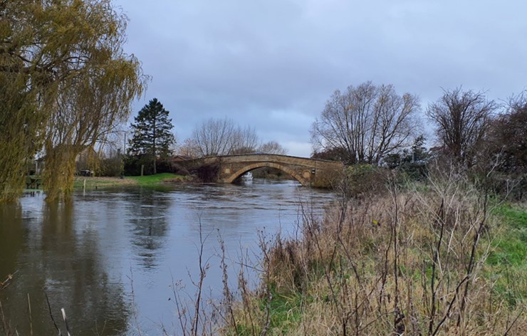
×![]()
Tadpole Bridge over the River Thames
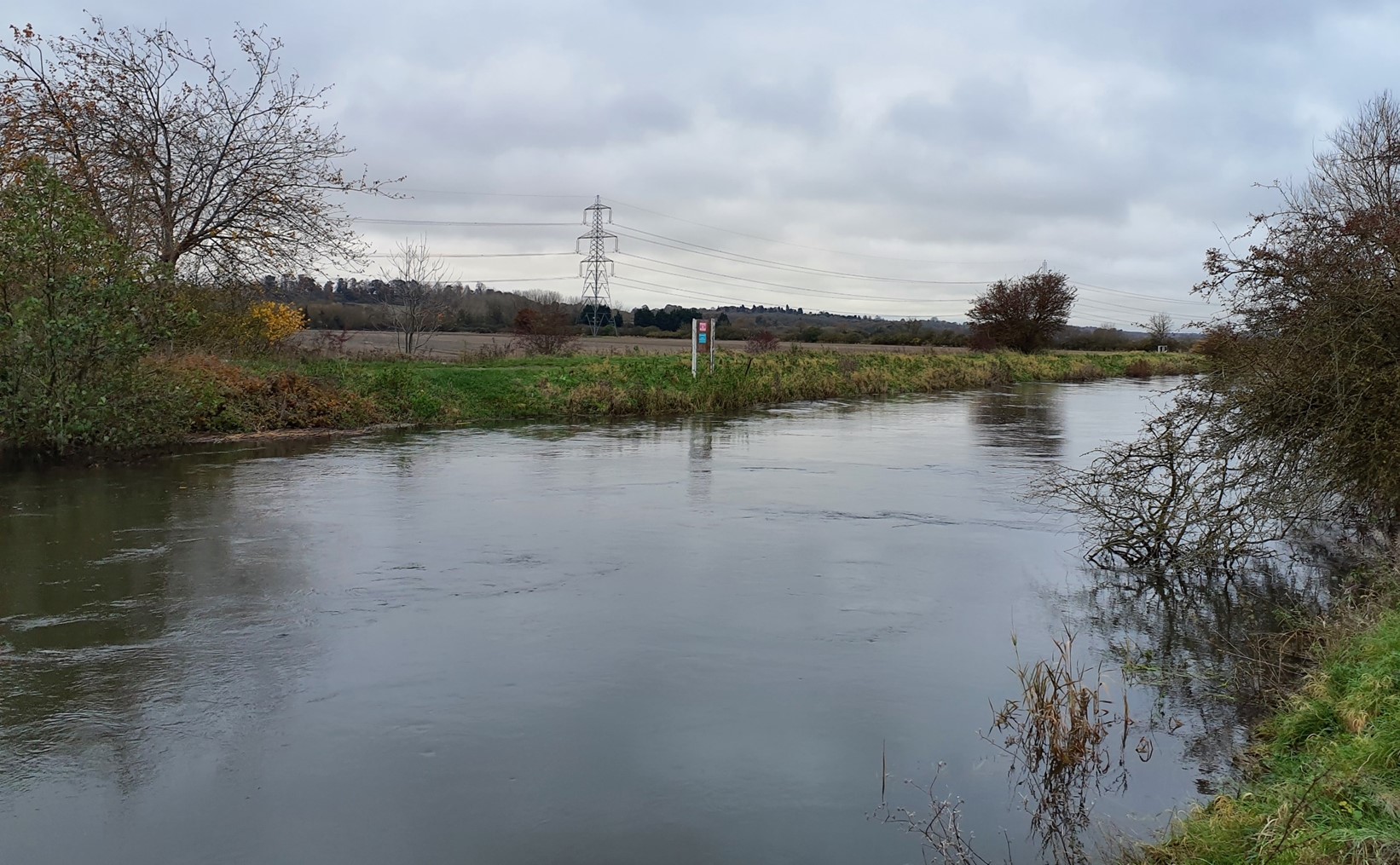
Open arable fields with long-distance views

×![]()
Open arable fields with long-distance views
Full evaluation
Local distinctiveness and sense of place
- Distinctive landscape of the flat floodplain of the River Thames contained by steep slopes rising to the Corallian Limestone Ridge, which forms a recognisable area.
- The low, rounded profile of Harrowdown Hill forms a locally distinctive landmark rising from the low-lying floodplain.
- Combination of dense riparian vegetation, boat moorings and occasional stone bridges result in a landscape with a strong sense of place.
- Parkland and estate character at Hinton Manor and Buckland House create a recognisable sense of place.
Landscape quality (condition and intactness)
- Areas of ancient woodland on the ridge slopes are generally in good condition, although some has since been replanted with conifers. The broadleaved wet ash-wych elm woodland at Appleton Lower Common SSSI is in favourable condition.
- Small pasture fields on the floodplain have greater intact boundary vegetation, with hawthorn and willow common tree species. Larger arable fields on the higher ground tend to have lower clipped hedgerows, with some gaps. Hawthorn and elm are common, with occasional mature oak hedgerow trees.
- The historic field pattern is still intact in some areas, with post Medieval and pre-18th century fields recognised in the Oxfordshire HLC. More modern areas of amalgamation are found in the west.
- Parkland estates at Hinton Manor and Buckland House are all well-managed, with formal gardens, pleasure grounds and parks in good condition.
- The small ridgetop villages of Littleworth, Buckland, Hinton Waldrist, Longworth, Appleton and Cumnor contain listed buildings and are covered by Conservation Areas, resulting in a visually coherent character.
- Detracting features are rare, although electricity pylons routes impinge on the east and west and the A415 is a busy road through the centre.
Scenic qualities and perceptual aspects
- The sloping valley side landform affords long views across the vales and Thames valley, and distant views to the North Wessex Downs National Landscape to the south. Wooded Wytham Hill is visible on the horizon to the north-east. Woodland cover within the LLD provides areas of enclosure, in contrast with the longer views.
- The River Thames is visible from section so the Thames Path along its banks, although often partially screened by riparian vegetation. This contributes to a sense of uninterrupted tracts of land with few built features. Farmoor Reservoir is visible from the northern edge of the LLD, although seen in context with the rising Wytham Woods.
- A sense of peace and tranquillity pervades across the area, and relative remoteness away from the edges of settlements. There is also a good experience of dark night skies.
- Slow moving boats on the Thames are a picturesque occasional feature, although they do reduce a sense of remoteness.
Natural and cultural qualities
- The River Thames with its natural meanders forms an important natural and cultural feature in the landscape. Small areas of priority habitat floodplain grazing marsh and priority habitat deciduous woodland are found along the river corridor.
- Priority habitat deciduous woodland blocks across the area, many recorded as ancient woodland, contribute to a sense of place. Appleton Lower Common is nationally designated as a SSSI.
- Limited settlement on the floodplain is part of the historic pattern of settlement, with villages set on the ridgetop, such as Buckland and Eaton, and occasional large manor houses and farmsteads on rural roads. These all contribute to a sense of place and provide time-depth.
- Historic river crossings at Tadpole Bridge (Grade II listed) and New Bridge (Grade II*) show the historic importance of the River Thames.
- Parkland estates provide a historic influence on the landscape, with parklands still significant at Registered Parks and Gardens Hinton Manor (Grade II) and Buckland House (Grade II*).
Recreation value
- A network of public rights of way, including the Oxford Greenbelt Way long distance footpath and Thames Path National Trail provide recreational value, and connect the chalk ridge in the south to the Thames valley in the north. Some areas of more limited access, particularly within the parklands. There is strong water-based recreation on the River Thames, with small pleasure boats common.
Associations
- Buckland and Hinton Waldrist are historic manors, both mentioned in the Domesday book. The MP Airey Neave is buried at Hinton Waldrist.
- The poet Matthew Arnold enjoyed walking near Cumnor, and set his elegiac poems The Scholar Gypsy and Thyrsis in these landscapes.
River Thames with wooded ridge on the horizon
×![]()
River Thames with wooded ridge on the horizon
Parkland character at Hinton Waldrist

×![]()
Parkland character at Hinton Waldrist
Landscape guidelines
Guidance to protect/conserve current landscape character
- Retain and enhance floodplain habitats, woodland blocks and tree lines; conserve and manage the ancient woodland sites and SSSIs to improve landscape character and encourage biodiversity.
- Encourage management in parklands and support plans for restoration where appropriate. Conserve and appropriately manage veteran trees within parkland areas.
- Maintain the settlement pattern of ridgetop villages, with extremely limited development in the floodplain. Protect and conserve historic assets and their setting, including listed bridges, parklands, and historic villages including those with Conservation Areas.
- Protect and where possible enhance long views north across the vales and the Thames valley, and south towards the North Wessex Downs National Landscape on the horizon.
- Protect the experiential qualities of the landscape, particularly the high levels of tranquillity and intact rural character.
Guidance to manage landscape character
- Ensure best practice management for floodplain grazing pastures and wet grassland, through suitable grazing regimes and avoiding agrochemical and fertiliser inputs; manage recreational routes to avoid/minimise disturbance; and manage scrub vegetation appropriately to maintain the open character of the floodplain.
- Encourage the appropriate management of woodland, including to reduce the impacts of pests and diseases and to increase its age structure and structural heterogeneity. Consider the promotion of natural colonisation adjacent to existing woodland, allowing locally native species to develop resilience to the pressures of climate change through natural processes.
- Support appropriate management and restoration of parkland and historic landscapes through (for example) the planting of a new generation of specimen trees and extensive grassland management.
- Maintain the valued recreational use of the landscape and consider opportunities to introduce additional connectivity where public rights of way access is currently more limited, to enhance appreciation of views and landscape character.
- Retain the naturalistic character of the Thames, avoiding excessive additional recreational facilities such as jetties and weirs.
Guidance to plan (enhance, restore, create) landscape character
- Encourage landowners to develop a woodland management strategy to conserve existing woodlands (including ancient woodland) and extend woodland where appropriate. Ensure any new woodland planting is respectful of local character and ecological conditions and maximises opportunities to link with other habitats.
- Ensure any new development retains the existing small-scale, scattered settlement pattern. Avoid linear expansion along the roads which would cause coalescence, or perceived coalescence, of the existing small villages.
- Any new development should consider using materials in keeping with the local vernacular of limestone, brick banding and slate roofs.
- New development should consider the role of the parklands and open spaces between the settlements.
- Consider plans to create new access routes linking both the river floodplain and ridge, and linking east-west across the ridge.