LCT 2: Wooded Chalk Escarpment
Contextual map of LCT 2 - View map full screen
Component Landscape Character Areas
- LCA 2A: Chiltern Wooded Chalk Escarpment
Long views from Watlington Hill across the vale

×![]()
Long views from Watlington Hill across the vale
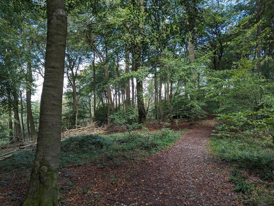
Enclosed character in Aston Rowant SAC woodland
×![]()
Enclosed character in Aston Rowant SAC woodland
Assessment of landscape sensitivity to renewable energy development
Landscape sensitivity assessment
Landform and scale (including sense of openness/ enclosure)
- The Chilterns escarpment has a smooth and well-defined profile of a chalk landform. It is heavily incised by spurs and valleys, creating pronounced undulations. The steepness of the scarp varies, with gentle slopes in the south and more steep and dramatic slopes in the north.
- Heights range from 100 metres AOD to 250 metres AOD. The lowest areas are in the south, close to the River Thames. Notable hills include Chinnor Hill at 245 metres AOD and Watlington Hill at 230 metres AOD.
- The scale and sense of openness is varied. Pasture and arable fields with weak or absent hedgerow structure create an open, large-scale landscape, particularly on the top of the scarp. This contrasts with the sense of enclosure in wooded areas and along the sunken lanes with tall hedgerows which climb the scarp face or minor valleys.
- Human scale features include frequent blocks of woodland, country mansions at Watlington Park and Swyncombe House and occasional farmsteads.
Landcover (including field and settlement patterns)
- A landscape dominated by priority habitat beech-yew deciduous woodland, with extensive areas of ancient woodland. Species-rich chalk grassland, mixed chalk scrub and juniper are found in unwooded areas. Aston Rowant is internationally designated as a Special Area of Conservation (SAC), for its lowland juniper scrub on chalk and ash-beech-yew woodlands. Many other sites are nationally designated as Sites of Special Scientific Interest (SSSI).
- Between the woodlands, fields are relatively open, with hedgerows along lanes and footpaths, but little internal division. The large-scale fields are generally in use for pasture, although arable cultivation dominates north-west of Nuffield.
- A very sparsely settled landscape, with occasional scattered farmsteads and estates.
Historic landscape character
- The field pattern between areas of woodland is of ancient unenclosed rough ground, planned 18th and 19th century enclosure, and some smaller areas of modern amalgamation.
- The historic strip parish pattern remains, where communities linked lower summer grazing pasture, fuel supply from woodlands and the spring-line streams water supply. The ancient Ridgeway crosses the LCT, which has provided access across the chalk landscape for thousands of years.
- Small estates and parklands, although not nationally designated, provide time-depth, such as at Watlington Park and Swyncombe House.
- Prehistoric monuments including bowl barrows on Chinnor Hill and Grim’s Ditch are Scheduled Monuments, which contribute to time-depth in the landscape.
- Occasional isolated farms and associated barns are Grade II Listed Buildings, and form historic features.
Visual character (including skylines)
- The wooded raised escarpment landform is prominent in views from the surrounding lower-lying areas. The skyline is undeveloped and marked by the trees along the length of the escarpment.
- The height of the escarpment offers long-distance and panoramic views to the west and north across Oxfordshire.
- The whole LCT is part of the Chilterns National Landscape, and views within the LCT are therefore of nationally important landscapes.
- Strong structure of woodland and incised valley landform creates an intimate and enclosed character at times. Tree-lined sunken lanes are a common feature in the area and form wooded skylines in views to the LCT.
Perceptual and scenic qualities
- A generally rural and unspoilt landscape, with a strong structure of woodland and incised valley landform creating an intimate and enclosed character, contrasting with an elevated expansive character in the more open locations.
- The entirety of the LCT is part of the Chilterns National Landscape. Special qualities of the AONB represented in this landscape include the distinctive beech yew woodlands, rare chalk grassland, tranquillity and dark night skies, extensive recreational routes and a strong structure of hedgerows, parkland and farmland.
- The LCT features an extensive network of PRoW, including the ancient Icknield Way, Chiltern Way, The Ridgeway and Oxfordshire Way. Areas of Open Access Land are also found within the woodlands.
- Access is provided by a distinctive pattern of winding rural lanes climbing the scarp and minor valleys. The M40 motorway carves a route through the chalk scarp at the Stokenchurch Gap, and creates a localised detractor in the landscape.
Sensitivity scores for LCT 2 Wooded Chalk Escarpment
| Criteria | Sensitivity Score: solar | Sensitivity Score: wind |
| Landform and scale (including sense of openness/enclosure) | High | High |
| Landcover (including field and settlement patterns) | Moderate-high | Moderate-high |
| Historic landscape character | Moderate | Moderate-high |
| Visual character (including skylines) | High | High |
| Perceptual and scenic qualities | High | High |
Overall assessment of landscape sensitivity to solar PV developments
Summary of overall landscape sensitivity of Wooded Chalk Escarpment LCT 2
The dramatic steep-sided chalk escarpment is a distinct landform feature, which has an irregular topographic appearance. Solar PV panels will be more easily perceived on the higher slopes. The open pasture and arable fields have little sense of enclosure and are likely to be more sensitive to solar PV as there are no current features to provide screening. However, significant areas of woodland and sunken lanes with tall hedgerows may be able to provide some screening, reducing sensitivity in locations with these features. The woodlands are ecologically important and often of ancient origin and are sensitive to the introduction of solar PV development. The larger-scale fields have less semi-natural land cover and have a slightly lower sensitivity. The historic strip parish pattern, small estates and parklands, and prehistoric monuments provide time depth, and have a higher sensitivity to solar PV development. The varied time-depth of the field pattern, and limited historic buildings slightly reduce landscape sensitivity. The escarpment landform forms a prominent, undeveloped skyline which is widely visible, and also allows long panoramic views out, indicating high sensitivity. The landscape is visible in views from a variety of long-distance or promoted public rights of way that are popular for recreation including the Icknield Way, Chiltern Way, The Ridgeway and Oxfordshire Way, which are all sensitive receptors. The rural landscape, with a pleasing combination of woodland, incised valley landform, and elevated open areas, creates an attractive character with visual contrasts and dramatic elements. The M40 at Stokenchurch Gap is a local detractor within the landscape.
The location of the LCT within the Chilterns National Landscape increases landscape sensitivity to all scales of solar PV development. Representative features including beech yew woodlands, rare chalk grassland, tranquillity and dark night skies, extensive recreational routes and a strong structure of hedgerows, parkland and farmland may be adversely impacted by the installation of solar PV development.
This LCT has ‘high’ landscape sensitivity to solar energy development greater than the ‘small-scale’ development scenario. There may be opportunities to accommodate carefully sited ‘very small’ and ‘small’ scale solar PV development scenarios in areas where existing woodland and thick hedgerows could be used to screen solar PV installations and reduce their landscape and visual impact. Care would need to be taken to ensure that development does not detract from views both within and to the LCT from the wider landscape. Areas with important semi-natural habitats, archaeological features, and on the steep slopes and top of the escarpment should be avoided.
Sensitivity of Landscape Character Areas
There is only one LCA in the Wooded Chalk Escarpment LCT, and therefore there is no variation in landscape sensitivity to solar PV development.
Landscape sensitivity to solar PV development in LCA 2A
| Development scenario | Overall landscape sensitivity rating |
| Very small solar (up to 1 hectare) | Moderate |
| Small solar (1-5 hectares) | Moderate-high |
| Medium solar (5-20 hectares) | High |
| Large solar (20-50 hectares) | High |
| Very large solar (50-120 hectares) | High |
Overall assessment of landscape sensitivity to wind energy developments
Summary of overall landscape sensitivity of Wooded Chalk Escarpment LCT 2
This is a landscape of slopes and valleys which create a complex topography, indicating higher sensitivity to wind energy development. Frequent human-scale features within the landscape, such as trees, woodland, hedgerows and scattered farm buildings are also sensitive to larger turbines, as they may be dominated or overwhelmed by wind turbines greater than ‘very-small scale’. The rural landscape has varied land cover, with high concentrations of semi-natural land cover in the woodlands and grasslands, which increases sensitivity. The larger-scale fields have lower levels of sensitivity. The historic strip parish pattern, small estates and parklands, and prehistoric monuments create a landscape with many historic features and a strong sense of time-depth. These features and their setting increase sensitivity to wind energy development. The varied field pattern origin from ancient woodland to areas of modern field amalgamation slightly lowers sensitivity. Undeveloped skylines, which are either open or marked by woodland are prominent, and visible from lower-lying landscapes due to the elevated landform are characteristic of the LCT and increase sensitivity. The pattern of woodlands, incised valley landforms and elevated open fields create an attractive character. Development is limited, with only the M40 at Stokenchurch Gap creating a localised detraction, slightly reducing sensitivity in this location.
The whole LCT lies within the Chilterns National Landscape, which increases sensitivity. Representative features including beech yew woodlands, rare chalk grassland, tranquillity and dark night skies, extensive recreational routes and a strong structure of hedgerows, parkland and farmland may be adversely impacted by wind energy development.
This LCT has ‘high’ landscape sensitivity to wind energy development greater than the ‘very small-scale’ development scenario (to which the LCT has moderate-high sensitivity). There may be potential for limited ‘very small-scale’ wind turbine development in locations where development would not be visually prominent within the wider landscape and would not detract from the setting of important archaeological features and the special qualities of the Chilterns National Landscape. The consideration of any cumulative landscape and visual impacts with other renewable energy development both within this LCT and adjacent landscapes is also important.
Sensitivity of Landscape Character Areas
- There is only one LCA in the Wooded Chalk Escarpment LCT, and therefore there is no variation in landscape sensitivity to wind energy development.
Landscape sensitivity to wind energy development in LCA 2A
| Development scenario | Overall landscape sensitivity rating |
| Very small-scale wind (<25 metres) | Moderate-high |
| Small-scale wind (25-60 metres) | High |
| Medium-scale wind (60-100 metres) | High |
| Large-scale wind (100-150 metres) | High |
| Very large-scale wind (150-220 metres) | High |